Menakoz (Meñakoz) Surf Report
| Wave height * | 3ft / 0.8m |
|---|---|
| Swell period | 13s |
| Swell direction | |
| Wind | |
| Sea temp | 14°C / 57°F |

10 day Menakoz surf forecast
Wed
31/Dec
3ft
8
7
3
- High 2:13am
- Low 8:33am
- High 2:46pm
- Low 8:56pm
Thu
1/Jan
2ft
8
9
3
- High 3:08am
- Low 9:29am
- High 3:41pm
- Low 9:48pm
Fri
2/Jan
1.5ft
8
13
16
- High 4:00am
- Low 10:20am
- High 4:32pm
- Low 10:37pm
Sat
3/Jan
1.5ft
20
21
19
- High 4:49am
- Low 11:08am
- High 5:20pm
- Low 11:22pm
Sun
4/Jan
2ft
19
19
18
- High 5:36am
- Low 11:54am
- High 6:06pm
Mon
5/Jan
2.5ft
18
16
24
- Low 12:07am
- High 6:21am
- Low 12:39pm
- High 6:51pm
Tue
6/Jan
7.5ft
17
8
7
- Low 12:50am
- High 7:06am
- Low 1:23pm
- High 7:36pm
Wed
7/Jan
2.5ft
29
17
7
- Low 1:34am
- High 7:52am
- Low 2:07pm
- High 8:21pm
Thu
8/Jan
7.5ft
23
23
23
- Low 2:19am
- High 8:39am
- Low 2:53pm
- High 9:10pm
Fri
9/Jan
7.5ft
14
18
26
- Low 3:07am
- High 9:31am
- Low 3:42pm
Wed 31st Dec
| 4:00 | 3ft | 3.4ft | 15s | 7mph (8mph) | |||
| 7:00 | 3ft | 3.5ft | 14s | 8mph (8mph) | |||
| 10:00 | 3ft | 3.3ft | 12s | 7mph (6mph) | |||
| 13:00 | 3ft | 3.2ft | 14s | 7mph (5mph) | |||
| 16:00 | 3ft | 3.1ft | 13s | 5mph (5mph) | |||
| 19:00 | 3ft | 3ft | 13s | 3mph (2mph) |
| Tide times |
|---|
| High 2:13am (3.69m) |
| Low 8:33am (0.73m) |
| High 2:46pm (3.68m) |
| Low 8:56pm (0.75m) |
| Daylight | |
|---|---|
| First light | 08:12 |
| Sunrise | 08:44 |
| Sunset | 17:45 |
| Dark | 18:18 |
Thu 1st Jan
| 4:00 | 2.5ft | 2.6ft | 12s | 9mph (9mph) | |||
| 7:00 | 2ft | 2.4ft | 12s | 8mph (9mph) | |||
| 10:00 | 2ft | 2.2ft | 12s | 10mph (11mph) | |||
| 13:00 | 2ft | 1.9ft | 12s | 9mph (11mph) | |||
| 16:00 | 1.5ft | 1.7ft | 12s | 1mph (3mph) | |||
| 19:00 | 1.5ft | 1.5ft | 12s | 3mph (4mph) |
| Tide times |
|---|
| High 3:08am (3.92m) |
| Low 9:29am (0.50m) |
| High 3:41pm (3.83m) |
| Low 9:48pm (0.60m) |
| Daylight | |
|---|---|
| First light | 08:12 |
| Sunrise | 08:44 |
| Sunset | 17:46 |
| Dark | 18:18 |
Fri 2nd Jan
| 4:00 | 1ft | 1.1ft | 11s | 8mph (8mph) | |||
| 7:00 | 1ft | 0.9ft | 12s | 8mph (8mph) | |||
| 10:00 | 1ft | 1.1ft | 13s | 10mph (10mph) | |||
| 13:00 | 1.5ft | 1.6ft | 7s | 13mph (12mph) | |||
| 16:00 | 1ft | 1.9ft | 3s | 15mph (14mph) | |||
| 19:00 | 1ft | 2.7ft | 4s | 16mph (15mph) |
| Tide times |
|---|
| High 4:00am (4.10m) |
| Low 10:20am (0.32m) |
| High 4:32pm (3.93m) |
| Low 10:37pm (0.49m) |
| Daylight | |
|---|---|
| First light | 08:12 |
| Sunrise | 08:44 |
| Sunset | 17:47 |
| Dark | 18:19 |
Sat 3rd Jan
| 4:00 | 1.5ft | 3.9ft | 5s | 22mph (22mph) | |||
| 7:00 | 1.5ft | 3.8ft | 5s | 20mph (21mph) | |||
| 10:00 | 1.5ft | 3.7ft | 5s | 19mph (19mph) | |||
| 13:00 | 1.5ft | 3.8ft | 5s | 21mph (19mph) | |||
| 16:00 | 2.5ft | 4.1ft | 6s | 19mph (19mph) | |||
| 19:00 | 2.5ft | 4ft | 6s | 19mph (19mph) |
| Tide times |
|---|
| High 4:49am (4.22m) |
| Low 11:08am (0.22m) |
| High 5:20pm (3.96m) |
| Low 11:22pm (0.45m) |
| Daylight | |
|---|---|
| First light | 08:12 |
| Sunrise | 08:44 |
| Sunset | 17:48 |
| Dark | 18:20 |
Sun 4th Jan
| 4:00 | 3ft | 3.8ft | 6s | 19mph (19mph) | |||
| 7:00 | 3ft | 3.6ft | 6s | 19mph (19mph) | |||
| 10:00 | 1.5ft | 3.7ft | 5s | 20mph (21mph) | |||
| 13:00 | 2ft | 4.2ft | 5s | 19mph (20mph) | |||
| 16:00 | 3.5ft | 4.4ft | 7s | 17mph (19mph) | |||
| 19:00 | 3.5ft | 4.4ft | 8s | 18mph (18mph) |
| Tide times |
|---|
| High 5:36am (4.26m) |
| Low 11:54am (0.23m) |
| High 6:06pm (3.92m) |
| Daylight | |
|---|---|
| First light | 08:12 |
| Sunrise | 08:44 |
| Sunset | 17:49 |
| Dark | 18:21 |
Mon 5th Jan
| 4:00 | 3.5ft | 4.1ft | 6s | 16mph (16mph) | |||
| 7:00 | 2ft | 3.9ft | 5s | 18mph (17mph) | |||
| 10:00 | 2ft | 3.6ft | 5s | 16mph (17mph) | |||
| 13:00 | 2.5ft | 3.1ft | 6s | 16mph (18mph) | |||
| 16:00 | 2ft | 2.6ft | 7s | 21mph (22mph) | |||
| 19:00 | 2ft | 2.2ft | 7s | 24mph (25mph) |
| Tide times |
|---|
| Low 12:07am (0.48m) |
| High 6:21am (4.20m) |
| Low 12:39pm (0.33m) |
| High 6:51pm (3.80m) |
| Daylight | |
|---|---|
| First light | 08:12 |
| Sunrise | 08:44 |
| Sunset | 17:50 |
| Dark | 18:22 |
Tue 6th Jan
| 4:00 | 4ft | 4.5ft | 6s | 20mph (21mph) | |||
| 7:00 | 7ft | 8.3ft | 8s | 17mph (18mph) | |||
| 10:00 | 8ft | 9.7ft | 9s | 13mph (13mph) | |||
| 13:00 | 7.5ft | 9.2ft | 10s | 8mph (8mph) | |||
| 16:00 | 6.5ft | 8.2ft | 9s | 4mph (5mph) | |||
| 19:00 | 5.5ft | 6.7ft | 9s | 7mph (9mph) |
| Tide times |
|---|
| Low 12:50am (0.59m) |
| High 7:06am (4.06m) |
| Low 1:23pm (0.50m) |
| High 7:36pm (3.64m) |
| Daylight | |
|---|---|
| First light | 08:12 |
| Sunrise | 08:44 |
| Sunset | 17:51 |
| Dark | 18:23 |
Wed 7th Jan
| 4:00 | 3.5ft | 4ft | 7s | 20mph (29mph) | |||
| 7:00 | 3ft | 3.5ft | 7s | 29mph (35mph) | |||
| 10:00 | 2.5ft | 3.1ft | 7s | 24mph (27mph) | |||
| 13:00 | 2.5ft | 2.9ft | 15s | 17mph (21mph) | |||
| 16:00 | 2.5ft | 2.7ft | 14s | 11mph (14mph) | |||
| 19:00 | 2.5ft | 2.9ft | 13s | 7mph (8mph) |
| Tide times |
|---|
| Low 1:34am (0.75m) |
| High 7:52am (3.85m) |
| Low 2:07pm (0.73m) |
| High 8:21pm (3.45m) |
| Daylight | |
|---|---|
| First light | 08:12 |
| Sunrise | 08:44 |
| Sunset | 17:52 |
| Dark | 18:24 |
Thu 8th Jan
| 4:00 | 7.5ft | 8.7ft | 8s | 10mph (11mph) | |||
| 7:00 | 7.5ft | 8.5ft | 8s | 23mph (29mph) | |||
| 10:00 | 7ft | 8.3ft | 8s | 23mph (28mph) | |||
| 13:00 | 7.5ft | 8.5ft | 8s | 23mph (31mph) | |||
| 16:00 | 8ft | 9ft | 9s | 23mph (32mph) | |||
| 19:00 | 7.5ft | 8.7ft | 10s | 23mph (32mph) |
| Tide times |
|---|
| Low 2:19am (0.96m) |
| High 8:39am (3.60m) |
| Low 2:53pm (0.98m) |
| High 9:10pm (3.25m) |
| Daylight | |
|---|---|
| First light | 08:11 |
| Sunrise | 08:43 |
| Sunset | 17:53 |
| Dark | 18:25 |
Fri 9th Jan
| 4:00 | 7ft | 8ft | 11s | 15mph (24mph) | |||
| 7:00 | 7ft | 7.9ft | 11s | 14mph (23mph) | |||
| 10:00 | 7ft | 8ft | 12s | 15mph (26mph) | |||
| 13:00 | 7.5ft | 8.6ft | 11s | 18mph (27mph) | |||
| 16:00 | 8ft | 9.3ft | 11s | 23mph (32mph) | |||
| 19:00 | 9ft | 10.5ft | 12s | 26mph (36mph) |
| Tide times |
|---|
| Low 3:07am (1.18m) |
| High 9:31am (3.35m) |
| Low 3:42pm (1.22m) |
| Daylight | |
|---|---|
| First light | 08:11 |
| Sunrise | 08:43 |
| Sunset | 17:54 |
| Dark | 18:26 |
Probably Spain's best known big wave spot. Only really gets going at 8ft and packs extreme power. Besides the wave itself hazards include strong rips and shallow, sharp, uneven reef. Experienced big wave surfers only!
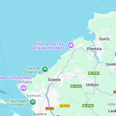
Surf spots nearby
- El Sitio (0.1 mi)
- Sopelana (0.6 mi)
- Playa Salvaje (1.2 mi)
- Aizkorri (1.7 mi)
- Jefrys (3.5 mi)
- Ereaga (4 mi)
- La Central (6.6 mi)
- Bakio (9.5 mi)
- Brazomar (11.3 mi)
- Mundaka (14.7 mi)
Not Magic Seaweed (MSW)
Although we look a bit like Magic Seaweed we are not MagicSeaweed as they no longer exist...