Bantham (Bigbury On Sea) Surf Report
| Wave height * | 4.5ft / 1.4m |
|---|---|
| Swell period | 14s |
| Swell direction | |
| Wind | |
| Sea temp | 12°C / 54°F |

10 day Bantham surf forecast
Sat
13/Dec
5.5ft
7
13
14
- High 12:50am
- Low 6:56am
- High 1:12pm
- Low 7:35pm
Sun
14/Dec
6ft
19
22
23
- High 1:58am
- Low 8:03am
- High 2:19pm
- Low 8:36pm
Mon
15/Dec
6.5ft
23
21
25
- High 2:54am
- Low 9:04am
- High 3:14pm
- Low 9:30pm
Tue
16/Dec
5ft
10
11
6
- High 3:42am
- Low 9:56am
- High 4:00pm
- Low 10:15pm
Wed
17/Dec
3.5ft
7
17
18
- High 4:24am
- Low 10:40am
- High 4:41pm
- Low 10:55pm
Thu
18/Dec
11ft
23
31
37
- High 5:01am
- Low 11:19am
- High 5:18pm
- Low 11:32pm
Fri
19/Dec
15ft
19
10
8
- High 5:37am
- Low 11:56am
- High 5:56pm
Sat
20/Dec
5.5ft
4
5
10
- Low 12:07am
- High 6:13am
- Low 12:32pm
- High 6:33pm
Sun
21/Dec
2.5ft
9
10
5
- Low 12:43am
- High 6:51am
- Low 1:08pm
- High 7:12pm
Mon
22/Dec
6.5ft
4
3
5
- Low 1:19am
- High 7:29am
- Low 1:45pm
Sat 13th Dec
| 3:00 | 7.5ft | 9.2ft | 17s | 7mph (9mph) | |||
| 6:00 | 7ft | 8.6ft | 17s | 7mph (9mph) | |||
| 9:00 | 6ft | 7.9ft | 16s | 10mph (12mph) | |||
| 12:00 | 5.5ft | 7.2ft | 16s | 13mph (15mph) | |||
| 15:00 | 5ft | 6.6ft | 15s | 13mph (17mph) | |||
| 18:00 | 4.5ft | 6.1ft | 14s | 14mph (18mph) | |||
| 21:00 | 4.5ft | 5.9ft | 14s | 17mph (21mph) |
| Tide times |
|---|
| High 12:50am (4.44m) |
| Low 6:56am (2.31m) |
| High 1:12pm (4.62m) |
| Low 7:35pm (2.13m) |
| Daylight | |
|---|---|
| First light | 07:28 |
| Sunrise | 08:07 |
| Sunset | 16:12 |
| Dark | 16:50 |
Sun 14th Dec
| 3:00 | 4.5ft | 6.1ft | 13s | 18mph (24mph) | |||
| 6:00 | 5ft | 6.4ft | 12s | 19mph (25mph) | |||
| 9:00 | 5.5ft | 6.9ft | 11s | 20mph (27mph) | |||
| 12:00 | 6ft | 7.6ft | 11s | 22mph (30mph) | |||
| 15:00 | 6ft | 8.2ft | 12s | 23mph (32mph) | |||
| 18:00 | 7ft | 8.9ft | 12s | 23mph (33mph) | |||
| 21:00 | 7ft | 9.4ft | 12s | 25mph (34mph) |
| Tide times |
|---|
| High 1:58am (4.54m) |
| Low 8:03am (2.23m) |
| High 2:19pm (4.68m) |
| Low 8:36pm (2.02m) |
| Daylight | |
|---|---|
| First light | 07:29 |
| Sunrise | 08:08 |
| Sunset | 16:12 |
| Dark | 16:51 |
Mon 15th Dec
| 3:00 | 7.5ft | 9.5ft | 12s | 24mph (32mph) | |||
| 6:00 | 7ft | 9.2ft | 12s | 23mph (30mph) | |||
| 9:00 | 7ft | 8.9ft | 11s | 21mph (30mph) | |||
| 12:00 | 6.5ft | 8.6ft | 11s | 21mph (27mph) | |||
| 15:00 | 6.5ft | 8.3ft | 12s | 20mph (29mph) | |||
| 18:00 | 6.5ft | 8.7ft | 13s | 25mph (36mph) | |||
| 21:00 | 6.5ft | 8.5ft | 13s | 26mph (37mph) |
| Tide times |
|---|
| High 2:54am (4.71m) |
| Low 9:04am (2.06m) |
| High 3:14pm (4.78m) |
| Low 9:30pm (1.88m) |
| Daylight | |
|---|---|
| First light | 07:30 |
| Sunrise | 08:08 |
| Sunset | 16:12 |
| Dark | 16:51 |
Tue 16th Dec
| 3:00 | 5.5ft | 7.3ft | 14s | 14mph (21mph) | |||
| 6:00 | 5ft | 6.8ft | 15s | 10mph (16mph) | |||
| 9:00 | 5ft | 6.5ft | 15s | 9mph (15mph) | |||
| 12:00 | 5ft | 6.3ft | 15s | 11mph (14mph) | |||
| 15:00 | 4.5ft | 6ft | 15s | 9mph (11mph) | |||
| 18:00 | 4.5ft | 5.7ft | 15s | 6mph (7mph) | |||
| 21:00 | 4ft | 5.5ft | 14s | 4mph (4mph) |
| Tide times |
|---|
| High 3:42am (4.89m) |
| Low 9:56am (1.89m) |
| High 4:00pm (4.89m) |
| Low 10:15pm (1.75m) |
| Daylight | |
|---|---|
| First light | 07:31 |
| Sunrise | 08:09 |
| Sunset | 16:12 |
| Dark | 16:51 |
Wed 17th Dec
| 3:00 | 4ft | 5.1ft | 14s | 3mph (4mph) | |||
| 6:00 | 3.5ft | 4.9ft | 14s | 7mph (10mph) | |||
| 9:00 | 3.5ft | 4.8ft | 13s | 12mph (15mph) | |||
| 12:00 | 3.5ft | 4.9ft | 13s | 17mph (20mph) | |||
| 15:00 | 4ft | 5.3ft | 12s | 18mph (22mph) | |||
| 18:00 | 4.5ft | 6ft | 12s | 18mph (24mph) | |||
| 21:00 | 5ft | 6.9ft | 11s | 19mph (24mph) |
| Tide times |
|---|
| High 4:24am (5.05m) |
| Low 10:40am (1.74m) |
| High 4:41pm (4.98m) |
| Low 10:55pm (1.65m) |
| Daylight | |
|---|---|
| First light | 07:31 |
| Sunrise | 08:10 |
| Sunset | 16:13 |
| Dark | 16:51 |
Thu 18th Dec
| 3:00 | 8.5ft | 10.2ft | 22s | 21mph (26mph) | |||
| 6:00 | 10ft | 12.4ft | 21s | 23mph (30mph) | |||
| 9:00 | 11ft | 13.4ft | 21s | 27mph (38mph) | |||
| 12:00 | 11ft | 13.3ft | 20s | 31mph (45mph) | |||
| 15:00 | 11ft | 13.2ft | 19s | 34mph (47mph) | |||
| 18:00 | 10.5ft | 12.9ft | 17s | 37mph (51mph) | |||
| 21:00 | 10.5ft | 12.6ft | 16s | 26mph (34mph) |
| Tide times |
|---|
| High 5:01am (5.19m) |
| Low 11:19am (1.62m) |
| High 5:18pm (5.06m) |
| Low 11:32pm (1.58m) |
| Daylight | |
|---|---|
| First light | 07:32 |
| Sunrise | 08:11 |
| Sunset | 16:13 |
| Dark | 16:52 |
Fri 19th Dec
| 3:00 | 10.5ft | 12.9ft | 16s | 29mph (37mph) | |||
| 6:00 | 10.5ft | 13.1ft | 15s | 19mph (25mph) | |||
| 9:00 | 11.5ft | 13.8ft | 15s | 14mph (20mph) | |||
| 12:00 | 15ft | 17.3ft | 17s | 10mph (14mph) | |||
| 15:00 | 15.5ft | 17.9ft | 13s | 9mph (11mph) | |||
| 18:00 | 14ft | 16.1ft | 14s | 8mph (9mph) | |||
| 21:00 | 12ft | 14.9ft | 14s | 6mph (7mph) |
| Tide times |
|---|
| High 5:37am (5.30m) |
| Low 11:56am (1.53m) |
| High 5:56pm (5.11m) |
| Daylight | |
|---|---|
| First light | 07:32 |
| Sunrise | 08:11 |
| Sunset | 16:13 |
| Dark | 16:52 |
Sat 20th Dec
| 3:00 | 9.5ft | 11.4ft | 13s | 3mph (3mph) | |||
| 6:00 | 7.5ft | 9.5ft | 13s | 4mph (4mph) | |||
| 9:00 | 6.5ft | 8.3ft | 13s | 6mph (7mph) | |||
| 12:00 | 5.5ft | 7.3ft | 13s | 5mph (6mph) | |||
| 15:00 | 5ft | 6.5ft | 12s | 5mph (4mph) | |||
| 18:00 | 4.5ft | 5.8ft | 12s | 10mph (11mph) | |||
| 21:00 | 4ft | 5.2ft | 12s | 11mph (14mph) |
| Tide times |
|---|
| Low 12:07am (1.52m) |
| High 6:13am (5.38m) |
| Low 12:32pm (1.46m) |
| High 6:33pm (5.14m) |
| Daylight | |
|---|---|
| First light | 07:33 |
| Sunrise | 08:12 |
| Sunset | 16:14 |
| Dark | 16:52 |
Sun 21st Dec
| 3:00 | 3.5ft | 4.3ft | 12s | 8mph (10mph) | |||
| 6:00 | 3ft | 4ft | 11s | 9mph (14mph) | |||
| 9:00 | 3ft | 3.7ft | 11s | 9mph (17mph) | |||
| 12:00 | 2.5ft | 3.4ft | 11s | 10mph (17mph) | |||
| 15:00 | 2.5ft | 3.2ft | 11s | 5mph (7mph) | |||
| 18:00 | 2.5ft | 3ft | 11s | 5mph (5mph) | |||
| 21:00 | 2.5ft | 3.1ft | 12s | 3mph (3mph) |
| Tide times |
|---|
| Low 12:43am (1.49m) |
| High 6:51am (5.41m) |
| Low 1:08pm (1.42m) |
| High 7:12pm (5.12m) |
| Daylight | |
|---|---|
| First light | 07:34 |
| Sunrise | 08:12 |
| Sunset | 16:14 |
| Dark | 16:53 |
Mon 22nd Dec
| 3:00 | 3.5ft | 4.2ft | 13s | 4mph (3mph) | |||
| 6:00 | 4ft | 5.1ft | 13s | 4mph (3mph) | |||
| 9:00 | 5ft | 6.5ft | 9s | 4mph (4mph) | |||
| 12:00 | 6.5ft | 7.6ft | 8s | 3mph (4mph) | |||
| 15:00 | 7ft | 7.8ft | 8s | 3mph (3mph) | |||
| 18:00 | 7ft | 7.7ft | 9s | 5mph (6mph) | |||
| 21:00 | 7.5ft | 8.6ft | 10s | 5mph (7mph) |
| Tide times |
|---|
| Low 1:19am (1.51m) |
| High 7:29am (5.38m) |
| Low 1:45pm (1.43m) |
| Daylight | |
|---|---|
| First light | 07:34 |
| Sunrise | 08:13 |
| Sunset | 16:15 |
| Dark | 16:53 |
Nearest buoys
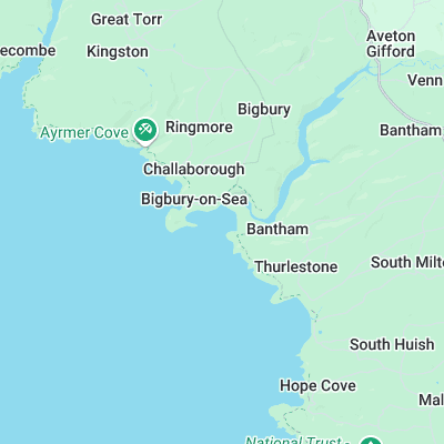
Consistent spot picking up more swell than any other break in the area. Quality banks are provided courtesy of the River Avon which empties into the sea here. Surprisingly powerful, sometimes hollow and capable of holding a bit of size. There is a long right that breaks into the rivermouth at lower tides and a peak on the main beach
Surf spots nearby
- Challabrough (0.8 mi)
- Thurlestone (1.3 mi)
- Hope Cove (2.4 mi)
- Mothecombe (3.6 mi)
- Salcombe (5.8 mi)
- Wembury Bay (9.1 mi)
- Bovisand (11.3 mi)
- Whitsand Bay (16.6 mi)
- Paignton Pier (18.2 mi)
- Gasworks (19 mi)
Not Magic Seaweed (MSW)
Although we look a bit like Magic Seaweed we are not MagicSeaweed as they no longer exist...