Hope Cove Surf Report
| Wave height * | 7.5ft / 2.4m |
|---|---|
| Swell period | 16s |
| Swell direction | |
| Wind | |
| Sea temp | 12°C / 54°F |

10 day Hope Cove surf forecast
Sun
21/Dec
7.5ft
8
14
21
- Low 12:07am
- High 6:13am
- Low 12:32pm
- High 6:33pm
Mon
22/Dec
5ft
13
10
12
- Low 12:43am
- High 6:51am
- Low 1:08pm
- High 7:12pm
Tue
23/Dec
4ft
19
19
21
- Low 1:19am
- High 7:29am
- Low 1:45pm
- High 7:52pm
Wed
24/Dec
5.5ft
24
24
26
- Low 1:56am
- High 8:07am
- Low 2:23pm
- High 8:30pm
Thu
25/Dec
0ft
25
29
30
- Low 2:34am
- High 8:43am
- Low 3:02pm
- High 9:07pm
Fri
26/Dec
2.5ft
18
15
14
- Low 3:14am
- High 9:19am
- Low 3:44pm
- High 9:45pm
Sat
27/Dec
0.5ft
16
21
23
- Low 3:58am
- High 9:59am
- Low 4:31pm
- High 10:30pm
Sun
28/Dec
0ft
23
28
26
- Low 4:49am
- High 10:49am
- Low 5:26pm
- High 11:27pm
Mon
29/Dec
3.5ft
16
14
14
- Low 5:51am
- High 11:53am
- Low 6:30pm
Tue
30/Dec
3.5ft
17
16
13
- High 12:40am
- Low 7:02am
- High 1:13pm
Sun 21st Dec
| 3:00 | 7.5ft | 9ft | 16s | 9mph (10mph) | |||
| 6:00 | 7.5ft | 9.2ft | 16s | 8mph (9mph) | |||
| 9:00 | 7.5ft | 9.1ft | 16s | 9mph (13mph) | |||
| 12:00 | 7.5ft | 8.9ft | 16s | 14mph (22mph) | |||
| 15:00 | 7.5ft | 8.8ft | 16s | 17mph (25mph) | |||
| 18:00 | 7.5ft | 8.6ft | 14s | 21mph (29mph) | |||
| 21:00 | 7ft | 8ft | 14s | 20mph (27mph) |
| Tide times |
|---|
| Low 12:07am (1.52m) |
| High 6:13am (5.38m) |
| Low 12:32pm (1.46m) |
| High 6:33pm (5.14m) |
| Daylight | |
|---|---|
| First light | 07:33 |
| Sunrise | 08:12 |
| Sunset | 16:14 |
| Dark | 16:53 |
Mon 22nd Dec
| 3:00 | 6ft | 6.8ft | 13s | 9mph (14mph) | |||
| 6:00 | 6ft | 6.6ft | 13s | 13mph (17mph) | |||
| 9:00 | 5.5ft | 6ft | 13s | 14mph (19mph) | |||
| 12:00 | 5ft | 5.3ft | 12s | 10mph (13mph) | |||
| 15:00 | 4.5ft | 4.8ft | 12s | 12mph (15mph) | |||
| 18:00 | 4ft | 4.6ft | 12s | 12mph (16mph) | |||
| 21:00 | 4ft | 4.4ft | 11s | 13mph (18mph) |
| Tide times |
|---|
| Low 12:43am (1.49m) |
| High 6:51am (5.41m) |
| Low 1:08pm (1.42m) |
| High 7:12pm (5.12m) |
| Daylight | |
|---|---|
| First light | 07:34 |
| Sunrise | 08:12 |
| Sunset | 16:15 |
| Dark | 16:53 |
Tue 23rd Dec
| 3:00 | 4.5ft | 4.5ft | 11s | 14mph (23mph) | |||
| 6:00 | 4.5ft | 4.8ft | 8s | 19mph (24mph) | |||
| 9:00 | 4ft | 4.8ft | 7s | 17mph (25mph) | |||
| 12:00 | 4ft | 4.7ft | 7s | 19mph (27mph) | |||
| 15:00 | 4ft | 4.3ft | 9s | 19mph (26mph) | |||
| 18:00 | 4ft | 4.4ft | 11s | 21mph (28mph) | |||
| 21:00 | 4.5ft | 4.9ft | 12s | 22mph (29mph) |
| Tide times |
|---|
| Low 1:19am (1.51m) |
| High 7:29am (5.38m) |
| Low 1:45pm (1.43m) |
| High 7:52pm (5.05m) |
| Daylight | |
|---|---|
| First light | 07:34 |
| Sunrise | 08:13 |
| Sunset | 16:15 |
| Dark | 16:54 |
Wed 24th Dec
| 3:00 | 5ft | 5.6ft | 10s | 21mph (29mph) | |||
| 6:00 | 5ft | 5.8ft | 9s | 24mph (32mph) | |||
| 9:00 | 5ft | 6.1ft | 9s | 26mph (32mph) | |||
| 12:00 | 5.5ft | 6.8ft | 9s | 24mph (30mph) | |||
| 15:00 | 5.5ft | 7.2ft | 9s | 25mph (32mph) | |||
| 18:00 | 6ft | 7.8ft | 9s | 26mph (33mph) | |||
| 21:00 | 6.5ft | 8.4ft | 9s | 27mph (35mph) |
| Tide times |
|---|
| Low 1:56am (1.56m) |
| High 8:07am (5.30m) |
| Low 2:23pm (1.49m) |
| High 8:30pm (4.93m) |
| Daylight | |
|---|---|
| First light | 07:35 |
| Sunrise | 08:13 |
| Sunset | 16:16 |
| Dark | 16:55 |
Thu 25th Dec
| 3:00 | 0ft | 7.9ft | 7s | 24mph (33mph) | |||
| 6:00 | 0ft | 7.7ft | 7s | 25mph (35mph) | |||
| 9:00 | 0ft | 7.9ft | 7s | 26mph (37mph) | |||
| 12:00 | 0ft | 8.2ft | 7s | 29mph (39mph) | |||
| 15:00 | 0ft | 9ft | 7s | 30mph (40mph) | |||
| 18:00 | 0ft | 8.2ft | 7s | 30mph (38mph) | |||
| 21:00 | 0.5ft | 7ft | 7s | 28mph (35mph) |
| Tide times |
|---|
| Low 2:34am (1.65m) |
| High 8:43am (5.18m) |
| Low 3:02pm (1.57m) |
| High 9:07pm (4.81m) |
| Daylight | |
|---|---|
| First light | 07:35 |
| Sunrise | 08:14 |
| Sunset | 16:17 |
| Dark | 16:55 |
Fri 26th Dec
| 3:00 | 3.5ft | 4.4ft | 7s | 20mph (25mph) | |||
| 6:00 | 3ft | 3.8ft | 7s | 18mph (23mph) | |||
| 9:00 | 3ft | 3.4ft | 8s | 16mph (20mph) | |||
| 12:00 | 2.5ft | 3ft | 9s | 15mph (17mph) | |||
| 15:00 | 2.5ft | 2.9ft | 11s | 16mph (18mph) | |||
| 18:00 | 2.5ft | 2.8ft | 9s | 14mph (18mph) | |||
| 21:00 | 2.5ft | 2.8ft | 9s | 13mph (17mph) |
| Tide times |
|---|
| Low 3:14am (1.76m) |
| High 9:19am (5.06m) |
| Low 3:44pm (1.67m) |
| High 9:45pm (4.71m) |
| Daylight | |
|---|---|
| First light | 07:35 |
| Sunrise | 08:14 |
| Sunset | 16:17 |
| Dark | 16:56 |
Sat 27th Dec
| 3:00 | 2.5ft | 3ft | 8s | 14mph (22mph) | |||
| 6:00 | 3ft | 3.5ft | 8s | 16mph (25mph) | |||
| 9:00 | 3.5ft | 4.3ft | 7s | 17mph (26mph) | |||
| 12:00 | 0.5ft | 5ft | 5s | 21mph (27mph) | |||
| 15:00 | 4.5ft | 5.4ft | 7s | 22mph (30mph) | |||
| 18:00 | 0.5ft | 5.9ft | 6s | 23mph (32mph) | |||
| 21:00 | 0ft | 6.5ft | 6s | 22mph (35mph) |
| Tide times |
|---|
| Low 3:58am (1.86m) |
| High 9:59am (4.96m) |
| Low 4:31pm (1.77m) |
| High 10:30pm (4.65m) |
| Daylight | |
|---|---|
| First light | 07:36 |
| Sunrise | 08:14 |
| Sunset | 16:18 |
| Dark | 16:57 |
Sun 28th Dec
| 3:00 | 0ft | 6.6ft | 6s | 24mph (36mph) | |||
| 6:00 | 0ft | 7.1ft | 6s | 23mph (35mph) | |||
| 9:00 | 0ft | 7.2ft | 7s | 25mph (36mph) | |||
| 12:00 | 0ft | 7.4ft | 7s | 28mph (36mph) | |||
| 15:00 | 0ft | 7.3ft | 7s | 26mph (33mph) | |||
| 18:00 | 0ft | 7.1ft | 6s | 26mph (31mph) | |||
| 21:00 | 0ft | 7ft | 6s | 23mph (30mph) |
| Tide times |
|---|
| Low 4:49am (1.95m) |
| High 10:49am (4.88m) |
| Low 5:26pm (1.85m) |
| High 11:27pm (4.63m) |
| Daylight | |
|---|---|
| First light | 07:36 |
| Sunrise | 08:14 |
| Sunset | 16:19 |
| Dark | 16:57 |
Mon 29th Dec
| 3:00 | 0.5ft | 5.4ft | 6s | 19mph (25mph) | |||
| 6:00 | 0ft | 4.6ft | 6s | 16mph (23mph) | |||
| 9:00 | 3.5ft | 4.3ft | 8s | 14mph (20mph) | |||
| 12:00 | 3.5ft | 4.4ft | 8s | 14mph (20mph) | |||
| 15:00 | 3.5ft | 4.4ft | 8s | 14mph (20mph) | |||
| 18:00 | 3.5ft | 4.5ft | 8s | 14mph (22mph) | |||
| 21:00 | 3.5ft | 4.7ft | 8s | 11mph (22mph) |
| Tide times |
|---|
| Low 5:51am (2.02m) |
| High 11:53am (4.82m) |
| Low 6:30pm (1.89m) |
| Daylight | |
|---|---|
| First light | 07:36 |
| Sunrise | 08:14 |
| Sunset | 16:20 |
| Dark | 16:58 |
Tue 30th Dec
| 3:00 | 4ft | 5.1ft | 8s | 16mph (23mph) | |||
| 6:00 | 4ft | 5.1ft | 8s | 17mph (22mph) | |||
| 9:00 | 4ft | 4.9ft | 8s | 16mph (21mph) | |||
| 12:00 | 3.5ft | 4.3ft | 8s | 16mph (21mph) | |||
| 15:00 | 3.5ft | 3.8ft | 8s | 15mph (21mph) | |||
| 18:00 | 3ft | 3.6ft | 10s | 13mph (19mph) | |||
| 21:00 | 3ft | 3.5ft | 10s | 13mph (19mph) |
| Tide times |
|---|
| High 12:40am (4.67m) |
| Low 7:02am (2.01m) |
| High 1:13pm (4.82m) |
| Daylight | |
|---|---|
| First light | 07:36 |
| Sunrise | 08:14 |
| Sunset | 16:21 |
| Dark | 16:59 |
Nearest buoys
Fickle right can sometimes be found on a big SW swell. Can get hollow.
Surf spots nearby
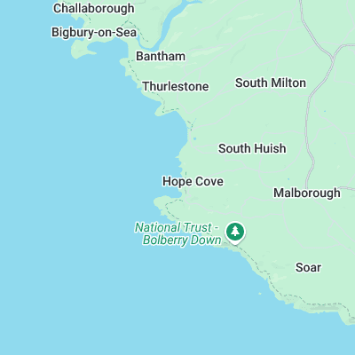
- Thurlestone (1.1 mi)
- Bantham (2.4 mi)
- Challabrough (3.1 mi)
- Salcombe (3.8 mi)
- Mothecombe (5.8 mi)
- Wembury Bay (10.8 mi)
- Bovisand (13.1 mi)
- Whitsand Bay (18.2 mi)
- Paignton Pier (18.8 mi)
- Gasworks (19.7 mi)
Not Magic Seaweed (MSW)
Although we look a bit like Magic Seaweed we are not MagicSeaweed as they no longer exist...