Hayle Towans Surf Report
| Wave height * | 3.5ft / 1m |
|---|---|
| Swell period | 7s |
| Swell direction | |
| Wind | |
| Sea temp | 10°C / 51°F |

10 day Hayle Towans surf forecast
Mon
5/Jan
4ft
14
17
20
- Low 12:53am
- High 6:28am
- Low 1:23pm
- High 6:52pm
Tue
6/Jan
3ft
11
15
24
- Low 1:37am
- High 7:11am
- Low 2:07pm
- High 7:35pm
Wed
7/Jan
5.5ft
25
13
18
- Low 2:18am
- High 7:53am
- Low 2:48pm
- High 8:17pm
Thu
8/Jan
4ft
15
18
45
- Low 2:58am
- High 8:35am
- Low 3:28pm
- High 8:59pm
Fri
9/Jan
12ft
35
33
26
- Low 3:39am
- High 9:19am
- Low 4:11pm
- High 9:46pm
Sat
10/Jan
7.5ft
21
24
27
- Low 4:24am
- High 10:08am
- Low 5:00pm
- High 10:42pm
Sun
11/Jan
8ft
30
21
24
- Low 5:20am
- High 11:10am
- Low 5:59pm
- High 11:52pm
Mon
12/Jan
9ft
13
22
16
- Low 6:29am
- High 12:26pm
- Low 7:08pm
Tue
13/Jan
10ft
13
25
9
- High 1:08am
- Low 7:42am
- High 1:39pm
- Low 8:15pm
Wed
14/Jan
13.5ft
6
9
18
- High 2:12am
- Low 8:47am
- High 2:38pm
- Low 9:11pm
Mon 5th Jan
| 3:00 | 2ft | 3ft | 12s | 8mph (13mph) | |||
| 6:00 | 3ft | 3.5ft | 10s | 14mph (19mph) | |||
| 9:00 | 4ft | 5.1ft | 7s | 24mph (26mph) | |||
| 12:00 | 4ft | 5ft | 7s | 17mph (21mph) | |||
| 15:00 | 4.5ft | 5.6ft | 7s | 22mph (25mph) | |||
| 18:00 | 5ft | 5.8ft | 6s | 20mph (24mph) | |||
| 21:00 | 4.5ft | 5.7ft | 6s | 21mph (24mph) |
| Tide times |
|---|
| Low 12:53am (0.88m) |
| High 6:28am (5.69m) |
| Low 1:23pm (0.79m) |
| High 6:52pm (5.33m) |
| Daylight | |
|---|---|
| First light | 07:42 |
| Sunrise | 08:19 |
| Sunset | 16:35 |
| Dark | 17:12 |
Tue 6th Jan
| 3:00 | 4ft | 4.3ft | 7s | 14mph (17mph) | |||
| 6:00 | 3.5ft | 3.9ft | 7s | 11mph (15mph) | |||
| 9:00 | 3ft | 3.5ft | 6s | 10mph (13mph) | |||
| 12:00 | 3ft | 3.2ft | 6s | 15mph (17mph) | |||
| 15:00 | 3.5ft | 3.9ft | 6s | 20mph (26mph) | |||
| 18:00 | 3.5ft | 5.4ft | 5s | 24mph (29mph) | |||
| 21:00 | 3.5ft | 6.2ft | 6s | 22mph (27mph) |
| Tide times |
|---|
| Low 1:37am (0.98m) |
| High 7:11am (5.56m) |
| Low 2:07pm (0.94m) |
| High 7:35pm (5.16m) |
| Daylight | |
|---|---|
| First light | 07:41 |
| Sunrise | 08:19 |
| Sunset | 16:36 |
| Dark | 17:14 |
Wed 7th Jan
| 3:00 | 5ft | 7.1ft | 7s | 25mph (31mph) | |||
| 6:00 | 6ft | 7.9ft | 7s | 25mph (31mph) | |||
| 9:00 | 6ft | 7.9ft | 7s | 21mph (27mph) | |||
| 12:00 | 5.5ft | 7.1ft | 8s | 13mph (17mph) | |||
| 15:00 | 4.5ft | 6.1ft | 8s | 6mph (8mph) | |||
| 18:00 | 4.5ft | 5.7ft | 11s | 18mph (29mph) | |||
| 21:00 | 4.5ft | 6.3ft | 8s | 21mph (33mph) |
| Tide times |
|---|
| Low 2:18am (1.16m) |
| High 7:53am (5.35m) |
| Low 2:48pm (1.17m) |
| High 8:17pm (4.95m) |
| Daylight | |
|---|---|
| First light | 07:41 |
| Sunrise | 08:19 |
| Sunset | 16:37 |
| Dark | 17:15 |
Thu 8th Jan
| 3:00 | 5ft | 7.6ft | 7s | 17mph (23mph) | |||
| 6:00 | 5ft | 7.4ft | 8s | 15mph (21mph) | |||
| 9:00 | 4ft | 6.9ft | 8s | 12mph (15mph) | |||
| 12:00 | 4ft | 6.5ft | 9s | 18mph (31mph) | |||
| 15:00 | 4ft | 7.1ft | 9s | 32mph (46mph) | |||
| 18:00 | 6.5ft | 11.7ft | 9s | 45mph (58mph) | |||
| 21:00 | 9.5ft | 21.6ft | 11s | 56mph (77mph) |
| Tide times |
|---|
| Low 2:58am (1.39m) |
| High 8:35am (5.09m) |
| Low 3:28pm (1.44m) |
| High 8:59pm (4.72m) |
| Daylight | |
|---|---|
| First light | 07:41 |
| Sunrise | 08:18 |
| Sunset | 16:38 |
| Dark | 17:16 |
Fri 9th Jan
| 3:00 | 17.5ft | 27.5ft | 14s | 39mph (51mph) | |||
| 6:00 | 14ft | 23.7ft | 13s | 35mph (43mph) | |||
| 9:00 | 12.5ft | 21.3ft | 13s | 34mph (43mph) | |||
| 12:00 | 12ft | 19.9ft | 13s | 33mph (40mph) | |||
| 15:00 | 11ft | 18.9ft | 13s | 31mph (37mph) | |||
| 18:00 | 12ft | 18.3ft | 12s | 26mph (32mph) | |||
| 21:00 | 11ft | 18.3ft | 13s | 29mph (35mph) |
| Tide times |
|---|
| Low 3:39am (1.64m) |
| High 9:19am (4.81m) |
| Low 4:11pm (1.71m) |
| High 9:46pm (4.50m) |
| Daylight | |
|---|---|
| First light | 07:40 |
| Sunrise | 08:18 |
| Sunset | 16:40 |
| Dark | 17:17 |
Sat 10th Jan
| 3:00 | 10.5ft | 16ft | 13s | 25mph (31mph) | |||
| 6:00 | 9ft | 14.1ft | 13s | 21mph (27mph) | |||
| 9:00 | 8ft | 12.7ft | 12s | 18mph (24mph) | |||
| 12:00 | 7.5ft | 11.3ft | 12s | 24mph (35mph) | |||
| 15:00 | 6.5ft | 9.9ft | 12s | 28mph (38mph) | |||
| 18:00 | 5.5ft | 8.6ft | 11s | 27mph (45mph) | |||
| 21:00 | 5ft | 7.8ft | 11s | 31mph (47mph) |
| Tide times |
|---|
| Low 4:24am (1.89m) |
| High 10:08am (4.54m) |
| Low 5:00pm (1.94m) |
| High 10:42pm (4.31m) |
| Daylight | |
|---|---|
| First light | 07:40 |
| Sunrise | 08:17 |
| Sunset | 16:41 |
| Dark | 17:18 |
Sun 11th Jan
| 3:00 | 4.5ft | 7.6ft | 10s | 35mph (51mph) | |||
| 6:00 | 4.5ft | 9.5ft | 7s | 30mph (47mph) | |||
| 9:00 | 6.5ft | 12.2ft | 9s | 26mph (37mph) | |||
| 12:00 | 8ft | 14.4ft | 10s | 21mph (30mph) | |||
| 15:00 | 8.5ft | 15.7ft | 10s | 27mph (37mph) | |||
| 18:00 | 8ft | 15ft | 11s | 24mph (35mph) | |||
| 21:00 | 7.5ft | 13.9ft | 11s | 27mph (38mph) |
| Tide times |
|---|
| Low 5:20am (2.10m) |
| High 11:10am (4.31m) |
| Low 5:59pm (2.10m) |
| High 11:52pm (4.21m) |
| Daylight | |
|---|---|
| First light | 07:39 |
| Sunrise | 08:16 |
| Sunset | 16:42 |
| Dark | 17:20 |
Mon 12th Jan
| 3:00 | 6.5ft | 13.5ft | 11s | 22mph (30mph) | |||
| 6:00 | 7.5ft | 15.1ft | 11s | 13mph (19mph) | |||
| 9:00 | 8.5ft | 15.7ft | 11s | 16mph (23mph) | |||
| 12:00 | 9ft | 15.2ft | 12s | 22mph (27mph) | |||
| 15:00 | 8.5ft | 14.3ft | 12s | 22mph (27mph) | |||
| 18:00 | 8ft | 13.4ft | 12s | 16mph (20mph) | |||
| 21:00 | 7.5ft | 12.7ft | 12s | 11mph (16mph) |
| Tide times |
|---|
| Low 6:29am (2.20m) |
| High 12:26pm (4.20m) |
| Low 7:08pm (2.14m) |
| Daylight | |
|---|---|
| First light | 07:39 |
| Sunrise | 08:16 |
| Sunset | 16:44 |
| Dark | 17:21 |
Tue 13th Jan
| 3:00 | 8.5ft | 13.2ft | 12s | 8mph (13mph) | |||
| 6:00 | 9ft | 15.1ft | 11s | 13mph (15mph) | |||
| 9:00 | 9ft | 17ft | 11s | 19mph (19mph) | |||
| 12:00 | 10ft | 16.7ft | 12s | 25mph (27mph) | |||
| 15:00 | 9.5ft | 15.8ft | 12s | 17mph (20mph) | |||
| 18:00 | 9ft | 15.2ft | 12s | 9mph (11mph) | |||
| 21:00 | 9ft | 15.6ft | 12s | 3mph (3mph) |
| Tide times |
|---|
| High 1:08am (4.26m) |
| Low 7:42am (2.17m) |
| High 1:39pm (4.26m) |
| Low 8:15pm (2.05m) |
| Daylight | |
|---|---|
| First light | 07:38 |
| Sunrise | 08:15 |
| Sunset | 16:45 |
| Dark | 17:22 |
Wed 14th Jan
| 3:00 | 10.5ft | 17.5ft | 13s | 22mph (28mph) | |||
| 6:00 | 11.5ft | 19.3ft | 13s | 6mph (14mph) | |||
| 9:00 | 13.5ft | 21ft | 15s | 12mph (18mph) | |||
| 12:00 | 13.5ft | 20.6ft | 16s | 9mph (16mph) | |||
| 15:00 | 13ft | 19.8ft | 16s | 5mph (8mph) | |||
| 18:00 | 12ft | 18.6ft | 16s | 18mph (21mph) | |||
| 21:00 | 11ft | 17.4ft | 16s | 20mph (23mph) |
| Tide times |
|---|
| High 2:12am (4.44m) |
| Low 8:47am (2.00m) |
| High 2:38pm (4.42m) |
| Low 9:11pm (1.87m) |
| Daylight | |
|---|---|
| First light | 07:37 |
| Sunrise | 08:14 |
| Sunset | 16:47 |
| Dark | 17:24 |
Nearest buoys
Long stretch of beach down to the rivermouth. Various spots including The Site which can produce long walling waves and lots of paddling!
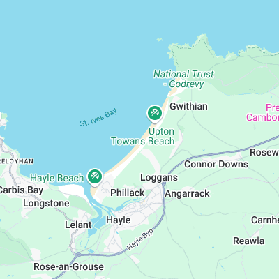
Surf spots nearby
- Sandy Acres (0.3 mi)
- Gwithian (1 mi)
- Godrevy (1.6 mi)
- Hawks Point (2.1 mi)
- Carbis Bay (2.4 mi)
- The Breakwater (2.9 mi)
- Porthmeor (3.3 mi)
- Portreath (6.3 mi)
- Portreath Harbour Wall (6.3 mi)
- Marazion (6.7 mi)
Not Magic Seaweed (MSW)
Although we look a bit like Magic Seaweed we are not MagicSeaweed as they no longer exist...