Le Braye (Le Brayes) Surf Report
| Wave height * | 6.5ft / 1.9m |
|---|---|
| Swell period | 12s |
| Swell direction | |
| Wind | |
| Sea temp | 13°C / 55°F |

10 day Le Braye surf forecast
Sat
29/Nov
8ft
29
28
22
- High 1:20am
- Low 7:52am
- High 1:53pm
- Low 8:32pm
Sun
30/Nov
5ft
28
15
16
- High 2:28am
- Low 9:05am
- High 2:58pm
- Low 9:37pm
Mon
1/Dec
8ft
32
33
37
- High 3:29am
- Low 10:07am
- High 3:58pm
- Low 10:35pm
Tue
2/Dec
5.5ft
14
13
1
- High 4:25am
- Low 11:04am
- High 4:53pm
- Low 11:29pm
Wed
3/Dec
6ft
5
5
11
- High 5:18am
- Low 11:58am
- High 5:46pm
Thu
4/Dec
6.5ft
31
15
12
- Low 12:22am
- High 6:08am
- Low 12:50pm
- High 6:36pm
Fri
5/Dec
7.5ft
15
32
46
- Low 1:12am
- High 6:57am
- Low 1:41pm
- High 7:25pm
Sat
6/Dec
12.5ft
39
38
30
- Low 2:02am
- High 7:44am
- Low 2:30pm
- High 8:12pm
Sun
7/Dec
7ft
21
20
24
- Low 2:49am
- High 8:30am
- Low 3:18pm
- High 8:59pm
Mon
8/Dec
6.5ft
25
27
26
- Low 3:35am
Sat 29th Nov
| 3:00 | 7.5ft | 8.2ft | 14s | 26mph (35mph) | |||
| 6:00 | 8ft | 8.4ft | 14s | 29mph (39mph) | |||
| 9:00 | 8.5ft | 9.2ft | 13s | 31mph (39mph) | |||
| 12:00 | 8ft | 8.6ft | 13s | 28mph (26mph) | |||
| 15:00 | 7.5ft | 7.9ft | 12s | 23mph (25mph) | |||
| 18:00 | 7ft | 7.2ft | 12s | 22mph (24mph) | |||
| 21:00 | 6.5ft | 6.8ft | 12s | 17mph (20mph) |
| Tide times |
|---|
| High 1:20am (8.36m) |
| Low 7:52am (3.95m) |
| High 1:53pm (8.75m) |
| Low 8:32pm (3.36m) |
| Daylight | |
|---|---|
| First light | 07:03 |
| Sunrise | 07:39 |
| Sunset | 16:14 |
| Dark | 16:50 |
Sun 30th Nov
| 3:00 | 6.5ft | 6.9ft | 12s | 27mph (27mph) | |||
| 6:00 | 6ft | 7.3ft | 11s | 28mph (27mph) | |||
| 9:00 | 6ft | 6.5ft | 11s | 20mph (22mph) | |||
| 12:00 | 5ft | 5.6ft | 11s | 15mph (16mph) | |||
| 15:00 | 4.5ft | 4.9ft | 11s | 8mph (10mph) | |||
| 18:00 | 4.5ft | 4.6ft | 11s | 16mph (16mph) | |||
| 21:00 | 4.5ft | 4.7ft | 11s | 21mph (22mph) |
| Tide times |
|---|
| High 2:28am (8.92m) |
| Low 9:05am (3.37m) |
| High 2:58pm (9.33m) |
| Low 9:37pm (2.79m) |
| Daylight | |
|---|---|
| First light | 07:04 |
| Sunrise | 07:41 |
| Sunset | 16:14 |
| Dark | 16:50 |
Mon 1st Dec
| 3:00 | 5.5ft | 6.1ft | 8s | 29mph (34mph) | |||
| 6:00 | 6.5ft | 6.7ft | 6s | 32mph (38mph) | |||
| 9:00 | 6.5ft | 7.4ft | 7s | 32mph (40mph) | |||
| 12:00 | 8ft | 8.4ft | 9s | 33mph (42mph) | |||
| 15:00 | 8ft | 9.2ft | 9s | 35mph (43mph) | |||
| 18:00 | 9ft | 9.7ft | 10s | 37mph (47mph) | |||
| 21:00 | 9ft | 10.1ft | 10s | 40mph (49mph) |
| Tide times |
|---|
| High 3:29am (9.58m) |
| Low 10:07am (2.68m) |
| High 3:58pm (9.95m) |
| Low 10:35pm (2.22m) |
| Daylight | |
|---|---|
| First light | 07:06 |
| Sunrise | 07:42 |
| Sunset | 16:13 |
| Dark | 16:49 |
Tue 2nd Dec
| 3:00 | 7.5ft | 8.6ft | 11s | 23mph (25mph) | |||
| 6:00 | 6.5ft | 7.2ft | 11s | 14mph (13mph) | |||
| 9:00 | 6ft | 6.7ft | 11s | 19mph (18mph) | |||
| 12:00 | 5.5ft | 6.2ft | 12s | 13mph (14mph) | |||
| 15:00 | 5.5ft | 5.9ft | 14s | 9mph (9mph) | |||
| 18:00 | 5.5ft | 5.9ft | 15s | 1mph (2mph) | |||
| 21:00 | 5.5ft | 6.1ft | 15s | 2mph (2mph) |
| Tide times |
|---|
| High 4:25am (10.23m) |
| Low 11:04am (2.06m) |
| High 4:53pm (10.50m) |
| Low 11:29pm (1.78m) |
| Daylight | |
|---|---|
| First light | 07:07 |
| Sunrise | 07:43 |
| Sunset | 16:12 |
| Dark | 16:49 |
Wed 3rd Dec
| 3:00 | 5.5ft | 6.3ft | 15s | 5mph (6mph) | |||
| 6:00 | 6ft | 6.4ft | 15s | 5mph (6mph) | |||
| 9:00 | 6ft | 6.4ft | 14s | 3mph (3mph) | |||
| 12:00 | 6ft | 6.4ft | 14s | 5mph (4mph) | |||
| 15:00 | 5.5ft | 6.1ft | 14s | 6mph (6mph) | |||
| 18:00 | 5.5ft | 5.8ft | 14s | 11mph (10mph) | |||
| 21:00 | 5ft | 5.5ft | 13s | 20mph (21mph) |
| Tide times |
|---|
| High 5:18am (10.76m) |
| Low 11:58am (1.60m) |
| High 5:46pm (10.88m) |
| Daylight | |
|---|---|
| First light | 07:08 |
| Sunrise | 07:45 |
| Sunset | 16:12 |
| Dark | 16:49 |
Thu 4th Dec
| 3:00 | 5.5ft | 5.8ft | 13s | 32mph (38mph) | |||
| 6:00 | 6ft | 6.7ft | 10s | 31mph (41mph) | |||
| 9:00 | 7ft | 7.3ft | 9s | 22mph (26mph) | |||
| 12:00 | 6.5ft | 7.1ft | 11s | 15mph (18mph) | |||
| 15:00 | 6.5ft | 6.8ft | 11s | 17mph (18mph) | |||
| 18:00 | 6ft | 6.4ft | 11s | 12mph (13mph) | |||
| 21:00 | 5.5ft | 6.1ft | 11s | 12mph (14mph) |
| Tide times |
|---|
| Low 12:22am (1.53m) |
| High 6:08am (11.11m) |
| Low 12:50pm (1.34m) |
| High 6:36pm (11.05m) |
| Daylight | |
|---|---|
| First light | 07:09 |
| Sunrise | 07:46 |
| Sunset | 16:12 |
| Dark | 16:48 |
Fri 5th Dec
| 3:00 | 6.5ft | 7.2ft | 16s | 11mph (13mph) | |||
| 6:00 | 7.5ft | 8.2ft | 19s | 15mph (15mph) | |||
| 9:00 | 7.5ft | 8.5ft | 19s | 23mph (24mph) | |||
| 12:00 | 7.5ft | 8.5ft | 18s | 32mph (37mph) | |||
| 15:00 | 8ft | 8.9ft | 17s | 39mph (47mph) | |||
| 18:00 | 8.5ft | 9.6ft | 13s | 46mph (58mph) | |||
| 21:00 | 9ft | 9.9ft | 13s | 31mph (37mph) |
| Tide times |
|---|
| Low 1:12am (1.48m) |
| High 6:57am (11.24m) |
| Low 1:41pm (1.29m) |
| High 7:25pm (10.99m) |
| Daylight | |
|---|---|
| First light | 07:10 |
| Sunrise | 07:47 |
| Sunset | 16:11 |
| Dark | 16:48 |
Sat 6th Dec
| 3:00 | 11ft | 12ft | 13s | 34mph (41mph) | |||
| 6:00 | 12.5ft | 13.5ft | 15s | 39mph (45mph) | |||
| 9:00 | 13ft | 14.1ft | 16s | 39mph (45mph) | |||
| 12:00 | 12.5ft | 13.6ft | 16s | 38mph (45mph) | |||
| 15:00 | 11.5ft | 12.5ft | 16s | 34mph (40mph) | |||
| 18:00 | 10.5ft | 11.3ft | 16s | 30mph (36mph) | |||
| 21:00 | 9.5ft | 10.1ft | 15s | 27mph (32mph) |
| Tide times |
|---|
| Low 2:02am (1.63m) |
| High 7:44am (11.13m) |
| Low 2:30pm (1.45m) |
| High 8:12pm (10.71m) |
| Daylight | |
|---|---|
| First light | 07:11 |
| Sunrise | 07:48 |
| Sunset | 16:11 |
| Dark | 16:48 |
Sun 7th Dec
| 3:00 | 7.5ft | 8.3ft | 14s | 20mph (23mph) | |||
| 6:00 | 7ft | 7.6ft | 14s | 21mph (25mph) | |||
| 9:00 | 7ft | 7.4ft | 14s | 20mph (23mph) | |||
| 12:00 | 7ft | 7.5ft | 13s | 20mph (25mph) | |||
| 15:00 | 6.5ft | 7ft | 13s | 23mph (30mph) | |||
| 18:00 | 6ft | 6.6ft | 12s | 24mph (30mph) | |||
| 21:00 | 6ft | 6.5ft | 12s | 23mph (34mph) |
| Tide times |
|---|
| Low 2:49am (1.93m) |
| High 8:30am (10.80m) |
| Low 3:18pm (1.80m) |
| High 8:59pm (10.24m) |
| Daylight | |
|---|---|
| First light | 07:12 |
| Sunrise | 07:49 |
| Sunset | 16:11 |
| Dark | 16:48 |
Mon 8th Dec
| 3:00 | 5.5ft | 6ft | 11s | 26mph (37mph) | |||
| 6:00 | 5.5ft | 6ft | 11s | 25mph (38mph) | |||
| 9:00 | 6ft | 6.2ft | 11s | 19mph (30mph) | |||
| 12:00 | 6.5ft | 6.7ft | 13s | 27mph (42mph) | |||
| 15:00 | 7ft | 7.4ft | 15s | 22mph (37mph) | |||
| 18:00 | 8ft | 8.8ft | 16s | 26mph (40mph) | |||
| 21:00 | 11.5ft | 12.3ft | 13s | 24mph (35mph) |
| Tide times |
|---|
| Low 3:35am (2.37m) |
| Daylight | |
|---|---|
| First light | 07:13 |
| Sunrise | 07:50 |
| Sunset | 16:11 |
| Dark | 16:48 |
Nearest buoys
Decent beachbreak that is often a touch smaller than Watersplash. Rights are generally better and there can be some good walls when it lines up.
Surf spots nearby
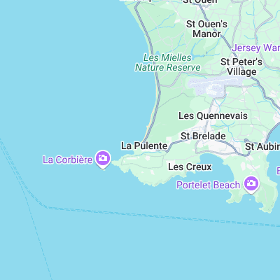
- La Rocco (0.5 mi)
- Petit Port (0.9 mi)
- Watersplash (1.5 mi)
- Secrets (2.5 mi)
- Greve de Lecq (4.3 mi)
- Plemont (4.7 mi)
- Baubigny (24.8 mi)
Not Magic Seaweed (MSW)
Although we look a bit like Magic Seaweed we are not MagicSeaweed as they no longer exist...