Woolacombe Surf Report
| Wave height * | 3.5ft / 1m |
|---|---|
| Swell period | 5s |
| Swell direction | |
| Wind | |
| Sea temp | 9°C / 49°F |

10 day Woolacombe surf forecast
Fri
2/Jan
3.5ft
27
25
24
- High 5:30am
- Low 11:42am
- High 6:00pm
Sat
3/Jan
3.5ft
22
27
20
- Low 12:04am
- High 6:22am
- Low 12:35pm
- High 6:51pm
Sun
4/Jan
2ft
14
12
19
- Low 12:52am
- High 7:10am
- Low 1:23pm
- High 7:37pm
Mon
5/Jan
2ft
18
12
11
- Low 1:36am
- High 7:55am
- Low 2:07pm
- High 8:21pm
Tue
6/Jan
2ft
4
9
16
- Low 2:17am
- High 8:38am
- Low 2:47pm
- High 9:02pm
Wed
7/Jan
1.5ft
20
5
19
- Low 2:55am
- High 9:18am
- Low 3:24pm
- High 9:41pm
Thu
8/Jan
2.5ft
34
21
15
- Low 3:32am
- High 9:58am
- Low 4:01pm
- High 10:21pm
Fri
9/Jan
4ft
34
27
24
- Low 4:11am
- High 10:38am
- Low 4:40pm
- High 11:03pm
Sat
10/Jan
2ft
13
19
20
- Low 4:56am
- High 11:24am
- Low 5:28pm
- High 11:56pm
Sun
11/Jan
3.5ft
23
14
20
- Low 5:54am
- High 12:21pm
- Low 6:32pm
Fri 2nd Jan
| 3:00 | 3.5ft | 4ft | 5s | 25mph (30mph) | |||
| 6:00 | 4.5ft | 5.1ft | 5s | 27mph (32mph) | |||
| 9:00 | 4ft | 5.1ft | 6s | 28mph (32mph) | |||
| 12:00 | 3.5ft | 5ft | 6s | 25mph (30mph) | |||
| 15:00 | 3.5ft | 4.4ft | 6s | 24mph (28mph) | |||
| 18:00 | 3ft | 4.2ft | 5s | 24mph (25mph) | |||
| 21:00 | 3ft | 4.3ft | 5s | 27mph (28mph) |
| Tide times |
|---|
| High 5:30am (9.02m) |
| Low 11:42am (1.17m) |
| High 6:00pm (9.03m) |
| Daylight | |
|---|---|
| First light | 07:41 |
| Sunrise | 08:20 |
| Sunset | 16:22 |
| Dark | 17:01 |
Sat 3rd Jan
| 3:00 | 3.5ft | 4.8ft | 5s | 28mph (29mph) | |||
| 6:00 | 3.5ft | 4.8ft | 5s | 22mph (29mph) | |||
| 9:00 | 3.5ft | 4.4ft | 5s | 24mph (30mph) | |||
| 12:00 | 3.5ft | 4.4ft | 5s | 27mph (30mph) | |||
| 15:00 | 3.5ft | 4.6ft | 5s | 24mph (28mph) | |||
| 18:00 | 3.5ft | 4.7ft | 5s | 20mph (29mph) | |||
| 21:00 | 3ft | 4.2ft | 5s | 20mph (24mph) |
| Tide times |
|---|
| Low 12:04am (1.11m) |
| High 6:22am (9.33m) |
| Low 12:35pm (0.95m) |
| High 6:51pm (9.20m) |
| Daylight | |
|---|---|
| First light | 07:40 |
| Sunrise | 08:20 |
| Sunset | 16:23 |
| Dark | 17:02 |
Sun 4th Jan
| 3:00 | 2.5ft | 3.2ft | 7s | 16mph (17mph) | |||
| 6:00 | 2.5ft | 3ft | 7s | 14mph (16mph) | |||
| 9:00 | 2.5ft | 2.9ft | 7s | 14mph (15mph) | |||
| 12:00 | 2ft | 2.6ft | 7s | 12mph (14mph) | |||
| 15:00 | 2ft | 2.7ft | 7s | 16mph (18mph) | |||
| 18:00 | 2.5ft | 2.9ft | 4s | 19mph (20mph) | |||
| 21:00 | 2.5ft | 3ft | 4s | 19mph (20mph) |
| Tide times |
|---|
| Low 12:52am (0.98m) |
| High 7:10am (9.46m) |
| Low 1:23pm (0.88m) |
| High 7:37pm (9.20m) |
| Daylight | |
|---|---|
| First light | 07:40 |
| Sunrise | 08:19 |
| Sunset | 16:24 |
| Dark | 17:03 |
Mon 5th Jan
| 3:00 | 3ft | 3.7ft | 5s | 22mph (23mph) | |||
| 6:00 | 2.5ft | 3.4ft | 5s | 18mph (19mph) | |||
| 9:00 | 2ft | 2.7ft | 5s | 13mph (15mph) | |||
| 12:00 | 2ft | 2.1ft | 5s | 12mph (12mph) | |||
| 15:00 | 1.5ft | 1.7ft | 7s | 15mph (12mph) | |||
| 18:00 | 1.5ft | 1.7ft | 11s | 11mph (13mph) | |||
| 21:00 | 1.5ft | 1.9ft | 9s | 11mph (13mph) |
| Tide times |
|---|
| Low 1:36am (1.00m) |
| High 7:55am (9.41m) |
| Low 2:07pm (0.98m) |
| High 8:21pm (9.03m) |
| Daylight | |
|---|---|
| First light | 07:40 |
| Sunrise | 08:19 |
| Sunset | 16:25 |
| Dark | 17:04 |
Tue 6th Jan
| 3:00 | 1.5ft | 1.5ft | 10s | 7mph (8mph) | |||
| 6:00 | 1ft | 1.4ft | 11s | 4mph (4mph) | |||
| 9:00 | 1.5ft | 1.7ft | 11s | 5mph (3mph) | |||
| 12:00 | 2ft | 2.2ft | 4s | 9mph (9mph) | |||
| 15:00 | 2.5ft | 3ft | 4s | 14mph (16mph) | |||
| 18:00 | 3.5ft | 3.7ft | 5s | 16mph (16mph) | |||
| 21:00 | 3ft | 3.6ft | 5s | 16mph (18mph) |
| Tide times |
|---|
| Low 2:17am (1.16m) |
| High 8:38am (9.20m) |
| Low 2:47pm (1.22m) |
| High 9:02pm (8.73m) |
| Daylight | |
|---|---|
| First light | 07:40 |
| Sunrise | 08:19 |
| Sunset | 16:27 |
| Dark | 17:06 |
Wed 7th Jan
| 3:00 | 2.5ft | 3ft | 5s | 13mph (14mph) | |||
| 6:00 | 2ft | 2.8ft | 5s | 20mph (22mph) | |||
| 9:00 | 2ft | 2.8ft | 5s | 12mph (13mph) | |||
| 12:00 | 1.5ft | 2.7ft | 6s | 5mph (6mph) | |||
| 15:00 | 2ft | 3.1ft | 6s | 13mph (17mph) | |||
| 18:00 | 2.5ft | 3.3ft | 6s | 19mph (21mph) | |||
| 21:00 | 3ft | 3.5ft | 5s | 22mph (26mph) |
| Tide times |
|---|
| Low 2:55am (1.44m) |
| High 9:18am (8.84m) |
| Low 3:24pm (1.58m) |
| High 9:41pm (8.32m) |
| Daylight | |
|---|---|
| First light | 07:39 |
| Sunrise | 08:18 |
| Sunset | 16:28 |
| Dark | 17:07 |
Thu 8th Jan
| 3:00 | 3ft | 3.7ft | 5s | 30mph (36mph) | |||
| 6:00 | 3ft | 3.4ft | 5s | 34mph (44mph) | |||
| 9:00 | 3ft | 3ft | 6s | 27mph (35mph) | |||
| 12:00 | 2.5ft | 2.7ft | 9s | 21mph (27mph) | |||
| 15:00 | 2ft | 2.6ft | 9s | 20mph (25mph) | |||
| 18:00 | 2ft | 2.4ft | 10s | 15mph (19mph) | |||
| 21:00 | 2ft | 2.2ft | 12s | 14mph (17mph) |
| Tide times |
|---|
| Low 3:32am (1.81m) |
| High 9:58am (8.37m) |
| Low 4:01pm (2.02m) |
| High 10:21pm (7.85m) |
| Daylight | |
|---|---|
| First light | 07:39 |
| Sunrise | 08:18 |
| Sunset | 16:29 |
| Dark | 17:08 |
Fri 9th Jan
| 3:00 | 3ft | 3.6ft | 7s | 5mph (6mph) | |||
| 6:00 | 4ft | 4.8ft | 6s | 34mph (49mph) | |||
| 9:00 | 3.5ft | 4.4ft | 6s | 43mph (56mph) | |||
| 12:00 | 4ft | 4.4ft | 6s | 27mph (31mph) | |||
| 15:00 | 3.5ft | 4.1ft | 6s | 28mph (30mph) | |||
| 18:00 | 3ft | 3.6ft | 6s | 24mph (28mph) | |||
| 21:00 | 3ft | 3.2ft | 11s | 23mph (26mph) |
| Tide times |
|---|
| Low 4:11am (2.25m) |
| High 10:38am (7.85m) |
| Low 4:40pm (2.49m) |
| High 11:03pm (7.37m) |
| Daylight | |
|---|---|
| First light | 07:39 |
| Sunrise | 08:17 |
| Sunset | 16:31 |
| Dark | 17:09 |
Sat 10th Jan
| 3:00 | 2.5ft | 2.8ft | 10s | 16mph (18mph) | |||
| 6:00 | 2ft | 2.7ft | 10s | 13mph (15mph) | |||
| 9:00 | 2ft | 2.5ft | 10s | 16mph (18mph) | |||
| 12:00 | 2ft | 2.4ft | 11s | 19mph (20mph) | |||
| 15:00 | 2ft | 2.3ft | 11s | 18mph (20mph) | |||
| 18:00 | 2ft | 2.4ft | 15s | 20mph (21mph) | |||
| 21:00 | 2ft | 2.8ft | 15s | 22mph (25mph) |
| Tide times |
|---|
| Low 4:56am (2.70m) |
| High 11:24am (7.33m) |
| Low 5:28pm (2.93m) |
| High 11:56pm (6.95m) |
| Daylight | |
|---|---|
| First light | 07:38 |
| Sunrise | 08:16 |
| Sunset | 16:32 |
| Dark | 17:11 |
Sun 11th Jan
| 3:00 | 3.5ft | 4.4ft | 12s | 24mph (26mph) | |||
| 6:00 | 3.5ft | 4.7ft | 12s | 23mph (24mph) | |||
| 9:00 | 3.5ft | 4.6ft | 12s | 17mph (19mph) | |||
| 12:00 | 3.5ft | 4.5ft | 11s | 14mph (16mph) | |||
| 15:00 | 3.5ft | 4.7ft | 11s | 15mph (19mph) | |||
| 18:00 | 4ft | 5.1ft | 11s | 20mph (26mph) | |||
| 21:00 | 4.5ft | 5.7ft | 11s | 26mph (39mph) |
| Tide times |
|---|
| Low 5:54am (3.11m) |
| High 12:21pm (6.91m) |
| Low 6:32pm (3.26m) |
| Daylight | |
|---|---|
| First light | 07:37 |
| Sunrise | 08:16 |
| Sunset | 16:34 |
| Dark | 17:12 |
Nearest buoys
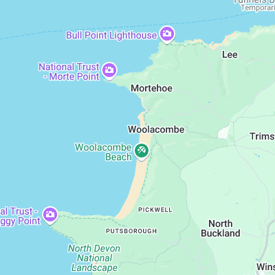
Long (2 miles) stretch of beach just around the corner from Croyde. The surf however is a lot mellower, favouring longboarders and beginners. Decent right often to be found off the rocks at the northern end
Surf spots nearby
- Combesgate (0.6 mi)
- Putsborough (1.8 mi)
- Croyde (3.1 mi)
- Downend Point (3.5 mi)
- Saunton Sands (4.1 mi)
- Westward Ho! (8.6 mi)
- Bucks Mill (13.7 mi)
- Clovelly (14.1 mi)
- Lynmouth (17.1 mi)
- Spekes Mill (18.9 mi)
Not Magic Seaweed (MSW)
Although we look a bit like Magic Seaweed we are not MagicSeaweed as they no longer exist...