Morro Bay (Morro Rock) Surf Report
| Wave height * | 2.5ft / 0.8m |
|---|---|
| Swell period | 10s |
| Swell direction | |
| Wind | |
| Sea temp | 16°C / 61°F |

10 day Morro Bay surf forecast
Mon
15/Dec
2.5ft
0
0
9
- Low 1:21am
- High 7:43am
- Low 3:19pm
- High 10:04pm
Tue
16/Dec
4ft
10
9
7
- Low 1:56am
- High 8:17am
- Low 3:58pm
- High 10:53pm
Wed
17/Dec
5.5ft
8
10
6
- Low 2:24am
- High 8:50am
- Low 4:36pm
- High 11:41pm
Thu
18/Dec
4.5ft
9
9
8
- Low 2:42am
- High 9:22am
- Low 5:14pm
Fri
19/Dec
4ft
7
11
8
- High 12:22am
- Low 3:01am
- High 9:55am
- Low 5:52pm
Sat
20/Dec
4ft
8
8
6
- High 12:52am
- Low 3:28am
- High 10:28am
- Low 6:28pm
Sun
21/Dec
4ft
3
4
3
- High 1:18am
- Low 4:05am
- High 11:05am
- Low 7:03pm
Mon
22/Dec
3.5ft
3
6
3
- High 1:47am
- Low 4:55am
- High 11:45am
- Low 7:37pm
Tue
23/Dec
4ft
6
15
12
- High 2:19am
- Low 6:07am
- High 12:32pm
- Low 8:09pm
Mon 15th Dec
| 4:00 | 2ft | 2.8ft | 13s | 0mph (0mph) | |||
| 7:00 | 2ft | 2.9ft | 13s | 0mph (0mph) | |||
| 10:00 | 2.5ft | 2.8ft | 10s | 0mph (0mph) | |||
| 13:00 | 2.5ft | 2.7ft | 10s | 0mph (0mph) | |||
| 16:00 | 3ft | 3.3ft | 9s | 0mph (0mph) | |||
| 19:00 | 3ft | 3.3ft | 9s | 9mph (12mph) |
| Tide times |
|---|
| Low 1:21am (2.03m) |
| High 7:43am (4.70m) |
| Low 3:19pm (0.08m) |
| High 10:04pm (2.57m) |
| Daylight | |
|---|---|
| First light | 06:37 |
| Sunrise | 07:05 |
| Sunset | 16:52 |
| Dark | 17:20 |
Tue 16th Dec
| 4:00 | 2.5ft | 3.3ft | 16s | 9mph (13mph) | |||
| 7:00 | 3.5ft | 3.9ft | 16s | 10mph (13mph) | |||
| 10:00 | 4ft | 4.3ft | 16s | 9mph (12mph) | |||
| 13:00 | 4ft | 4.8ft | 13s | 9mph (13mph) | |||
| 16:00 | 5ft | 5.7ft | 12s | 8mph (10mph) | |||
| 19:00 | 5.5ft | 6.6ft | 12s | 7mph (9mph) |
| Tide times |
|---|
| Low 1:56am (2.25m) |
| High 8:17am (4.81m) |
| Low 3:58pm (-0.14m) |
| High 10:53pm (2.59m) |
| Daylight | |
|---|---|
| First light | 06:37 |
| Sunrise | 07:05 |
| Sunset | 16:52 |
| Dark | 17:20 |
Wed 17th Dec
| 4:00 | 5.5ft | 6.4ft | 12s | 8mph (10mph) | |||
| 7:00 | 5.5ft | 6.3ft | 12s | 8mph (9mph) | |||
| 10:00 | 5.5ft | 6.1ft | 12s | 7mph (12mph) | |||
| 13:00 | 5.5ft | 5.9ft | 12s | 10mph (18mph) | |||
| 16:00 | 5.5ft | 6.2ft | 12s | 8mph (16mph) | |||
| 19:00 | 5.5ft | 6.2ft | 12s | 6mph (6mph) |
| Tide times |
|---|
| Low 2:24am (2.41m) |
| High 8:50am (4.89m) |
| Low 4:36pm (-0.29m) |
| High 11:41pm (2.60m) |
| Daylight | |
|---|---|
| First light | 06:38 |
| Sunrise | 07:06 |
| Sunset | 16:53 |
| Dark | 17:21 |
Thu 18th Dec
| 4:00 | 4.5ft | 5.2ft | 12s | 8mph (10mph) | |||
| 7:00 | 4.5ft | 5.4ft | 12s | 9mph (11mph) | |||
| 10:00 | 4.5ft | 5.5ft | 12s | 9mph (14mph) | |||
| 13:00 | 4.5ft | 5.5ft | 12s | 9mph (14mph) | |||
| 16:00 | 4.5ft | 5.6ft | 11s | 8mph (11mph) | |||
| 19:00 | 4.5ft | 5.5ft | 11s | 8mph (9mph) |
| Tide times |
|---|
| Low 2:42am (2.49m) |
| High 9:22am (4.95m) |
| Low 5:14pm (-0.37m) |
| Daylight | |
|---|---|
| First light | 06:38 |
| Sunrise | 07:07 |
| Sunset | 16:53 |
| Dark | 17:21 |
Fri 19th Dec
| 4:00 | 3.5ft | 4.7ft | 11s | 7mph (8mph) | |||
| 7:00 | 3.5ft | 4.7ft | 10s | 7mph (8mph) | |||
| 10:00 | 3.5ft | 4.7ft | 10s | 6mph (8mph) | |||
| 13:00 | 4ft | 5.2ft | 10s | 11mph (11mph) | |||
| 16:00 | 5ft | 6ft | 10s | 13mph (15mph) | |||
| 19:00 | 5ft | 6.3ft | 10s | 8mph (10mph) |
| Tide times |
|---|
| High 12:22am (2.61m) |
| Low 3:01am (2.52m) |
| High 9:55am (4.96m) |
| Low 5:52pm (-0.39m) |
| Daylight | |
|---|---|
| First light | 06:39 |
| Sunrise | 07:07 |
| Sunset | 16:53 |
| Dark | 17:22 |
Sat 20th Dec
| 4:00 | 3.5ft | 4.7ft | 10s | 9mph (14mph) | |||
| 7:00 | 3.5ft | 4.7ft | 10s | 8mph (10mph) | |||
| 10:00 | 3.5ft | 4.8ft | 11s | 4mph (6mph) | |||
| 13:00 | 4ft | 4.9ft | 11s | 8mph (7mph) | |||
| 16:00 | 3.5ft | 4.9ft | 11s | 10mph (13mph) | |||
| 19:00 | 4ft | 4.9ft | 12s | 6mph (7mph) |
| Tide times |
|---|
| High 12:52am (2.64m) |
| Low 3:28am (2.53m) |
| High 10:28am (4.92m) |
| Low 6:28pm (-0.37m) |
| Daylight | |
|---|---|
| First light | 06:39 |
| Sunrise | 07:08 |
| Sunset | 16:54 |
| Dark | 17:22 |
Sun 21st Dec
| 4:00 | 4ft | 4.8ft | 12s | 4mph (4mph) | |||
| 7:00 | 4ft | 4.7ft | 11s | 3mph (3mph) | |||
| 10:00 | 4ft | 4.7ft | 11s | 2mph (2mph) | |||
| 13:00 | 4ft | 4.6ft | 11s | 4mph (3mph) | |||
| 16:00 | 4ft | 4.5ft | 11s | 4mph (4mph) | |||
| 19:00 | 3.5ft | 4.2ft | 11s | 3mph (3mph) |
| Tide times |
|---|
| High 1:18am (2.71m) |
| Low 4:05am (2.55m) |
| High 11:05am (4.80m) |
| Low 7:03pm (-0.29m) |
| Daylight | |
|---|---|
| First light | 06:40 |
| Sunrise | 07:08 |
| Sunset | 16:54 |
| Dark | 17:23 |
Mon 22nd Dec
| 4:00 | 3.5ft | 4.2ft | 10s | 3mph (2mph) | |||
| 7:00 | 3.5ft | 4.1ft | 10s | 3mph (3mph) | |||
| 10:00 | 3.5ft | 3.9ft | 10s | 1mph (1mph) | |||
| 13:00 | 3.5ft | 3.9ft | 11s | 6mph (5mph) | |||
| 16:00 | 3.5ft | 4ft | 11s | 5mph (6mph) | |||
| 19:00 | 3ft | 4.1ft | 12s | 3mph (3mph) |
| Tide times |
|---|
| High 1:47am (2.83m) |
| Low 4:55am (2.58m) |
| High 11:45am (4.58m) |
| Low 7:37pm (-0.15m) |
| Daylight | |
|---|---|
| First light | 06:40 |
| Sunrise | 07:09 |
| Sunset | 16:55 |
| Dark | 17:23 |
Tue 23rd Dec
| 4:00 | 3ft | 4ft | 11s | 7mph (9mph) | |||
| 7:00 | 3.5ft | 4.2ft | 13s | 6mph (9mph) | |||
| 10:00 | 3.5ft | 4.6ft | 13s | 11mph (21mph) | |||
| 13:00 | 4ft | 4.9ft | 13s | 15mph (22mph) | |||
| 16:00 | 4.5ft | 5.2ft | 10s | 13mph (21mph) | |||
| 19:00 | 5.5ft | 5.9ft | 6s | 12mph (23mph) |
| Tide times |
|---|
| High 2:19am (3.00m) |
| Low 6:07am (2.60m) |
| High 12:32pm (4.27m) |
| Low 8:09pm (0.07m) |
| Daylight | |
|---|---|
| First light | 06:41 |
| Sunrise | 07:09 |
| Sunset | 16:56 |
| Dark | 17:24 |
Wed 24th Dec
| 4:00 | 5ft | 9.4ft | 7s | 11mph (22mph) | |||
| 7:00 | 5.5ft | 11.6ft | 8s | 4mph (12mph) | |||
| 10:00 | 6.5ft | 12.2ft | 9s | 2mph (5mph) | |||
| 13:00 | 6ft | 9.8ft | 9s | 6mph (6mph) | |||
| 16:00 | 7ft | 9.3ft | 9s | 6mph (8mph) |
| Tide times |
|---|
| High 2:54am (3.24m) |
| Low 7:35am (2.55m) |
| High 1:23pm (3.84m) |
| Daylight | |
|---|---|
| First light | 06:41 |
| Sunrise | 07:10 |
| Sunset | 16:56 |
| Dark | 17:24 |
Nearest buoys
Range of breaks including left off the breakwater. Works best on summer S swells
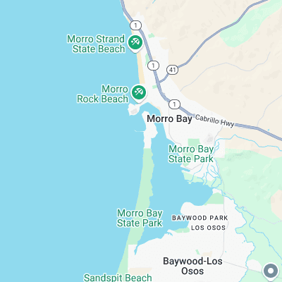
Surf spots nearby
- Sand Spit (3.7 mi)
- Hazard Canyon (4.8 mi)
- Studio Drive (5.2 mi)
- Spooners Cove (5.9 mi)
- Cayucos Pier (6.8 mi)
- Avila Beach (14.4 mi)
- Sewers (16.9 mi)
- Pismo Beach (19.5 mi)
- Moonstone (20.3 mi)
- Grover Beach (20.7 mi)
Not Magic Seaweed (MSW)
Although we look a bit like Magic Seaweed we are not MagicSeaweed as they no longer exist...