Hermosa (Playa Hermosa) Surf Report
| Wave height * | 2.5ft / 0.8m |
|---|---|
| Swell period | 13s |
| Swell direction | |
| Wind | |
| Sea temp | 28°C / 82°F |

10 day Hermosa surf forecast
Tue
2/Dec
2.5ft
4
6
0
- High 12:29am
- Low 6:49am
- High 1:04pm
- Low 6:59pm
Wed
3/Dec
3ft
5
8
5
- High 1:22am
- Low 7:41am
- High 1:57pm
- Low 7:53pm
Thu
4/Dec
3ft
3
6
2
- High 2:14am
- Low 8:33am
- High 2:49pm
- Low 8:47pm
Fri
5/Dec
1ft
4
7
4
- High 3:06am
- Low 9:23am
- High 3:41pm
- Low 9:40pm
Sat
6/Dec
1.5ft
5
8
6
- High 3:57am
- Low 10:14am
- High 4:33pm
- Low 10:33pm
Sun
7/Dec
1.5ft
6
5
7
- High 4:49am
- Low 11:04am
- High 5:25pm
- Low 11:27pm
Mon
8/Dec
2.5ft
5
6
5
- High 5:42am
- Low 11:55am
- High 6:19pm
Tue
9/Dec
3.5ft
3
6
2
- Low 12:22am
- High 6:36am
- Low 12:47pm
- High 7:14pm
Wed
10/Dec
3ft
5
9
6
- Low 1:20am
- High 7:33am
- Low 1:41pm
- High 8:10pm
Tue 2nd Dec
| 3:00 | 2.5ft | 3ft | 14s | 5mph (5mph) | |||
| 6:00 | 2.5ft | 3ft | 13s | 4mph (4mph) | |||
| 9:00 | 2.5ft | 3ft | 12s | 2mph (2mph) | |||
| 12:00 | 2.5ft | 3ft | 12s | 6mph (5mph) | |||
| 15:00 | 3ft | 3.1ft | 12s | 4mph (3mph) | |||
| 18:00 | 3ft | 3.1ft | 13s | 0mph (1mph) | |||
| 21:00 | 3ft | 3.2ft | 12s | 2mph (1mph) |
| Tide times |
|---|
| High 12:29am (9.36m) |
| Low 6:49am (0.16m) |
| High 1:04pm (8.42m) |
| Low 6:59pm (0.50m) |
| Daylight | |
|---|---|
| First light | 05:17 |
| Sunrise | 05:39 |
| Sunset | 17:16 |
| Dark | 17:38 |
Wed 3rd Dec
| 3:00 | 3ft | 3.3ft | 13s | 4mph (3mph) | |||
| 6:00 | 3ft | 3.3ft | 13s | 5mph (4mph) | |||
| 9:00 | 3ft | 3.3ft | 13s | 4mph (5mph) | |||
| 12:00 | 3ft | 3.3ft | 12s | 8mph (7mph) | |||
| 15:00 | 3ft | 3.3ft | 12s | 8mph (8mph) | |||
| 18:00 | 3ft | 3.3ft | 12s | 5mph (6mph) | |||
| 21:00 | 3ft | 3.3ft | 12s | 4mph (5mph) |
| Tide times |
|---|
| High 1:22am (9.80m) |
| Low 7:41am (-0.33m) |
| High 1:57pm (8.86m) |
| Low 7:53pm (0.17m) |
| Daylight | |
|---|---|
| First light | 05:17 |
| Sunrise | 05:40 |
| Sunset | 17:16 |
| Dark | 17:38 |
Thu 4th Dec
| 3:00 | 3ft | 3.2ft | 11s | 3mph (3mph) | |||
| 6:00 | 3ft | 3.1ft | 11s | 3mph (3mph) | |||
| 9:00 | 3ft | 3.1ft | 11s | 1mph (0mph) | |||
| 12:00 | 3ft | 3.1ft | 11s | 6mph (5mph) | |||
| 15:00 | 3ft | 3ft | 11s | 5mph (5mph) | |||
| 18:00 | 3ft | 3ft | 10s | 2mph (3mph) | |||
| 21:00 | 1.5ft | 3ft | 12s | 2mph (2mph) |
| Tide times |
|---|
| High 2:14am (10.11m) |
| Low 8:33am (-0.70m) |
| High 2:49pm (9.22m) |
| Low 8:47pm (-0.04m) |
| Daylight | |
|---|---|
| First light | 05:18 |
| Sunrise | 05:40 |
| Sunset | 17:16 |
| Dark | 17:39 |
Fri 5th Dec
| 3:00 | 1ft | 2.8ft | 12s | 4mph (4mph) | |||
| 6:00 | 1ft | 2.8ft | 11s | 4mph (4mph) | |||
| 9:00 | 1ft | 2.8ft | 13s | 2mph (2mph) | |||
| 12:00 | 1ft | 2.9ft | 16s | 7mph (5mph) | |||
| 15:00 | 1.5ft | 2.9ft | 16s | 6mph (6mph) | |||
| 18:00 | 1.5ft | 3ft | 16s | 4mph (5mph) | |||
| 21:00 | 1.5ft | 3ft | 16s | 3mph (4mph) |
| Tide times |
|---|
| High 3:06am (10.24m) |
| Low 9:23am (-0.88m) |
| High 3:41pm (9.44m) |
| Low 9:40pm (-0.09m) |
| Daylight | |
|---|---|
| First light | 05:18 |
| Sunrise | 05:41 |
| Sunset | 17:16 |
| Dark | 17:39 |
Sat 6th Dec
| 3:00 | 1.5ft | 3ft | 15s | 5mph (5mph) | |||
| 6:00 | 1.5ft | 3.1ft | 16s | 5mph (5mph) | |||
| 9:00 | 1.5ft | 3.1ft | 16s | 5mph (6mph) | |||
| 12:00 | 1.5ft | 3.2ft | 15s | 8mph (7mph) | |||
| 15:00 | 1.5ft | 3.2ft | 14s | 8mph (8mph) | |||
| 18:00 | 1.5ft | 3.3ft | 14s | 6mph (8mph) | |||
| 21:00 | 1.5ft | 3.2ft | 14s | 5mph (7mph) |
| Tide times |
|---|
| High 3:57am (10.15m) |
| Low 10:14am (-0.86m) |
| High 4:33pm (9.50m) |
| Low 10:33pm (0.03m) |
| Daylight | |
|---|---|
| First light | 05:19 |
| Sunrise | 05:41 |
| Sunset | 17:17 |
| Dark | 17:39 |
Sun 7th Dec
| 3:00 | 1.5ft | 3.1ft | 14s | 5mph (5mph) | |||
| 6:00 | 1.5ft | 3ft | 14s | 6mph (6mph) | |||
| 9:00 | 1.5ft | 3ft | 14s | 3mph (4mph) | |||
| 12:00 | 1.5ft | 3ft | 14s | 5mph (6mph) | |||
| 15:00 | 1.5ft | 3ft | 14s | 9mph (10mph) | |||
| 18:00 | 1.5ft | 2.9ft | 14s | 7mph (9mph) | |||
| 21:00 | 2ft | 2.9ft | 15s | 5mph (7mph) |
| Tide times |
|---|
| High 4:49am (9.85m) |
| Low 11:04am (-0.64m) |
| High 5:25pm (9.39m) |
| Low 11:27pm (0.30m) |
| Daylight | |
|---|---|
| First light | 05:19 |
| Sunrise | 05:42 |
| Sunset | 17:17 |
| Dark | 17:40 |
Mon 8th Dec
| 3:00 | 2.5ft | 2.9ft | 16s | 4mph (4mph) | |||
| 6:00 | 2.5ft | 2.9ft | 16s | 5mph (5mph) | |||
| 9:00 | 2ft | 3ft | 15s | 2mph (2mph) | |||
| 12:00 | 2.5ft | 3.1ft | 15s | 6mph (5mph) | |||
| 15:00 | 3ft | 3.3ft | 15s | 6mph (5mph) | |||
| 18:00 | 3ft | 3.5ft | 15s | 5mph (6mph) | |||
| 21:00 | 3.5ft | 3.7ft | 15s | 1mph (2mph) |
| Tide times |
|---|
| High 5:42am (9.39m) |
| Low 11:55am (-0.26m) |
| High 6:19pm (9.16m) |
| Daylight | |
|---|---|
| First light | 05:20 |
| Sunrise | 05:43 |
| Sunset | 17:18 |
| Dark | 17:40 |
Tue 9th Dec
| 3:00 | 3.5ft | 3.9ft | 14s | 2mph (2mph) | |||
| 6:00 | 3.5ft | 3.8ft | 14s | 3mph (2mph) | |||
| 9:00 | 3.5ft | 3.7ft | 13s | 1mph (2mph) | |||
| 12:00 | 3.5ft | 3.7ft | 13s | 6mph (4mph) | |||
| 15:00 | 3.5ft | 3.7ft | 13s | 5mph (4mph) | |||
| 18:00 | 3.5ft | 3.6ft | 13s | 2mph (3mph) | |||
| 21:00 | 3ft | 3.5ft | 13s | 1mph (1mph) |
| Tide times |
|---|
| Low 12:22am (0.68m) |
| High 6:36am (8.82m) |
| Low 12:47pm (0.23m) |
| High 7:14pm (8.84m) |
| Daylight | |
|---|---|
| First light | 05:20 |
| Sunrise | 05:43 |
| Sunset | 17:18 |
| Dark | 17:41 |
Wed 10th Dec
| 3:00 | 3ft | 3.3ft | 13s | 4mph (4mph) | |||
| 6:00 | 3ft | 3.2ft | 13s | 5mph (5mph) | |||
| 9:00 | 3ft | 3.1ft | 13s | 4mph (5mph) | |||
| 12:00 | 3ft | 3ft | 13s | 9mph (7mph) | |||
| 15:00 | 3ft | 3ft | 14s | 6mph (6mph) | |||
| 18:00 | 2.5ft | 2.9ft | 14s | 6mph (8mph) | |||
| 21:00 | 2.5ft | 2.9ft | 14s | 5mph (5mph) |
| Tide times |
|---|
| Low 1:20am (1.10m) |
| High 7:33am (8.22m) |
| Low 1:41pm (0.77m) |
| High 8:10pm (8.51m) |
| Daylight | |
|---|---|
| First light | 05:21 |
| Sunrise | 05:44 |
| Sunset | 17:18 |
| Dark | 17:41 |
Thu 11th Dec
| 3:00 | 2.5ft | 2.9ft | 13s | 5mph (4mph) | |||
| 6:00 | 2.5ft | 2.9ft | 12s | 5mph (4mph) | |||
| 9:00 | 2.5ft | 2.9ft | 12s | 4mph (4mph) | |||
| 12:00 | 2.5ft | 2.8ft | 12s | 7mph (7mph) | |||
| 15:00 | 2.5ft | 2.8ft | 12s | 5mph (5mph) | |||
| 18:00 | 2.5ft | 2.8ft | 12s | 1mph (2mph) |
| Tide times |
|---|
| Low 2:21am (1.48m) |
| High 8:32am (7.67m) |
| Daylight | |
|---|---|
| First light | 05:21 |
| Sunrise | 05:44 |
| Sunset | 17:19 |
| Dark | 17:41 |
4 mile long beachbreak that can live up to it's rep as the Costa Rican Puerto Escondido. Hollow and heavy with size. Usually plenty of waves to go around and shifting peaks mean everyone gets a go
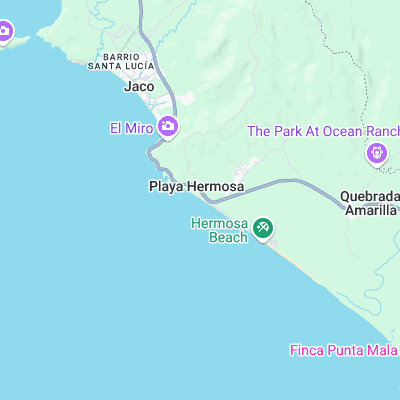
Surf spots nearby
- The Tree (1.2 mi)
- Roca Loca (1.6 mi)
- Perro Fino (1.7 mi)
- Jaco Beach (1.9 mi)
- Playa Escondida (7.5 mi)
- Esterillos (7.8 mi)
- Corralillo (24 mi)
Not Magic Seaweed (MSW)
Although we look a bit like Magic Seaweed we are not MagicSeaweed as they no longer exist...