Baie des Trepasses (Baie des Trépassés) Surf Report
| Wave height * | 2.5ft / 0.8m |
|---|---|
| Swell period | 6s |
| Swell direction | |
| Wind | |
| Sea temp | 12°C / 53°F |

10 day Baie des Trepasses surf forecast
Tue
6/Jan
2.5ft
9
3
16
- Low 12:54am
- High 6:53am
- Low 1:22pm
- High 7:19pm
Wed
7/Jan
6ft
28
22
24
- Low 1:38am
- High 7:36am
- Low 2:06pm
- High 8:02pm
Thu
8/Jan
10ft
30
36
57
- Low 2:21am
- High 8:20am
- Low 2:50pm
- High 8:45pm
Fri
9/Jan
16ft
41
38
38
- Low 3:05am
- High 9:05am
- Low 3:34pm
- High 9:31pm
Sat
10/Jan
11.5ft
36
21
5
- Low 3:51am
- High 9:53am
- Low 4:21pm
- High 10:22pm
Sun
11/Jan
9ft
33
40
19
- Low 4:42am
- High 10:48am
- Low 5:14pm
- High 11:22pm
Mon
12/Jan
11.5ft
20
27
27
- Low 5:42am
- High 11:53am
- Low 6:16pm
Tue
13/Jan
13ft
14
23
12
- High 12:31am
- Low 6:53am
- High 1:05pm
- Low 7:26pm
Wed
14/Jan
11ft
16
25
32
- High 1:40am
- Low 8:05am
- High 2:12pm
- Low 8:31pm
Thu
15/Jan
10.5ft
38
23
23
- High 2:40am
- Low 9:06am
- High 3:08pm
- Low 9:26pm
Tue 6th Jan
| 4:00 | 3.5ft | 5.3ft | 7s | 14mph (18mph) | |||
| 7:00 | 3.5ft | 4.5ft | 7s | 9mph (11mph) | |||
| 10:00 | 3ft | 4ft | 7s | 7mph (9mph) | |||
| 13:00 | 2.5ft | 3.6ft | 6s | 3mph (6mph) | |||
| 16:00 | 2.5ft | 3.3ft | 6s | 8mph (10mph) | |||
| 19:00 | 2.5ft | 3.2ft | 7s | 16mph (17mph) |
| Tide times |
|---|
| Low 12:54am (1.12m) |
| High 6:53am (7.14m) |
| Low 1:22pm (0.96m) |
| High 7:19pm (6.71m) |
| Daylight | |
|---|---|
| First light | 08:32 |
| Sunrise | 09:07 |
| Sunset | 17:41 |
| Dark | 18:17 |
Wed 7th Jan
| 4:00 | 5ft | 5.3ft | 6s | 23mph (28mph) | |||
| 7:00 | 6ft | 6.4ft | 7s | 28mph (32mph) | |||
| 10:00 | 6.5ft | 7.4ft | 7s | 25mph (37mph) | |||
| 13:00 | 6ft | 7ft | 7s | 22mph (28mph) | |||
| 16:00 | 6ft | 6.8ft | 8s | 14mph (23mph) | |||
| 19:00 | 6.5ft | 7.1ft | 8s | 24mph (37mph) |
| Tide times |
|---|
| Low 1:38am (1.27m) |
| High 7:36am (6.95m) |
| Low 2:06pm (1.20m) |
| High 8:02pm (6.48m) |
| Daylight | |
|---|---|
| First light | 08:32 |
| Sunrise | 09:07 |
| Sunset | 17:42 |
| Dark | 18:18 |
Thu 8th Jan
| 4:00 | 9.5ft | 10.3ft | 9s | 29mph (38mph) | |||
| 7:00 | 10ft | 10.6ft | 9s | 30mph (42mph) | |||
| 10:00 | 9.5ft | 10.7ft | 9s | 30mph (41mph) | |||
| 13:00 | 10ft | 11.8ft | 9s | 36mph (49mph) | |||
| 16:00 | 11ft | 14.1ft | 9s | 40mph (53mph) | |||
| 19:00 | 15ft | 19.5ft | 11s | 57mph (71mph) |
| Tide times |
|---|
| Low 2:21am (1.52m) |
| High 8:20am (6.65m) |
| Low 2:50pm (1.53m) |
| High 8:45pm (6.18m) |
| Daylight | |
|---|---|
| First light | 08:31 |
| Sunrise | 09:07 |
| Sunset | 17:43 |
| Dark | 18:19 |
Fri 9th Jan
| 4:00 | 18.5ft | 20.9ft | 13s | 43mph (53mph) | |||
| 7:00 | 17ft | 19.1ft | 12s | 41mph (48mph) | |||
| 10:00 | 16ft | 17.9ft | 12s | 38mph (43mph) | |||
| 13:00 | 16ft | 18.1ft | 12s | 38mph (41mph) | |||
| 16:00 | 16ft | 18.4ft | 13s | 40mph (46mph) | |||
| 19:00 | 16ft | 18.1ft | 13s | 38mph (47mph) |
| Tide times |
|---|
| Low 3:05am (1.83m) |
| High 9:05am (6.29m) |
| Low 3:34pm (1.90m) |
| High 9:31pm (5.87m) |
| Daylight | |
|---|---|
| First light | 08:31 |
| Sunrise | 09:06 |
| Sunset | 17:44 |
| Dark | 18:20 |
Sat 10th Jan
| 4:00 | 17ft | 18.3ft | 13s | 36mph (43mph) | |||
| 7:00 | 15ft | 16ft | 13s | 36mph (45mph) | |||
| 10:00 | 13ft | 14.2ft | 13s | 30mph (33mph) | |||
| 13:00 | 11.5ft | 12.5ft | 12s | 21mph (23mph) | |||
| 16:00 | 10ft | 11ft | 12s | 15mph (17mph) | |||
| 19:00 | 9ft | 9.7ft | 12s | 5mph (6mph) |
| Tide times |
|---|
| Low 3:51am (2.18m) |
| High 9:53am (5.91m) |
| Low 4:21pm (2.27m) |
| High 10:22pm (5.57m) |
| Daylight | |
|---|---|
| First light | 08:31 |
| Sunrise | 09:06 |
| Sunset | 17:46 |
| Dark | 18:21 |
Sun 11th Jan
| 4:00 | 8ft | 8.8ft | 11s | 26mph (28mph) | |||
| 7:00 | 7ft | 11ft | 8s | 33mph (37mph) | |||
| 10:00 | 9ft | 13.2ft | 9s | 37mph (44mph) | |||
| 13:00 | 9ft | 12.2ft | 10s | 40mph (47mph) | |||
| 16:00 | 8.5ft | 11.7ft | 10s | 36mph (40mph) | |||
| 19:00 | 8ft | 11.4ft | 10s | 19mph (26mph) |
| Tide times |
|---|
| Low 4:42am (2.51m) |
| High 10:48am (5.56m) |
| Low 5:14pm (2.58m) |
| High 11:22pm (5.35m) |
| Daylight | |
|---|---|
| First light | 08:30 |
| Sunrise | 09:06 |
| Sunset | 17:47 |
| Dark | 18:22 |
Mon 12th Jan
| 4:00 | 10.5ft | 12.6ft | 12s | 23mph (28mph) | |||
| 7:00 | 10.5ft | 12.8ft | 12s | 20mph (27mph) | |||
| 10:00 | 11ft | 13.5ft | 12s | 22mph (29mph) | |||
| 13:00 | 11.5ft | 14.1ft | 12s | 27mph (37mph) | |||
| 16:00 | 12ft | 14.7ft | 13s | 31mph (42mph) | |||
| 19:00 | 12.5ft | 15.2ft | 14s | 27mph (36mph) |
| Tide times |
|---|
| Low 5:42am (2.76m) |
| High 11:53am (5.30m) |
| Low 6:16pm (2.79m) |
| Daylight | |
|---|---|
| First light | 08:30 |
| Sunrise | 09:05 |
| Sunset | 17:48 |
| Dark | 18:23 |
Tue 13th Jan
| 4:00 | 12.5ft | 13.9ft | 14s | 15mph (21mph) | |||
| 7:00 | 13ft | 14.9ft | 13s | 14mph (18mph) | |||
| 10:00 | 14ft | 17ft | 13s | 13mph (16mph) | |||
| 13:00 | 13ft | 16.5ft | 12s | 23mph (23mph) | |||
| 16:00 | 12.5ft | 16.2ft | 14s | 16mph (19mph) | |||
| 19:00 | 13.5ft | 16.5ft | 14s | 12mph (14mph) |
| Tide times |
|---|
| High 12:31am (5.25m) |
| Low 6:53am (2.86m) |
| High 1:05pm (5.21m) |
| Low 7:26pm (2.84m) |
| Daylight | |
|---|---|
| First light | 08:29 |
| Sunrise | 09:04 |
| Sunset | 17:50 |
| Dark | 18:25 |
Wed 14th Jan
| 4:00 | 13ft | 14.1ft | 13s | 15mph (17mph) | |||
| 7:00 | 12.5ft | 13.2ft | 13s | 16mph (18mph) | |||
| 10:00 | 11.5ft | 12.4ft | 13s | 19mph (22mph) | |||
| 13:00 | 11ft | 11.8ft | 12s | 25mph (31mph) | |||
| 16:00 | 11ft | 11.9ft | 12s | 28mph (36mph) | |||
| 19:00 | 11.5ft | 12.4ft | 12s | 32mph (41mph) |
| Tide times |
|---|
| High 1:40am (5.31m) |
| Low 8:05am (2.79m) |
| High 2:12pm (5.28m) |
| Low 8:31pm (2.73m) |
| Daylight | |
|---|---|
| First light | 08:29 |
| Sunrise | 09:04 |
| Sunset | 17:51 |
| Dark | 18:26 |
Thu 15th Jan
| 4:00 | 14ft | 14.8ft | 12s | 36mph (46mph) | |||
| 7:00 | 13.5ft | 14.6ft | 13s | 38mph (51mph) | |||
| 10:00 | 12.5ft | 13.3ft | 13s | 29mph (35mph) | |||
| 13:00 | 10.5ft | 12.1ft | 13s | 23mph (31mph) | |||
| 16:00 | 10ft | 11.3ft | 13s | 22mph (27mph) | |||
| 19:00 | 9.5ft | 11ft | 13s | 23mph (26mph) |
| Tide times |
|---|
| High 2:40am (5.50m) |
| Low 9:06am (2.57m) |
| High 3:08pm (5.48m) |
| Low 9:26pm (2.51m) |
| Daylight | |
|---|---|
| First light | 08:28 |
| Sunrise | 09:03 |
| Sunset | 17:52 |
| Dark | 18:27 |
Most westerly spot in Finestere picking up more swell than other spots. Works better when smaller and with lighter winds
The name translates to 'Bay of Death' Draw your own conclusions!
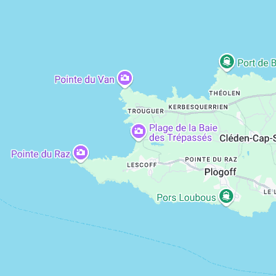
Surf spots nearby
- Cap Sizun (1.8 mi)
- Pors Theolen (1.9 mi)
- Saint Tugen (5.7 mi)
- Sein Island (6.8 mi)
- La Gamelle (7.9 mi)
- Cap de la Chevre (10.9 mi)
- Gwendrez (11.2 mi)
- Pors Poulhan (12 mi)
- La Palue (13 mi)
- Lostmarc'h (13.3 mi)
Not Magic Seaweed (MSW)
Although we look a bit like Magic Seaweed we are not MagicSeaweed as they no longer exist...