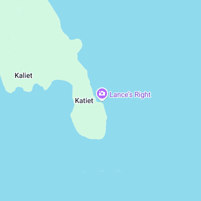
Lances Right (Lance's Right) Surf Report
| Wave height * | 1.5ft / 0.4m |
|---|---|
| Swell period | 10s |
| Swell direction | |
| Wind | |
| Sea temp | 29°C / 84°F |

10 day Lances Right surf forecast
Sat
3/Jan
0.5ft
17
18
14
- High 7:36am
- Low 10:14pm
Sun
4/Jan
1.5ft
11
8
7
- High 8:14am
- Low 10:53pm
Mon
5/Jan
2ft
9
11
14
- High 8:54am
- Low 11:33pm
Tue
6/Jan
1.5ft
11
13
11
- High 9:32am
Wed
7/Jan
1ft
10
12
13
- Low 12:10am
- High 10:09am
Thu
8/Jan
1.5ft
9
8
13
- Low 12:41am
- High 10:42am
Fri
9/Jan
2ft
8
6
16
- Low 1:04am
- High 11:09am
Sat
10/Jan
2ft
13
14
9
- Low 12:56am
- High 11:28am
- Low 9:30pm
Sun
11/Jan
1.5ft
5
7
8
- High 11:28am
- Low 8:29pm
Sat 3rd Jan
| 4:00 | 1.5ft | 5.6ft | 8s | 13mph (17mph) | |||
| 7:00 | 1.5ft | 5.6ft | 8s | 17mph (22mph) | |||
| 10:00 | 1ft | 6ft | 7s | 18mph (20mph) | |||
| 13:00 | 0.5ft | 5.8ft | 9s | 18mph (19mph) | |||
| 16:00 | 1.5ft | 5.4ft | 10s | 17mph (18mph) | |||
| 19:00 | 1.5ft | 5ft | 14s | 14mph (17mph) |
| Tide times |
|---|
| High 7:36am (4.02m) |
| Low 10:14pm (0.06m) |
| Daylight | |
|---|---|
| First light | 05:54 |
| Sunrise | 06:17 |
| Sunset | 18:32 |
| Dark | 18:55 |
Sun 4th Jan
| 4:00 | 1.5ft | 4.1ft | 14s | 14mph (16mph) | |||
| 7:00 | 1.5ft | 4ft | 13s | 11mph (13mph) | |||
| 10:00 | 1.5ft | 4ft | 14s | 9mph (11mph) | |||
| 13:00 | 1.5ft | 4.2ft | 12s | 8mph (10mph) | |||
| 16:00 | 1.5ft | 4.3ft | 11s | 8mph (8mph) | |||
| 19:00 | 1.5ft | 4.6ft | 9s | 7mph (7mph) |
| Tide times |
|---|
| High 8:14am (4.18m) |
| Low 10:53pm (0.01m) |
| Daylight | |
|---|---|
| First light | 05:55 |
| Sunrise | 06:17 |
| Sunset | 18:33 |
| Dark | 18:55 |
Mon 5th Jan
| 4:00 | 1.5ft | 5ft | 10s | 9mph (9mph) | |||
| 7:00 | 1.5ft | 5ft | 10s | 9mph (10mph) | |||
| 10:00 | 2ft | 5.1ft | 10s | 10mph (12mph) | |||
| 13:00 | 2ft | 5.4ft | 12s | 11mph (13mph) | |||
| 16:00 | 2ft | 5.5ft | 11s | 13mph (15mph) | |||
| 19:00 | 2ft | 5.4ft | 11s | 14mph (16mph) |
| Tide times |
|---|
| High 8:54am (4.23m) |
| Low 11:33pm (0.05m) |
| Daylight | |
|---|---|
| First light | 05:55 |
| Sunrise | 06:18 |
| Sunset | 18:33 |
| Dark | 18:55 |
Tue 6th Jan
| 4:00 | 2ft | 5ft | 10s | 11mph (14mph) | |||
| 7:00 | 1.5ft | 4.8ft | 10s | 11mph (14mph) | |||
| 10:00 | 1.5ft | 4.6ft | 9s | 12mph (14mph) | |||
| 13:00 | 1.5ft | 4.5ft | 9s | 13mph (15mph) | |||
| 16:00 | 1.5ft | 4.3ft | 9s | 11mph (12mph) | |||
| 19:00 | 1.5ft | 4.1ft | 9s | 11mph (13mph) |
| Tide times |
|---|
| High 9:32am (4.17m) |
| Daylight | |
|---|---|
| First light | 05:56 |
| Sunrise | 06:18 |
| Sunset | 18:33 |
| Dark | 18:56 |
Wed 7th Jan
| 4:00 | 1.5ft | 3.9ft | 9s | 13mph (15mph) | |||
| 7:00 | 1.5ft | 3.8ft | 9s | 10mph (12mph) | |||
| 10:00 | 1.5ft | 3.7ft | 9s | 10mph (13mph) | |||
| 13:00 | 1ft | 3.7ft | 9s | 12mph (13mph) | |||
| 16:00 | 1ft | 3.7ft | 9s | 13mph (13mph) | |||
| 19:00 | 1ft | 3.6ft | 9s | 13mph (15mph) |
| Tide times |
|---|
| Low 12:10am (0.18m) |
| High 10:09am (4.00m) |
| Daylight | |
|---|---|
| First light | 05:56 |
| Sunrise | 06:19 |
| Sunset | 18:34 |
| Dark | 18:56 |
Thu 8th Jan
| 4:00 | 1ft | 3.4ft | 11s | 12mph (14mph) | |||
| 7:00 | 1ft | 3.4ft | 11s | 9mph (11mph) | |||
| 10:00 | 1ft | 3.4ft | 14s | 8mph (10mph) | |||
| 13:00 | 1.5ft | 3.4ft | 15s | 8mph (8mph) | |||
| 16:00 | 1.5ft | 3.5ft | 15s | 11mph (11mph) | |||
| 19:00 | 2ft | 3.6ft | 15s | 13mph (15mph) |
| Tide times |
|---|
| Low 12:41am (0.39m) |
| High 10:42am (3.74m) |
| Daylight | |
|---|---|
| First light | 05:57 |
| Sunrise | 06:19 |
| Sunset | 18:34 |
| Dark | 18:57 |
Fri 9th Jan
| 4:00 | 2ft | 3.9ft | 14s | 4mph (3mph) | |||
| 7:00 | 2ft | 4ft | 14s | 8mph (6mph) | |||
| 10:00 | 2ft | 4ft | 13s | 7mph (5mph) | |||
| 13:00 | 2ft | 4ft | 13s | 6mph (7mph) | |||
| 16:00 | 2ft | 3.9ft | 13s | 12mph (12mph) | |||
| 19:00 | 2ft | 3.8ft | 13s | 16mph (17mph) |
| Tide times |
|---|
| Low 1:04am (0.69m) |
| High 11:09am (3.41m) |
| Daylight | |
|---|---|
| First light | 05:57 |
| Sunrise | 06:20 |
| Sunset | 18:35 |
| Dark | 18:57 |
Sat 10th Jan
| 4:00 | 2ft | 3.7ft | 13s | 11mph (12mph) | |||
| 7:00 | 2ft | 3.7ft | 13s | 13mph (15mph) | |||
| 10:00 | 2ft | 3.7ft | 12s | 17mph (17mph) | |||
| 13:00 | 2ft | 3.8ft | 12s | 14mph (15mph) | |||
| 16:00 | 2ft | 4ft | 12s | 9mph (10mph) | |||
| 19:00 | 2.5ft | 4.4ft | 12s | 9mph (9mph) |
| Tide times |
|---|
| Low 12:56am (1.04m) |
| High 11:28am (3.03m) |
| Low 9:30pm (1.29m) |
| Daylight | |
|---|---|
| First light | 05:58 |
| Sunrise | 06:20 |
| Sunset | 18:35 |
| Dark | 18:57 |
Sun 11th Jan
| 4:00 | 0ft | 4.2ft | 11s | 8mph (9mph) | |||
| 7:00 | 1.5ft | 3.9ft | 12s | 5mph (6mph) | |||
| 10:00 | 1.5ft | 3.6ft | 12s | 7mph (8mph) | |||
| 13:00 | 1.5ft | 3.4ft | 12s | 7mph (8mph) | |||
| 16:00 | 2ft | 3.2ft | 11s | 7mph (7mph) | |||
| 19:00 | 2ft | 3.1ft | 11s | 8mph (8mph) |
| Tide times |
|---|
| High 11:28am (2.65m) |
| Low 8:29pm (1.33m) |
| Daylight | |
|---|---|
| First light | 05:58 |
| Sunrise | 06:20 |
| Sunset | 18:35 |
| Dark | 18:58 |
Mon 12th Jan
| 4:00 | 1.5ft | 3.1ft | 11s | 4mph (5mph) | |||
| 7:00 | 1.5ft | 3.2ft | 11s | 2mph (3mph) | |||
| 19:00 | 1.5ft | 3.2ft | 10s | 8mph (7mph) |
Intense barrel breaking over sometimes shallow coral reef. Fast, often crowded and sometimes dangerous. Requires a big SW swell to break as it is on the sheltered side of Sipora
Surf spots nearby
- Lances Left (1.6 mi)
- Bintang (2.5 mi)
Not Magic Seaweed (MSW)
Although we look a bit like Magic Seaweed we are not MagicSeaweed as they no longer exist...