Periscopes Surf Report
| Wave height * | 2.5ft / 0.8m |
|---|---|
| Swell period | 11s |
| Swell direction | |
| Wind | |
| Sea temp | 29°C / 85°F |

10 day Periscopes surf forecast
Wed
7/Jan
2.5ft
1
8
5
- Low 10:50am
- High 7:11pm
Thu
8/Jan
3ft
3
3
3
- Low 2:45am
- High 4:02am
- Low 11:28am
- High 7:16pm
Fri
9/Jan
3.5ft
3
5
3
- Low 2:17am
- High 6:08am
- Low 12:00pm
- High 7:21pm
Sat
10/Jan
3ft
3
4
1
- Low 2:29am
- High 7:37am
- Low 12:23pm
- High 7:25pm
Sun
11/Jan
3ft
0
4
3
- Low 2:52am
- High 9:11am
- Low 12:26pm
- High 7:22pm
Mon
12/Jan
2.5ft
4
5
4
- Low 3:19am
- High 7:11pm
Tue
13/Jan
2ft
5
9
4
- Low 3:49am
- High 6:50pm
Wed
14/Jan
2ft
3
5
3
- Low 4:24am
- High 6:28pm
Thu
15/Jan
2.5ft
3
6
3
- Low 5:05am
- High 6:20pm
Wed 7th Jan
| 5:00 | 2.5ft | 3.8ft | 12s | 2mph (2mph) | |||
| 8:00 | 2.5ft | 3.8ft | 12s | 1mph (2mph) | |||
| 11:00 | 2.5ft | 4ft | 11s | 5mph (4mph) | |||
| 14:00 | 2.5ft | 4.2ft | 11s | 8mph (7mph) | |||
| 17:00 | 3ft | 4.4ft | 11s | 6mph (11mph) | |||
| 20:00 | 3.5ft | 4.6ft | 13s | 5mph (12mph) |
| Tide times |
|---|
| Low 10:50am (0.28m) |
| High 7:11pm (1.26m) |
| Daylight | |
|---|---|
| First light | 05:31 |
| Sunrise | 05:54 |
| Sunset | 18:30 |
| Dark | 18:53 |
Thu 8th Jan
| 5:00 | 2.5ft | 3.9ft | 12s | 2mph (2mph) | |||
| 8:00 | 2.5ft | 3.9ft | 12s | 3mph (3mph) | |||
| 11:00 | 3ft | 4ft | 12s | 2mph (4mph) | |||
| 14:00 | 3ft | 4.2ft | 14s | 3mph (4mph) | |||
| 17:00 | 3ft | 4.6ft | 16s | 3mph (3mph) | |||
| 20:00 | 3ft | 4.8ft | 16s | 3mph (4mph) |
| Tide times |
|---|
| Low 2:45am (0.81m) |
| High 4:02am (0.81m) |
| Low 11:28am (0.38m) |
| High 7:16pm (1.22m) |
| Daylight | |
|---|---|
| First light | 05:32 |
| Sunrise | 05:54 |
| Sunset | 18:31 |
| Dark | 18:53 |
Fri 9th Jan
| 5:00 | 3ft | 5.1ft | 15s | 4mph (6mph) | |||
| 8:00 | 3ft | 5.1ft | 15s | 3mph (5mph) | |||
| 11:00 | 3.5ft | 5.2ft | 14s | 5mph (7mph) | |||
| 14:00 | 3.5ft | 5.3ft | 14s | 5mph (7mph) | |||
| 17:00 | 3.5ft | 5.3ft | 14s | 6mph (11mph) | |||
| 20:00 | 3.5ft | 5.2ft | 14s | 3mph (5mph) |
| Tide times |
|---|
| Low 2:17am (0.70m) |
| High 6:08am (0.79m) |
| Low 12:00pm (0.50m) |
| High 7:21pm (1.19m) |
| Daylight | |
|---|---|
| First light | 05:32 |
| Sunrise | 05:55 |
| Sunset | 18:31 |
| Dark | 18:54 |
Sat 10th Jan
| 5:00 | 3ft | 5.1ft | 13s | 4mph (4mph) | |||
| 8:00 | 3ft | 5ft | 13s | 3mph (4mph) | |||
| 11:00 | 3ft | 4.9ft | 13s | 4mph (4mph) | |||
| 14:00 | 3ft | 4.8ft | 13s | 4mph (3mph) | |||
| 17:00 | 3ft | 4.7ft | 13s | 3mph (2mph) | |||
| 20:00 | 3ft | 4.6ft | 12s | 1mph (1mph) |
| Tide times |
|---|
| Low 2:29am (0.59m) |
| High 7:37am (0.79m) |
| Low 12:23pm (0.63m) |
| High 7:25pm (1.17m) |
| Daylight | |
|---|---|
| First light | 05:33 |
| Sunrise | 05:55 |
| Sunset | 18:31 |
| Dark | 18:54 |
Sun 11th Jan
| 5:00 | 3ft | 4.5ft | 12s | 3mph (4mph) | |||
| 8:00 | 3ft | 4.5ft | 12s | 0mph (0mph) | |||
| 11:00 | 3ft | 4.5ft | 12s | 4mph (4mph) | |||
| 14:00 | 3ft | 4.4ft | 12s | 4mph (4mph) | |||
| 17:00 | 3ft | 4.5ft | 12s | 3mph (5mph) | |||
| 20:00 | 3ft | 4.7ft | 11s | 3mph (3mph) |
| Tide times |
|---|
| Low 2:52am (0.50m) |
| High 9:11am (0.80m) |
| Low 12:26pm (0.75m) |
| High 7:22pm (1.16m) |
| Daylight | |
|---|---|
| First light | 05:33 |
| Sunrise | 05:56 |
| Sunset | 18:32 |
| Dark | 18:54 |
Mon 12th Jan
| 5:00 | 3ft | 4.4ft | 11s | 5mph (7mph) | |||
| 8:00 | 2.5ft | 4.1ft | 11s | 4mph (7mph) | |||
| 11:00 | 2.5ft | 4.1ft | 11s | 7mph (11mph) | |||
| 14:00 | 2.5ft | 4ft | 11s | 5mph (7mph) | |||
| 17:00 | 2.5ft | 4ft | 11s | 4mph (6mph) | |||
| 20:00 | 2.5ft | 3.8ft | 11s | 4mph (6mph) |
| Tide times |
|---|
| Low 3:19am (0.43m) |
| High 7:11pm (1.16m) |
| Daylight | |
|---|---|
| First light | 05:34 |
| Sunrise | 05:56 |
| Sunset | 18:32 |
| Dark | 18:55 |
Tue 13th Jan
| 5:00 | 2ft | 3.4ft | 10s | 4mph (7mph) | |||
| 8:00 | 2ft | 3.3ft | 10s | 5mph (7mph) | |||
| 11:00 | 2ft | 3.2ft | 10s | 6mph (9mph) | |||
| 14:00 | 2ft | 3.2ft | 10s | 9mph (11mph) | |||
| 17:00 | 2ft | 3.2ft | 10s | 6mph (10mph) | |||
| 20:00 | 2ft | 3.2ft | 10s | 4mph (6mph) |
| Tide times |
|---|
| Low 3:49am (0.38m) |
| High 6:50pm (1.18m) |
| Daylight | |
|---|---|
| First light | 05:34 |
| Sunrise | 05:57 |
| Sunset | 18:32 |
| Dark | 18:55 |
Wed 14th Jan
| 5:00 | 2ft | 3.3ft | 10s | 4mph (4mph) | |||
| 8:00 | 2ft | 3.2ft | 10s | 3mph (4mph) | |||
| 11:00 | 2ft | 3.1ft | 10s | 4mph (6mph) | |||
| 14:00 | 2ft | 3ft | 10s | 5mph (6mph) | |||
| 17:00 | 2ft | 3.1ft | 16s | 7mph (9mph) | |||
| 20:00 | 2.5ft | 3.4ft | 16s | 3mph (4mph) |
| Tide times |
|---|
| Low 4:24am (0.35m) |
| High 6:28pm (1.22m) |
| Daylight | |
|---|---|
| First light | 05:35 |
| Sunrise | 05:57 |
| Sunset | 18:32 |
| Dark | 18:55 |
Thu 15th Jan
| 5:00 | 2.5ft | 3.9ft | 15s | 2mph (3mph) | |||
| 8:00 | 2.5ft | 3.9ft | 15s | 3mph (4mph) | |||
| 11:00 | 2.5ft | 3.8ft | 15s | 4mph (4mph) | |||
| 14:00 | 2.5ft | 4ft | 15s | 6mph (6mph) | |||
| 17:00 | 3.5ft | 4.8ft | 15s | 7mph (11mph) | |||
| 20:00 | 3.5ft | 5.3ft | 14s | 3mph (4mph) |
| Tide times |
|---|
| Low 5:05am (0.34m) |
| High 6:20pm (1.28m) |
| Daylight | |
|---|---|
| First light | 05:35 |
| Sunrise | 05:58 |
| Sunset | 18:33 |
| Dark | 18:55 |
Fri 16th Jan
| 5:00 | 3.5ft | 5.2ft | 13s | 3mph (3mph) | |||
| 8:00 | 3.5ft | 5.2ft | 13s | 3mph (5mph) | |||
| 20:00 | 4.5ft | 6.4ft | 14s | 3mph (3mph) |
Thick, powerful top to bottom right breaking just off the beach. Suffers from the same crowd situation as Lakey Peak just across the bay
Surf spots nearby
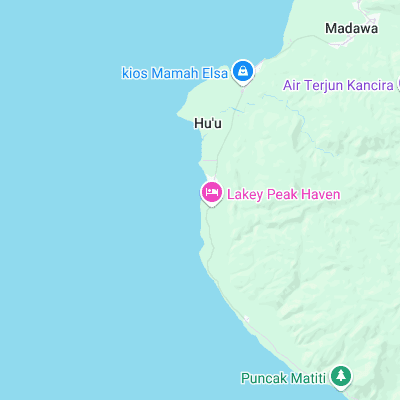
- Lakey Peak (0.1 mi)
Not Magic Seaweed (MSW)
Although we look a bit like Magic Seaweed we are not MagicSeaweed as they no longer exist...