Caleta de Caballo Right (Derecha) Surf Report
| Wave height * | 7ft / 2.1m |
|---|---|
| Swell period | 19s |
| Swell direction | |
| Wind | |
| Sea temp | 20°C / 68°F |

10 day Caleta de Caballo Right surf forecast
Fri
19/Dec
5ft
9
11
10
- High 1:06am
- Low 7:20am
- High 1:28pm
- Low 7:22pm
Sat
20/Dec
6.5ft
17
18
19
- High 1:41am
- Low 7:55am
- High 2:04pm
- Low 7:55pm
Sun
21/Dec
5.5ft
17
13
18
- High 2:16am
- Low 8:30am
- High 2:40pm
- Low 8:30pm
Mon
22/Dec
7ft
14
23
19
- High 2:51am
- Low 9:06am
- High 3:17pm
- Low 9:06pm
Tue
23/Dec
6.5ft
21
21
17
- High 3:29am
- Low 9:45am
- High 3:58pm
- Low 9:46pm
Wed
24/Dec
6ft
15
16
22
- High 4:11am
- Low 10:28am
- High 4:44pm
- Low 10:30pm
Thu
25/Dec
6ft
18
19
17
- High 4:58am
- Low 11:17am
- High 5:37pm
- Low 11:24pm
Fri
26/Dec
4.5ft
12
12
12
- High 5:53am
- Low 12:15pm
- High 6:38pm
Sat
27/Dec
9ft
13
12
11
- Low 12:30am
- High 6:57am
- Low 1:22pm
- High 7:46pm
Sun
28/Dec
7ft
16
12
8
- Low 1:47am
- High 8:07am
Fri 19th Dec
| 3:00 | 5.5ft | 8.8ft | 19s | 9mph (13mph) | |||
| 6:00 | 5ft | 8.5ft | 18s | 9mph (12mph) | |||
| 9:00 | 5ft | 8.2ft | 17s | 12mph (13mph) | |||
| 12:00 | 5ft | 7.9ft | 16s | 11mph (13mph) | |||
| 15:00 | 5ft | 7.9ft | 16s | 12mph (13mph) | |||
| 18:00 | 5.5ft | 7.9ft | 15s | 10mph (12mph) | |||
| 21:00 | 6ft | 8.1ft | 16s | 16mph (20mph) |
| Tide times |
|---|
| High 1:06am (2.34m) |
| Low 7:20am (0.57m) |
| High 1:28pm (2.14m) |
| Low 7:22pm (0.63m) |
| Daylight | |
|---|---|
| First light | 07:17 |
| Sunrise | 07:43 |
| Sunset | 18:00 |
| Dark | 18:26 |
Sat 20th Dec
| 3:00 | 7ft | 9.4ft | 19s | 18mph (22mph) | |||
| 6:00 | 7ft | 9.9ft | 18s | 17mph (21mph) | |||
| 9:00 | 7ft | 10.1ft | 18s | 16mph (18mph) | |||
| 12:00 | 6.5ft | 10ft | 18s | 18mph (20mph) | |||
| 15:00 | 7ft | 9.9ft | 17s | 20mph (20mph) | |||
| 18:00 | 7ft | 9.8ft | 17s | 19mph (22mph) | |||
| 21:00 | 6.5ft | 9.4ft | 16s | 18mph (20mph) |
| Tide times |
|---|
| High 1:41am (2.36m) |
| Low 7:55am (0.55m) |
| High 2:04pm (2.14m) |
| Low 7:55pm (0.63m) |
| Daylight | |
|---|---|
| First light | 07:18 |
| Sunrise | 07:44 |
| Sunset | 18:01 |
| Dark | 18:27 |
Sun 21st Dec
| 3:00 | 6ft | 8.5ft | 16s | 14mph (19mph) | |||
| 6:00 | 5.5ft | 8ft | 15s | 17mph (20mph) | |||
| 9:00 | 5ft | 7.6ft | 14s | 12mph (17mph) | |||
| 12:00 | 5.5ft | 7.9ft | 15s | 13mph (15mph) | |||
| 15:00 | 6.5ft | 8.8ft | 15s | 15mph (15mph) | |||
| 18:00 | 6.5ft | 9.3ft | 15s | 18mph (20mph) | |||
| 21:00 | 7ft | 9.7ft | 15s | 17mph (21mph) |
| Tide times |
|---|
| High 2:16am (2.36m) |
| Low 8:30am (0.55m) |
| High 2:40pm (2.12m) |
| Low 8:30pm (0.65m) |
| Daylight | |
|---|---|
| First light | 07:18 |
| Sunrise | 07:44 |
| Sunset | 18:01 |
| Dark | 18:27 |
Mon 22nd Dec
| 3:00 | 7ft | 9.5ft | 15s | 12mph (17mph) | |||
| 6:00 | 7ft | 9.4ft | 14s | 14mph (19mph) | |||
| 9:00 | 7ft | 9.6ft | 14s | 15mph (19mph) | |||
| 12:00 | 7ft | 9.9ft | 14s | 23mph (22mph) | |||
| 15:00 | 7.5ft | 10.1ft | 17s | 21mph (21mph) | |||
| 18:00 | 7.5ft | 10.1ft | 17s | 19mph (22mph) | |||
| 21:00 | 7.5ft | 10ft | 16s | 19mph (24mph) |
| Tide times |
|---|
| High 2:51am (2.35m) |
| Low 9:06am (0.57m) |
| High 3:17pm (2.08m) |
| Low 9:06pm (0.68m) |
| Daylight | |
|---|---|
| First light | 07:19 |
| Sunrise | 07:45 |
| Sunset | 18:02 |
| Dark | 18:28 |
Tue 23rd Dec
| 3:00 | 7ft | 9.8ft | 16s | 21mph (26mph) | |||
| 6:00 | 7ft | 9.6ft | 15s | 21mph (27mph) | |||
| 9:00 | 6.5ft | 9.3ft | 15s | 21mph (25mph) | |||
| 12:00 | 6.5ft | 8.9ft | 14s | 21mph (22mph) | |||
| 15:00 | 6ft | 8.5ft | 14s | 20mph (22mph) | |||
| 18:00 | 6ft | 8ft | 14s | 17mph (20mph) | |||
| 21:00 | 5.5ft | 7.7ft | 13s | 16mph (20mph) |
| Tide times |
|---|
| High 3:29am (2.31m) |
| Low 9:45am (0.61m) |
| High 3:58pm (2.04m) |
| Low 9:46pm (0.73m) |
| Daylight | |
|---|---|
| First light | 07:19 |
| Sunrise | 07:45 |
| Sunset | 18:02 |
| Dark | 18:28 |
Wed 24th Dec
| 3:00 | 5.5ft | 7.5ft | 13s | 15mph (18mph) | |||
| 6:00 | 5.5ft | 7.5ft | 13s | 15mph (19mph) | |||
| 9:00 | 5.5ft | 7.5ft | 13s | 13mph (19mph) | |||
| 12:00 | 6ft | 8ft | 13s | 16mph (17mph) | |||
| 15:00 | 6ft | 8.6ft | 13s | 16mph (19mph) | |||
| 18:00 | 6.5ft | 8.9ft | 14s | 22mph (25mph) | |||
| 21:00 | 6.5ft | 8.9ft | 14s | 21mph (22mph) |
| Tide times |
|---|
| High 4:11am (2.27m) |
| Low 10:28am (0.65m) |
| High 4:44pm (2.00m) |
| Low 10:30pm (0.78m) |
| Daylight | |
|---|---|
| First light | 07:20 |
| Sunrise | 07:46 |
| Sunset | 18:03 |
| Dark | 18:29 |
Thu 25th Dec
| 3:00 | 6ft | 8.6ft | 13s | 19mph (22mph) | |||
| 6:00 | 6ft | 8.4ft | 13s | 18mph (22mph) | |||
| 9:00 | 6ft | 8.4ft | 12s | 20mph (23mph) | |||
| 12:00 | 6ft | 8.4ft | 12s | 19mph (22mph) | |||
| 15:00 | 6ft | 8.3ft | 12s | 16mph (18mph) | |||
| 18:00 | 6ft | 8.3ft | 11s | 17mph (19mph) | |||
| 21:00 | 5.5ft | 8.2ft | 10s | 16mph (18mph) |
| Tide times |
|---|
| High 4:58am (2.21m) |
| Low 11:17am (0.70m) |
| High 5:37pm (1.96m) |
| Low 11:24pm (0.84m) |
| Daylight | |
|---|---|
| First light | 07:20 |
| Sunrise | 07:46 |
| Sunset | 18:03 |
| Dark | 18:29 |
Fri 26th Dec
| 3:00 | 5ft | 7.6ft | 10s | 13mph (16mph) | |||
| 6:00 | 4.5ft | 7.3ft | 10s | 12mph (15mph) | |||
| 9:00 | 5ft | 6.9ft | 10s | 11mph (14mph) | |||
| 12:00 | 4.5ft | 6.4ft | 10s | 12mph (13mph) | |||
| 15:00 | 4ft | 6.3ft | 10s | 14mph (15mph) | |||
| 18:00 | 4ft | 6.3ft | 8s | 12mph (13mph) | |||
| 21:00 | 5.5ft | 6.8ft | 6s | 10mph (11mph) |
| Tide times |
|---|
| High 5:53am (2.15m) |
| Low 12:15pm (0.74m) |
| High 6:38pm (1.95m) |
| Daylight | |
|---|---|
| First light | 07:20 |
| Sunrise | 07:46 |
| Sunset | 18:04 |
| Dark | 18:30 |
Sat 27th Dec
| 3:00 | 7ft | 8.2ft | 8s | 13mph (15mph) | |||
| 6:00 | 7.5ft | 8.8ft | 9s | 13mph (16mph) | |||
| 9:00 | 8ft | 9.6ft | 9s | 12mph (14mph) | |||
| 12:00 | 9ft | 10.6ft | 10s | 12mph (13mph) | |||
| 15:00 | 10ft | 11.9ft | 12s | 12mph (12mph) | |||
| 18:00 | 9.5ft | 11.7ft | 11s | 11mph (12mph) | |||
| 21:00 | 9ft | 11.1ft | 11s | 11mph (13mph) |
| Tide times |
|---|
| Low 12:30am (0.89m) |
| High 6:57am (2.10m) |
| Low 1:22pm (0.76m) |
| High 7:46pm (1.98m) |
| Daylight | |
|---|---|
| First light | 07:21 |
| Sunrise | 07:47 |
| Sunset | 18:05 |
| Dark | 18:31 |
Sun 28th Dec
| 3:00 | 8ft | 10ft | 11s | 17mph (20mph) | |||
| 6:00 | 7.5ft | 9.7ft | 11s | 16mph (19mph) | |||
| 9:00 | 7.5ft | 9.3ft | 11s | 15mph (16mph) | |||
| 12:00 | 7ft | 8.7ft | 11s | 12mph (13mph) | |||
| 15:00 | 7ft | 8.2ft | 11s | 10mph (11mph) | |||
| 18:00 | 6.5ft | 7.8ft | 11s | 8mph (9mph) | |||
| 21:00 | 6ft | 7.5ft | 10s | 6mph (7mph) |
| Tide times |
|---|
| Low 1:47am (0.89m) |
| High 8:07am (2.09m) |
| Daylight | |
|---|---|
| First light | 07:21 |
| Sunrise | 07:47 |
| Sunset | 18:05 |
| Dark | 18:31 |
Not as busy as the La Santa waves but just as heavy, hollow and shallow.
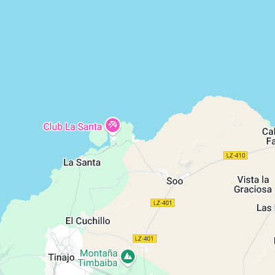
Surf spots nearby
- Caleta de Caballo Left (0.1 mi)
- Boca del Abajo (1.2 mi)
- La Santa Right (1.5 mi)
- La Santa Left (1.7 mi)
- El Quemao (1.9 mi)
- San Juan (3.9 mi)
- Caleta de Famara (4.5 mi)
- Playa de Farama (6 mi)
- La Graciosa (10.8 mi)
- Punta de Mujeres (11.3 mi)
Not Magic Seaweed (MSW)
Although we look a bit like Magic Seaweed we are not MagicSeaweed as they no longer exist...