El Quemao Surf Report
| Wave height * | 9ft / 2.7m |
|---|---|
| Swell period | 19s |
| Swell direction | |
| Wind | |
| Sea temp | 20°C / 68°F |

10 day El Quemao surf forecast
Fri
19/Dec
6.5ft
9
11
10
- High 1:06am
- Low 7:20am
- High 1:28pm
- Low 7:22pm
Sat
20/Dec
9ft
17
18
19
- High 1:41am
- Low 7:55am
- High 2:04pm
- Low 7:55pm
Sun
21/Dec
7.5ft
17
13
18
- High 2:16am
- Low 8:30am
- High 2:40pm
- Low 8:30pm
Mon
22/Dec
9.5ft
14
23
19
- High 2:51am
- Low 9:06am
- High 3:17pm
- Low 9:06pm
Tue
23/Dec
8.5ft
21
21
17
- High 3:29am
- Low 9:45am
- High 3:58pm
- Low 9:46pm
Wed
24/Dec
7.5ft
15
16
22
- High 4:11am
- Low 10:28am
- High 4:44pm
- Low 10:30pm
Thu
25/Dec
8ft
18
19
17
- High 4:58am
- Low 11:17am
- High 5:37pm
- Low 11:24pm
Fri
26/Dec
6ft
12
12
12
- High 5:53am
- Low 12:15pm
- High 6:38pm
Sat
27/Dec
9ft
13
12
11
- Low 12:30am
- High 6:57am
- Low 1:22pm
- High 7:46pm
Sun
28/Dec
7ft
16
12
8
- Low 1:47am
- High 8:07am
Fri 19th Dec
| 3:00 | 7.5ft | 8.8ft | 19s | 9mph (13mph) | |||
| 6:00 | 7ft | 8.5ft | 18s | 9mph (12mph) | |||
| 9:00 | 7ft | 8.2ft | 17s | 12mph (13mph) | |||
| 12:00 | 6.5ft | 7.9ft | 16s | 11mph (13mph) | |||
| 15:00 | 6.5ft | 7.9ft | 16s | 12mph (13mph) | |||
| 18:00 | 7ft | 7.9ft | 15s | 10mph (12mph) | |||
| 21:00 | 7.5ft | 8.1ft | 16s | 16mph (20mph) |
| Tide times |
|---|
| High 1:06am (2.34m) |
| Low 7:20am (0.57m) |
| High 1:28pm (2.14m) |
| Low 7:22pm (0.63m) |
| Daylight | |
|---|---|
| First light | 07:17 |
| Sunrise | 07:43 |
| Sunset | 18:00 |
| Dark | 18:26 |
Sat 20th Dec
| 3:00 | 9ft | 9.4ft | 19s | 18mph (22mph) | |||
| 6:00 | 9.5ft | 9.9ft | 18s | 17mph (21mph) | |||
| 9:00 | 9ft | 10.1ft | 18s | 16mph (18mph) | |||
| 12:00 | 9ft | 10ft | 18s | 18mph (20mph) | |||
| 15:00 | 9ft | 9.9ft | 17s | 20mph (20mph) | |||
| 18:00 | 9ft | 9.8ft | 17s | 19mph (22mph) | |||
| 21:00 | 8.5ft | 9.4ft | 16s | 18mph (20mph) |
| Tide times |
|---|
| High 1:41am (2.36m) |
| Low 7:55am (0.55m) |
| High 2:04pm (2.14m) |
| Low 7:55pm (0.63m) |
| Daylight | |
|---|---|
| First light | 07:18 |
| Sunrise | 07:44 |
| Sunset | 18:01 |
| Dark | 18:27 |
Sun 21st Dec
| 3:00 | 8ft | 8.5ft | 16s | 14mph (19mph) | |||
| 6:00 | 7ft | 8ft | 15s | 17mph (20mph) | |||
| 9:00 | 7ft | 7.6ft | 14s | 12mph (17mph) | |||
| 12:00 | 7.5ft | 7.9ft | 15s | 13mph (15mph) | |||
| 15:00 | 8ft | 8.8ft | 15s | 15mph (15mph) | |||
| 18:00 | 8.5ft | 9.3ft | 15s | 18mph (20mph) | |||
| 21:00 | 9ft | 9.7ft | 15s | 17mph (21mph) |
| Tide times |
|---|
| High 2:16am (2.36m) |
| Low 8:30am (0.55m) |
| High 2:40pm (2.12m) |
| Low 8:30pm (0.65m) |
| Daylight | |
|---|---|
| First light | 07:18 |
| Sunrise | 07:44 |
| Sunset | 18:01 |
| Dark | 18:27 |
Mon 22nd Dec
| 3:00 | 9ft | 9.5ft | 15s | 12mph (17mph) | |||
| 6:00 | 9ft | 9.4ft | 14s | 14mph (19mph) | |||
| 9:00 | 9ft | 9.6ft | 14s | 15mph (19mph) | |||
| 12:00 | 9.5ft | 9.9ft | 14s | 23mph (22mph) | |||
| 15:00 | 9.5ft | 10.1ft | 17s | 21mph (21mph) | |||
| 18:00 | 9.5ft | 10.1ft | 17s | 19mph (22mph) | |||
| 21:00 | 9.5ft | 10ft | 16s | 19mph (24mph) |
| Tide times |
|---|
| High 2:51am (2.35m) |
| Low 9:06am (0.57m) |
| High 3:17pm (2.08m) |
| Low 9:06pm (0.68m) |
| Daylight | |
|---|---|
| First light | 07:19 |
| Sunrise | 07:45 |
| Sunset | 18:02 |
| Dark | 18:28 |
Tue 23rd Dec
| 3:00 | 9ft | 9.8ft | 16s | 21mph (26mph) | |||
| 6:00 | 9ft | 9.6ft | 15s | 21mph (27mph) | |||
| 9:00 | 8.5ft | 9.3ft | 15s | 21mph (25mph) | |||
| 12:00 | 8.5ft | 8.9ft | 14s | 21mph (22mph) | |||
| 15:00 | 8ft | 8.5ft | 14s | 20mph (22mph) | |||
| 18:00 | 7.5ft | 8ft | 14s | 17mph (20mph) | |||
| 21:00 | 7ft | 7.7ft | 13s | 16mph (20mph) |
| Tide times |
|---|
| High 3:29am (2.31m) |
| Low 9:45am (0.61m) |
| High 3:58pm (2.04m) |
| Low 9:46pm (0.73m) |
| Daylight | |
|---|---|
| First light | 07:19 |
| Sunrise | 07:45 |
| Sunset | 18:02 |
| Dark | 18:28 |
Wed 24th Dec
| 3:00 | 7ft | 7.5ft | 13s | 15mph (18mph) | |||
| 6:00 | 7ft | 7.5ft | 13s | 15mph (19mph) | |||
| 9:00 | 7ft | 7.5ft | 13s | 13mph (19mph) | |||
| 12:00 | 7.5ft | 8ft | 13s | 16mph (17mph) | |||
| 15:00 | 8ft | 8.6ft | 13s | 16mph (19mph) | |||
| 18:00 | 8.5ft | 8.9ft | 14s | 22mph (25mph) | |||
| 21:00 | 8.5ft | 8.9ft | 14s | 21mph (22mph) |
| Tide times |
|---|
| High 4:11am (2.27m) |
| Low 10:28am (0.65m) |
| High 4:44pm (2.00m) |
| Low 10:30pm (0.78m) |
| Daylight | |
|---|---|
| First light | 07:20 |
| Sunrise | 07:46 |
| Sunset | 18:03 |
| Dark | 18:29 |
Thu 25th Dec
| 3:00 | 8ft | 8.6ft | 13s | 19mph (22mph) | |||
| 6:00 | 8ft | 8.4ft | 13s | 18mph (22mph) | |||
| 9:00 | 8ft | 8.4ft | 12s | 20mph (23mph) | |||
| 12:00 | 8ft | 8.4ft | 12s | 19mph (22mph) | |||
| 15:00 | 8ft | 8.3ft | 12s | 16mph (18mph) | |||
| 18:00 | 7.5ft | 8.3ft | 11s | 17mph (19mph) | |||
| 21:00 | 7.5ft | 8.2ft | 10s | 16mph (18mph) |
| Tide times |
|---|
| High 4:58am (2.21m) |
| Low 11:17am (0.70m) |
| High 5:37pm (1.96m) |
| Low 11:24pm (0.84m) |
| Daylight | |
|---|---|
| First light | 07:20 |
| Sunrise | 07:46 |
| Sunset | 18:04 |
| Dark | 18:30 |
Fri 26th Dec
| 3:00 | 7ft | 7.6ft | 10s | 13mph (16mph) | |||
| 6:00 | 6.5ft | 7.3ft | 10s | 12mph (15mph) | |||
| 9:00 | 6.5ft | 6.9ft | 10s | 11mph (14mph) | |||
| 12:00 | 6ft | 6.4ft | 10s | 12mph (13mph) | |||
| 15:00 | 5.5ft | 6.3ft | 10s | 14mph (15mph) | |||
| 18:00 | 5.5ft | 6.3ft | 8s | 12mph (13mph) | |||
| 21:00 | 5.5ft | 6.8ft | 6s | 10mph (11mph) |
| Tide times |
|---|
| High 5:53am (2.15m) |
| Low 12:15pm (0.74m) |
| High 6:38pm (1.95m) |
| Daylight | |
|---|---|
| First light | 07:21 |
| Sunrise | 07:46 |
| Sunset | 18:04 |
| Dark | 18:30 |
Sat 27th Dec
| 3:00 | 7ft | 8.2ft | 8s | 13mph (15mph) | |||
| 6:00 | 7.5ft | 8.8ft | 9s | 13mph (16mph) | |||
| 9:00 | 8ft | 9.6ft | 9s | 12mph (14mph) | |||
| 12:00 | 9ft | 10.6ft | 10s | 12mph (13mph) | |||
| 15:00 | 10ft | 11.9ft | 12s | 12mph (12mph) | |||
| 18:00 | 9.5ft | 11.7ft | 11s | 11mph (12mph) | |||
| 21:00 | 9ft | 11.1ft | 11s | 11mph (13mph) |
| Tide times |
|---|
| Low 12:30am (0.89m) |
| High 6:57am (2.10m) |
| Low 1:22pm (0.76m) |
| High 7:46pm (1.98m) |
| Daylight | |
|---|---|
| First light | 07:21 |
| Sunrise | 07:47 |
| Sunset | 18:05 |
| Dark | 18:31 |
Sun 28th Dec
| 3:00 | 9ft | 10ft | 11s | 17mph (20mph) | |||
| 6:00 | 8.5ft | 9.7ft | 11s | 16mph (19mph) | |||
| 9:00 | 7.5ft | 9.3ft | 11s | 15mph (16mph) | |||
| 12:00 | 7ft | 8.7ft | 11s | 12mph (13mph) | |||
| 15:00 | 7ft | 8.2ft | 11s | 10mph (11mph) | |||
| 18:00 | 6.5ft | 7.8ft | 11s | 8mph (9mph) | |||
| 21:00 | 6ft | 7.5ft | 10s | 6mph (7mph) |
| Tide times |
|---|
| Low 1:47am (0.89m) |
| High 8:07am (2.09m) |
| Daylight | |
|---|---|
| First light | 07:21 |
| Sunrise | 07:47 |
| Sunset | 18:05 |
| Dark | 18:31 |
Europe's answer to Pipeline. Plenty of comparisons including the power, hollowness, crowds and sharp reef just below the surface. If you are going to surf here then you'll need to charge to impress the locals
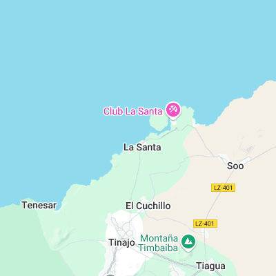
Surf spots nearby
- La Santa Left (0.3 mi)
- La Santa Right (0.6 mi)
- Boca del Abajo (1.2 mi)
- Caleta de Caballo Left (1.9 mi)
- Caleta de Caballo Right (1.9 mi)
- San Juan (5.8 mi)
- Caleta de Famara (6.3 mi)
- Playa de Farama (7.9 mi)
- La Graciosa (12.4 mi)
- Punta de Mujeres (13.2 mi)
Not Magic Seaweed (MSW)
Although we look a bit like Magic Seaweed we are not MagicSeaweed as they no longer exist...