La Izquierda (Spanish Left) Surf Report
| Wave height * | 3.5ft / 1.1m |
|---|---|
| Swell period | 17s |
| Swell direction | |
| Wind | |
| Sea temp | 20°C / 68°F |

10 day La Izquierda surf forecast
Mon
5/Jan
3.5ft
11
4
7
- High 3:00am
- Low 9:19am
- High 3:27pm
- Low 9:25pm
Tue
6/Jan
3ft
6
3
4
- High 3:41am
- Low 10:02am
- High 4:08pm
- Low 10:07pm
Wed
7/Jan
3.5ft
6
11
15
- High 4:22am
- Low 10:44am
- High 4:50pm
- Low 10:50pm
Thu
8/Jan
4ft
11
12
13
- High 5:04am
- Low 11:29am
- High 5:35pm
- Low 11:37pm
Fri
9/Jan
2ft
14
11
17
- High 5:50am
- Low 12:19pm
- High 6:28pm
Sat
10/Jan
3ft
5
3
5
- Low 12:35am
- High 6:46am
- Low 1:18pm
- High 7:34pm
Sun
11/Jan
2.5ft
1
4
7
- Low 1:48am
- High 7:58am
- Low 2:28pm
- High 8:54pm
Mon
12/Jan
2.5ft
3
8
3
- Low 3:10am
- High 9:22am
- Low 3:38pm
- High 10:07pm
Tue
13/Jan
2.5ft
2
6
12
- Low 4:21am
- High 10:34am
- Low 4:37pm
- High 11:03pm
Wed
14/Jan
2ft
1
5
7
- Low 5:16am
Mon 5th Jan
| 3:00 | 4ft | 5.3ft | 16s | 10mph (11mph) | |||
| 6:00 | 3.5ft | 5.3ft | 15s | 11mph (11mph) | |||
| 9:00 | 3.5ft | 5.4ft | 15s | 6mph (6mph) | |||
| 12:00 | 3.5ft | 5.5ft | 16s | 4mph (2mph) | |||
| 15:00 | 3.5ft | 5.6ft | 17s | 4mph (4mph) | |||
| 18:00 | 3.5ft | 5.7ft | 16s | 7mph (7mph) | |||
| 21:00 | 4ft | 6.3ft | 15s | 5mph (6mph) |
| Tide times |
|---|
| High 3:00am (2.49m) |
| Low 9:19am (0.43m) |
| High 3:27pm (2.21m) |
| Low 9:25pm (0.57m) |
| Daylight | |
|---|---|
| First light | 07:33 |
| Sunrise | 07:59 |
| Sunset | 18:25 |
| Dark | 18:50 |
Tue 6th Jan
| 3:00 | 4ft | 7ft | 15s | 6mph (5mph) | |||
| 6:00 | 3ft | 7ft | 15s | 6mph (6mph) | |||
| 9:00 | 3ft | 7ft | 15s | 7mph (6mph) | |||
| 12:00 | 3ft | 6.9ft | 14s | 3mph (4mph) | |||
| 15:00 | 3ft | 6.6ft | 14s | 6mph (8mph) | |||
| 18:00 | 3ft | 6.8ft | 14s | 4mph (7mph) | |||
| 21:00 | 3ft | 6.7ft | 14s | 10mph (10mph) |
| Tide times |
|---|
| High 3:41am (2.41m) |
| Low 10:02am (0.52m) |
| High 4:08pm (2.12m) |
| Low 10:07pm (0.67m) |
| Daylight | |
|---|---|
| First light | 07:33 |
| Sunrise | 07:59 |
| Sunset | 18:26 |
| Dark | 18:51 |
Wed 7th Jan
| 3:00 | 3ft | 6.7ft | 14s | 7mph (11mph) | |||
| 6:00 | 3ft | 6.6ft | 14s | 6mph (7mph) | |||
| 9:00 | 3ft | 6.5ft | 12s | 7mph (6mph) | |||
| 12:00 | 3.5ft | 6.5ft | 11s | 11mph (8mph) | |||
| 15:00 | 3.5ft | 6.5ft | 9s | 10mph (8mph) | |||
| 18:00 | 3ft | 6.4ft | 8s | 15mph (14mph) | |||
| 21:00 | 3ft | 6.3ft | 8s | 10mph (11mph) |
| Tide times |
|---|
| High 4:22am (2.29m) |
| Low 10:44am (0.65m) |
| High 4:50pm (2.01m) |
| Low 10:50pm (0.79m) |
| Daylight | |
|---|---|
| First light | 07:34 |
| Sunrise | 07:59 |
| Sunset | 18:26 |
| Dark | 18:52 |
Thu 8th Jan
| 3:00 | 4.5ft | 6.7ft | 7s | 10mph (13mph) | |||
| 6:00 | 4.5ft | 6.6ft | 7s | 11mph (14mph) | |||
| 9:00 | 4.5ft | 6.3ft | 7s | 10mph (15mph) | |||
| 12:00 | 4ft | 6ft | 7s | 12mph (15mph) | |||
| 15:00 | 4ft | 5.8ft | 7s | 15mph (15mph) | |||
| 18:00 | 3.5ft | 5.3ft | 7s | 13mph (13mph) | |||
| 21:00 | 3ft | 4.8ft | 8s | 11mph (12mph) |
| Tide times |
|---|
| High 5:04am (2.14m) |
| Low 11:29am (0.77m) |
| High 5:35pm (1.91m) |
| Low 11:37pm (0.91m) |
| Daylight | |
|---|---|
| First light | 07:34 |
| Sunrise | 07:59 |
| Sunset | 18:27 |
| Dark | 18:53 |
Fri 9th Jan
| 3:00 | 2.5ft | 4.2ft | 8s | 9mph (11mph) | |||
| 6:00 | 2.5ft | 3.8ft | 11s | 14mph (15mph) | |||
| 9:00 | 2.5ft | 3.7ft | 10s | 12mph (13mph) | |||
| 12:00 | 2ft | 3.7ft | 11s | 11mph (10mph) | |||
| 15:00 | 2ft | 3.6ft | 11s | 11mph (11mph) | |||
| 18:00 | 3.5ft | 3.7ft | 11s | 17mph (18mph) | |||
| 21:00 | 3ft | 3.9ft | 9s | 10mph (11mph) |
| Tide times |
|---|
| High 5:50am (1.99m) |
| Low 12:19pm (0.90m) |
| High 6:28pm (1.82m) |
| Daylight | |
|---|---|
| First light | 07:34 |
| Sunrise | 07:59 |
| Sunset | 18:28 |
| Dark | 18:53 |
Sat 10th Jan
| 3:00 | 3.5ft | 3.9ft | 6s | 6mph (9mph) | |||
| 6:00 | 3.5ft | 3.8ft | 7s | 5mph (9mph) | |||
| 9:00 | 3ft | 3.7ft | 8s | 4mph (8mph) | |||
| 12:00 | 3ft | 3.7ft | 8s | 3mph (9mph) | |||
| 15:00 | 3ft | 3.6ft | 7s | 1mph (5mph) | |||
| 18:00 | 3ft | 3.5ft | 10s | 5mph (5mph) | |||
| 21:00 | 3ft | 3.7ft | 7s | 5mph (9mph) |
| Tide times |
|---|
| Low 12:35am (1.03m) |
| High 6:46am (1.86m) |
| Low 1:18pm (0.99m) |
| High 7:34pm (1.76m) |
| Daylight | |
|---|---|
| First light | 07:34 |
| Sunrise | 07:59 |
| Sunset | 18:29 |
| Dark | 18:54 |
Sun 11th Jan
| 3:00 | 3ft | 3.8ft | 8s | 3mph (6mph) | |||
| 6:00 | 3ft | 3.8ft | 9s | 1mph (2mph) | |||
| 9:00 | 3ft | 3.8ft | 9s | 1mph (4mph) | |||
| 12:00 | 2.5ft | 3.7ft | 10s | 4mph (7mph) | |||
| 15:00 | 2.5ft | 3.5ft | 13s | 5mph (6mph) | |||
| 18:00 | 2.5ft | 3.7ft | 14s | 7mph (8mph) | |||
| 21:00 | 2.5ft | 4.1ft | 11s | 10mph (9mph) |
| Tide times |
|---|
| Low 1:48am (1.10m) |
| High 7:58am (1.76m) |
| Low 2:28pm (1.04m) |
| High 8:54pm (1.76m) |
| Daylight | |
|---|---|
| First light | 07:34 |
| Sunrise | 07:59 |
| Sunset | 18:30 |
| Dark | 18:55 |
Mon 12th Jan
| 3:00 | 3ft | 4.1ft | 11s | 3mph (5mph) | |||
| 6:00 | 3ft | 4.1ft | 11s | 3mph (3mph) | |||
| 9:00 | 3ft | 4ft | 12s | 9mph (7mph) | |||
| 12:00 | 2.5ft | 3.5ft | 13s | 8mph (7mph) | |||
| 15:00 | 3ft | 3.2ft | 13s | 4mph (5mph) | |||
| 18:00 | 3ft | 3.2ft | 13s | 3mph (4mph) | |||
| 21:00 | 3ft | 3.5ft | 11s | 3mph (4mph) |
| Tide times |
|---|
| Low 3:10am (1.10m) |
| High 9:22am (1.74m) |
| Low 3:38pm (1.03m) |
| High 10:07pm (1.83m) |
| Daylight | |
|---|---|
| First light | 07:34 |
| Sunrise | 07:59 |
| Sunset | 18:30 |
| Dark | 18:56 |
Tue 13th Jan
| 3:00 | 3ft | 3.4ft | 12s | 2mph (2mph) | |||
| 6:00 | 3ft | 3.1ft | 12s | 2mph (2mph) | |||
| 9:00 | 2.5ft | 3ft | 12s | 4mph (4mph) | |||
| 12:00 | 2.5ft | 2.8ft | 12s | 6mph (5mph) | |||
| 15:00 | 2.5ft | 2.5ft | 11s | 9mph (9mph) | |||
| 18:00 | 2ft | 2.6ft | 11s | 12mph (12mph) | |||
| 21:00 | 2ft | 2.8ft | 11s | 8mph (7mph) |
| Tide times |
|---|
| Low 4:21am (1.03m) |
| High 10:34am (1.78m) |
| Low 4:37pm (0.97m) |
| High 11:03pm (1.93m) |
| Daylight | |
|---|---|
| First light | 07:34 |
| Sunrise | 07:59 |
| Sunset | 18:31 |
| Dark | 18:56 |
Wed 14th Jan
| 3:00 | 2.5ft | 3.1ft | 12s | 2mph (3mph) | |||
| 6:00 | 2.5ft | 3.1ft | 12s | 1mph (1mph) | |||
| 9:00 | 2ft | 2.9ft | 12s | 2mph (2mph) | |||
| 12:00 | 2ft | 2.9ft | 11s | 5mph (4mph) | |||
| 15:00 | 2ft | 3ft | 12s | 6mph (5mph) | |||
| 18:00 | 2.5ft | 3.3ft | 12s | 7mph (6mph) | |||
| 21:00 | 3ft | 4.1ft | 18s | 5mph (8mph) |
| Tide times |
|---|
| Low 5:16am (0.92m) |
| Daylight | |
|---|---|
| First light | 07:34 |
| Sunrise | 07:59 |
| Sunset | 18:32 |
| Dark | 18:57 |
Long walling left breaking over shallow lava reef. Steep take-offs and workable walls are the order of the day. Always busy and locals aren't always friendly!
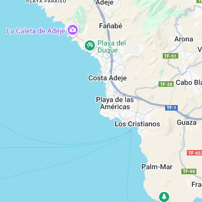
Surf spots nearby
- La Caleta de Adeje (3.1 mi)
- El Medano (11.9 mi)
- Los Gigantes (14.4 mi)
Not Magic Seaweed (MSW)
Although we look a bit like Magic Seaweed we are not MagicSeaweed as they no longer exist...