Chapel Porth Surf Report
| Wave height * | 9.5ft / 2.9m |
|---|---|
| Swell period | 12s |
| Swell direction | |
| Wind | |
| Sea temp | 10°C / 51°F |

10 day Chapel Porth surf forecast
Mon
12/Jan
8.5ft
20
22
14
- Low 6:29am
- High 12:26pm
- Low 7:08pm
Tue
13/Jan
6.5ft
6
9
17
- High 1:08am
- Low 7:42am
- High 1:39pm
- Low 8:15pm
Wed
14/Jan
4ft
4
8
16
- High 2:12am
- Low 8:47am
- High 2:38pm
- Low 9:11pm
Thu
15/Jan
10ft
5
3
12
- High 3:03am
- Low 9:40am
- High 3:24pm
- Low 9:59pm
Fri
16/Jan
11.5ft
15
18
15
- High 3:45am
- Low 10:24am
- High 4:04pm
- Low 10:39pm
Sat
17/Jan
7.5ft
11
5
9
- High 4:22am
- Low 11:03am
- High 4:40pm
- Low 11:17pm
Sun
18/Jan
4ft
8
14
10
- High 4:58am
- Low 11:40am
- High 5:16pm
- Low 11:53pm
Mon
19/Jan
11.5ft
14
12
13
- High 5:33am
- Low 12:16pm
- High 5:51pm
Tue
20/Jan
11.5ft
11
10
11
- Low 12:29am
- High 6:08am
- Low 12:51pm
- High 6:26pm
Wed
21/Jan
6.5ft
11
11
9
- Low 1:04am
Mon 12th Jan
| 3:00 | 10ft | 14.1ft | 12s | 22mph (36mph) | |||
| 6:00 | 10ft | 13.9ft | 12s | 20mph (33mph) | |||
| 9:00 | 9.5ft | 13.3ft | 12s | 20mph (33mph) | |||
| 12:00 | 8.5ft | 12.8ft | 12s | 22mph (32mph) | |||
| 15:00 | 8ft | 12.1ft | 12s | 19mph (30mph) | |||
| 18:00 | 7.5ft | 11.4ft | 11s | 14mph (26mph) | |||
| 21:00 | 7ft | 10.9ft | 11s | 12mph (22mph) |
| Tide times |
|---|
| Low 6:29am (2.20m) |
| High 12:26pm (4.20m) |
| Low 7:08pm (2.14m) |
| Daylight | |
|---|---|
| First light | 07:39 |
| Sunrise | 08:16 |
| Sunset | 16:41 |
| Dark | 17:19 |
Tue 13th Jan
| 3:00 | 6.5ft | 10.1ft | 11s | 9mph (19mph) | |||
| 6:00 | 6.5ft | 9.8ft | 11s | 6mph (8mph) | |||
| 9:00 | 6.5ft | 9.9ft | 11s | 1mph (13mph) | |||
| 12:00 | 6.5ft | 9.8ft | 11s | 9mph (13mph) | |||
| 15:00 | 6ft | 9.3ft | 11s | 13mph (17mph) | |||
| 18:00 | 6ft | 8.8ft | 11s | 17mph (22mph) | |||
| 21:00 | 5.5ft | 8.1ft | 11s | 14mph (21mph) |
| Tide times |
|---|
| High 1:08am (4.26m) |
| Low 7:42am (2.17m) |
| High 1:39pm (4.26m) |
| Low 8:15pm (2.05m) |
| Daylight | |
|---|---|
| First light | 07:38 |
| Sunrise | 08:15 |
| Sunset | 16:43 |
| Dark | 17:20 |
Wed 14th Jan
| 3:00 | 4.5ft | 6.8ft | 11s | 8mph (12mph) | |||
| 6:00 | 4.5ft | 6.4ft | 12s | 4mph (5mph) | |||
| 9:00 | 4.5ft | 6.1ft | 13s | 4mph (4mph) | |||
| 12:00 | 4ft | 5.8ft | 13s | 8mph (13mph) | |||
| 15:00 | 4ft | 5.6ft | 13s | 12mph (19mph) | |||
| 18:00 | 4ft | 5.5ft | 13s | 16mph (26mph) | |||
| 21:00 | 4.5ft | 6.2ft | 12s | 21mph (32mph) |
| Tide times |
|---|
| High 2:12am (4.44m) |
| Low 8:47am (2.00m) |
| High 2:38pm (4.42m) |
| Low 9:11pm (1.87m) |
| Daylight | |
|---|---|
| First light | 07:38 |
| Sunrise | 08:15 |
| Sunset | 16:44 |
| Dark | 17:21 |
Thu 15th Jan
| 3:00 | 5.5ft | 8.8ft | 8s | 11mph (21mph) | |||
| 6:00 | 6.5ft | 9.5ft | 9s | 5mph (6mph) | |||
| 9:00 | 8.5ft | 10.7ft | 20s | 5mph (7mph) | |||
| 12:00 | 10ft | 12.4ft | 19s | 3mph (4mph) | |||
| 15:00 | 10.5ft | 13.1ft | 18s | 4mph (7mph) | |||
| 18:00 | 11ft | 13.3ft | 17s | 12mph (18mph) | |||
| 21:00 | 10.5ft | 12.9ft | 17s | 12mph (20mph) |
| Tide times |
|---|
| High 3:03am (4.67m) |
| Low 9:40am (1.78m) |
| High 3:24pm (4.61m) |
| Low 9:59pm (1.66m) |
| Daylight | |
|---|---|
| First light | 07:37 |
| Sunrise | 08:14 |
| Sunset | 16:46 |
| Dark | 17:23 |
Fri 16th Jan
| 3:00 | 10.5ft | 13.1ft | 16s | 15mph (27mph) | |||
| 6:00 | 10.5ft | 13ft | 16s | 15mph (27mph) | |||
| 9:00 | 10.5ft | 13.1ft | 16s | 19mph (30mph) | |||
| 12:00 | 11.5ft | 13.8ft | 16s | 18mph (27mph) | |||
| 15:00 | 11.5ft | 15.2ft | 16s | 18mph (26mph) | |||
| 18:00 | 12.5ft | 16.3ft | 16s | 15mph (27mph) | |||
| 21:00 | 12.5ft | 16.2ft | 16s | 15mph (27mph) |
| Tide times |
|---|
| High 3:45am (4.91m) |
| Low 10:24am (1.56m) |
| High 4:04pm (4.80m) |
| Low 10:39pm (1.47m) |
| Daylight | |
|---|---|
| First light | 07:36 |
| Sunrise | 08:13 |
| Sunset | 16:47 |
| Dark | 17:24 |
Sat 17th Jan
| 3:00 | 10ft | 13.3ft | 15s | 13mph (26mph) | |||
| 6:00 | 9.5ft | 11.8ft | 14s | 11mph (23mph) | |||
| 9:00 | 8ft | 10.7ft | 14s | 5mph (6mph) | |||
| 12:00 | 7.5ft | 9.8ft | 13s | 5mph (6mph) | |||
| 15:00 | 7.5ft | 9ft | 13s | 5mph (8mph) | |||
| 18:00 | 6ft | 8.2ft | 12s | 9mph (19mph) | |||
| 21:00 | 5.5ft | 7.4ft | 12s | 9mph (19mph) |
| Tide times |
|---|
| High 4:22am (5.11m) |
| Low 11:03am (1.35m) |
| High 4:40pm (4.97m) |
| Low 11:17pm (1.29m) |
| Daylight | |
|---|---|
| First light | 07:35 |
| Sunrise | 08:12 |
| Sunset | 16:49 |
| Dark | 17:26 |
Sun 18th Jan
| 3:00 | 4.5ft | 6.2ft | 11s | 9mph (18mph) | |||
| 6:00 | 4.5ft | 5.8ft | 11s | 8mph (16mph) | |||
| 9:00 | 4ft | 5.5ft | 11s | 10mph (21mph) | |||
| 12:00 | 4ft | 5.2ft | 11s | 14mph (19mph) | |||
| 15:00 | 4ft | 5.3ft | 11s | 13mph (21mph) | |||
| 18:00 | 5ft | 6.4ft | 11s | 10mph (24mph) | |||
| 21:00 | 4.5ft | 8ft | 6s | 13mph (25mph) |
| Tide times |
|---|
| High 4:58am (5.28m) |
| Low 11:40am (1.17m) |
| High 5:16pm (5.09m) |
| Low 11:53pm (1.16m) |
| Daylight | |
|---|---|
| First light | 07:35 |
| Sunrise | 08:11 |
| Sunset | 16:50 |
| Dark | 17:27 |
Mon 19th Jan
| 3:00 | 6.5ft | 10.5ft | 8s | 13mph (24mph) | |||
| 6:00 | 8ft | 10.8ft | 9s | 14mph (23mph) | |||
| 9:00 | 10.5ft | 13.4ft | 13s | 9mph (15mph) | |||
| 12:00 | 11.5ft | 13.9ft | 15s | 12mph (20mph) | |||
| 15:00 | 11.5ft | 13.9ft | 16s | 14mph (21mph) | |||
| 18:00 | 11ft | 13.5ft | 16s | 13mph (21mph) | |||
| 21:00 | 11ft | 13.2ft | 16s | 13mph (22mph) |
| Tide times |
|---|
| High 5:33am (5.39m) |
| Low 12:16pm (1.03m) |
| High 5:51pm (5.16m) |
| Daylight | |
|---|---|
| First light | 07:34 |
| Sunrise | 08:10 |
| Sunset | 16:52 |
| Dark | 17:28 |
Tue 20th Jan
| 3:00 | 11.5ft | 14ft | 17s | 9mph (17mph) | |||
| 6:00 | 12ft | 14.5ft | 17s | 11mph (20mph) | |||
| 9:00 | 12ft | 14.6ft | 18s | 8mph (17mph) | |||
| 12:00 | 11.5ft | 14.2ft | 18s | 10mph (16mph) | |||
| 15:00 | 11ft | 13.5ft | 17s | 11mph (16mph) | |||
| 18:00 | 10ft | 12.5ft | 16s | 11mph (19mph) | |||
| 21:00 | 9.5ft | 11.5ft | 16s | 9mph (19mph) |
| Tide times |
|---|
| Low 12:29am (1.07m) |
| High 6:08am (5.45m) |
| Low 12:51pm (0.96m) |
| High 6:26pm (5.18m) |
| Daylight | |
|---|---|
| First light | 07:33 |
| Sunrise | 08:09 |
| Sunset | 16:54 |
| Dark | 17:30 |
Wed 21st Jan
| 3:00 | 8ft | 9.8ft | 15s | 10mph (17mph) | |||
| 6:00 | 7.5ft | 9.1ft | 14s | 11mph (18mph) | |||
| 9:00 | 7ft | 8.4ft | 14s | 10mph (16mph) | |||
| 12:00 | 6.5ft | 8ft | 13s | 11mph (17mph) | |||
| 15:00 | 6ft | 7.4ft | 13s | 9mph (15mph) | |||
| 18:00 | 5.5ft | 6.9ft | 13s | 9mph (15mph) | |||
| 21:00 | 5ft | 6.3ft | 12s | 9mph (14mph) |
| Tide times |
|---|
| Low 1:04am (1.04m) |
| Daylight | |
|---|---|
| First light | 07:32 |
| Sunrise | 08:08 |
| Sunset | 16:55 |
| Dark | 17:31 |
Nearest buoys
One of the best beachbreaks around with fast, hollow and punchy waves. Has a bit of a rep for localism so mind your manners!
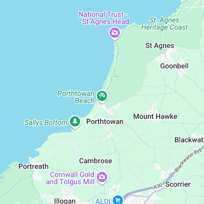
Surf spots nearby
- Porthtowan (0.2 mi)
- Portreath Harbour Wall (2.8 mi)
- Portreath (2.9 mi)
- Trevaunance Cove (2.9 mi)
- Perranporth (5.6 mi)
- Penhale (7.1 mi)
- Godrevy (7.7 mi)
- Gwithian (8.2 mi)
- Holywell Bay (8.3 mi)
- Hayle Towans (9.1 mi)
Not Magic Seaweed (MSW)
Although we look a bit like Magic Seaweed we are not MagicSeaweed as they no longer exist...