Perranporth (Droskyn) Surf Report
| Wave height * | 3ft / 0.9m |
|---|---|
| Swell period | 12s |
| Swell direction | |
| Wind | |
| Sea temp | 11°C / 52°F |

10 day Perranporth surf forecast
Mon
29/Dec
2.5ft
10
12
14
- Low 5:28am
- High 11:17am
- Low 6:07pm
- High 11:55pm
Tue
30/Dec
4ft
15
16
14
- Low 6:40am
- High 12:30pm
- Low 7:17pm
Wed
31/Dec
2ft
9
7
4
- High 1:08am
- Low 7:52am
- High 1:41pm
- Low 8:24pm
Thu
1/Jan
2ft
8
11
12
- High 2:16am
- Low 8:58am
- High 2:47pm
- Low 9:25pm
Fri
2/Jan
2ft
4
0
5
- High 3:15am
- Low 9:59am
- High 3:43pm
- Low 10:23pm
Sat
3/Jan
2.5ft
9
15
17
- High 4:08am
- Low 10:56am
- High 4:34pm
- Low 11:16pm
Sun
4/Jan
4.5ft
18
20
21
- High 4:57am
- Low 11:48am
- High 5:22pm
Mon
5/Jan
3.5ft
17
16
6
- Low 12:06am
- High 5:43am
- Low 12:37pm
- High 6:08pm
Tue
6/Jan
1.5ft
6
10
18
- Low 12:53am
- High 6:28am
- Low 1:23pm
- High 6:52pm
Wed
7/Jan
2.5ft
13
16
18
- Low 1:37am
- High 7:11am
- Low 2:07pm
- High 7:35pm
Mon 29th Dec
| 3:00 | 3ft | 3.1ft | 13s | 10mph (16mph) | |||
| 6:00 | 3ft | 3.2ft | 12s | 10mph (17mph) | |||
| 9:00 | 2.5ft | 3ft | 12s | 9mph (17mph) | |||
| 12:00 | 2.5ft | 2.9ft | 12s | 12mph (17mph) | |||
| 15:00 | 2.5ft | 2.9ft | 11s | 13mph (18mph) | |||
| 18:00 | 2.5ft | 3ft | 11s | 14mph (20mph) | |||
| 21:00 | 3ft | 3.2ft | 11s | 15mph (21mph) |
| Tide times |
|---|
| Low 5:28am (1.83m) |
| High 11:17am (4.77m) |
| Low 6:07pm (1.70m) |
| High 11:55pm (4.61m) |
| Daylight | |
|---|---|
| First light | 07:41 |
| Sunrise | 08:20 |
| Sunset | 16:25 |
| Dark | 17:03 |
Tue 30th Dec
| 3:00 | 3ft | 3.8ft | 11s | 15mph (23mph) | |||
| 6:00 | 3.5ft | 4ft | 12s | 15mph (23mph) | |||
| 9:00 | 3.5ft | 4.2ft | 12s | 17mph (25mph) | |||
| 12:00 | 4ft | 4.4ft | 14s | 16mph (22mph) | |||
| 15:00 | 3.5ft | 4.1ft | 14s | 15mph (19mph) | |||
| 18:00 | 3.5ft | 4ft | 13s | 14mph (22mph) | |||
| 21:00 | 3.5ft | 4ft | 13s | 12mph (22mph) |
| Tide times |
|---|
| Low 6:40am (1.76m) |
| High 12:30pm (4.79m) |
| Low 7:17pm (1.62m) |
| Daylight | |
|---|---|
| First light | 07:42 |
| Sunrise | 08:20 |
| Sunset | 16:25 |
| Dark | 17:04 |
Wed 31st Dec
| 3:00 | 3ft | 3.3ft | 12s | 10mph (17mph) | |||
| 6:00 | 2.5ft | 3ft | 12s | 9mph (15mph) | |||
| 9:00 | 2.5ft | 2.7ft | 13s | 8mph (14mph) | |||
| 12:00 | 2ft | 2.5ft | 13s | 7mph (9mph) | |||
| 15:00 | 2ft | 2.2ft | 13s | 6mph (7mph) | |||
| 18:00 | 2ft | 2.1ft | 12s | 4mph (4mph) | |||
| 21:00 | 1.5ft | 2ft | 12s | 3mph (3mph) |
| Tide times |
|---|
| High 1:08am (4.75m) |
| Low 7:52am (1.60m) |
| High 1:41pm (4.91m) |
| Low 8:24pm (1.46m) |
| Daylight | |
|---|---|
| First light | 07:42 |
| Sunrise | 08:20 |
| Sunset | 16:26 |
| Dark | 17:05 |
Thu 1st Jan
| 3:00 | 1.5ft | 1.8ft | 12s | 1mph (2mph) | |||
| 6:00 | 1.5ft | 1.8ft | 14s | 8mph (12mph) | |||
| 9:00 | 1.5ft | 2ft | 12s | 8mph (14mph) | |||
| 12:00 | 2ft | 2.4ft | 15s | 11mph (16mph) | |||
| 15:00 | 2ft | 2.4ft | 15s | 10mph (15mph) | |||
| 18:00 | 2ft | 2.4ft | 14s | 12mph (19mph) | |||
| 21:00 | 2.5ft | 2.6ft | 13s | 9mph (15mph) |
| Tide times |
|---|
| High 2:16am (4.94m) |
| Low 8:58am (1.42m) |
| High 2:47pm (5.04m) |
| Low 9:25pm (1.31m) |
| Daylight | |
|---|---|
| First light | 07:42 |
| Sunrise | 08:20 |
| Sunset | 16:27 |
| Dark | 17:06 |
Fri 2nd Jan
| 3:00 | 2ft | 2.5ft | 13s | 5mph (6mph) | |||
| 6:00 | 2ft | 2.5ft | 13s | 4mph (5mph) | |||
| 9:00 | 2ft | 2.5ft | 12s | 2mph (3mph) | |||
| 12:00 | 2ft | 2.6ft | 12s | 0mph (1mph) | |||
| 15:00 | 2ft | 2.6ft | 12s | 5mph (6mph) | |||
| 18:00 | 2ft | 2.9ft | 11s | 5mph (6mph) | |||
| 21:00 | 2ft | 3.1ft | 11s | 4mph (6mph) |
| Tide times |
|---|
| High 3:15am (5.22m) |
| Low 9:59am (1.16m) |
| High 3:43pm (5.24m) |
| Low 10:23pm (1.11m) |
| Daylight | |
|---|---|
| First light | 07:42 |
| Sunrise | 08:20 |
| Sunset | 16:28 |
| Dark | 17:07 |
Sat 3rd Jan
| 3:00 | 1.5ft | 3.1ft | 10s | 6mph (7mph) | |||
| 6:00 | 2ft | 3.4ft | 10s | 9mph (17mph) | |||
| 9:00 | 3ft | 4.9ft | 8s | 13mph (23mph) | |||
| 12:00 | 2.5ft | 4.8ft | 7s | 15mph (23mph) | |||
| 15:00 | 2ft | 4.3ft | 7s | 16mph (23mph) | |||
| 18:00 | 2ft | 4.1ft | 6s | 17mph (28mph) | |||
| 21:00 | 2.5ft | 4.4ft | 6s | 20mph (32mph) |
| Tide times |
|---|
| High 4:08am (5.48m) |
| Low 10:56am (0.94m) |
| High 4:34pm (5.39m) |
| Low 11:16pm (0.96m) |
| Daylight | |
|---|---|
| First light | 07:42 |
| Sunrise | 08:20 |
| Sunset | 16:29 |
| Dark | 17:08 |
Sun 4th Jan
| 3:00 | 3ft | 5ft | 7s | 22mph (32mph) | |||
| 6:00 | 3.5ft | 5.1ft | 6s | 18mph (28mph) | |||
| 9:00 | 4ft | 5.9ft | 6s | 16mph (26mph) | |||
| 12:00 | 4.5ft | 6.8ft | 7s | 20mph (26mph) | |||
| 15:00 | 4.5ft | 7.3ft | 7s | 22mph (29mph) | |||
| 18:00 | 4.5ft | 7.7ft | 7s | 21mph (28mph) | |||
| 21:00 | 4.5ft | 7.6ft | 7s | 25mph (35mph) |
| Tide times |
|---|
| High 4:57am (5.65m) |
| Low 11:48am (0.79m) |
| High 5:22pm (5.45m) |
| Daylight | |
|---|---|
| First light | 07:41 |
| Sunrise | 08:20 |
| Sunset | 16:31 |
| Dark | 17:09 |
Mon 5th Jan
| 3:00 | 4ft | 6.6ft | 8s | 15mph (25mph) | |||
| 6:00 | 3.5ft | 5.9ft | 8s | 17mph (27mph) | |||
| 9:00 | 3.5ft | 5.8ft | 6s | 18mph (28mph) | |||
| 12:00 | 3.5ft | 5.5ft | 6s | 16mph (22mph) | |||
| 15:00 | 3ft | 4.9ft | 6s | 13mph (19mph) | |||
| 18:00 | 3ft | 4.6ft | 7s | 6mph (9mph) | |||
| 21:00 | 2.5ft | 4.4ft | 7s | 5mph (7mph) |
| Tide times |
|---|
| Low 12:06am (0.88m) |
| High 5:43am (5.72m) |
| Low 12:37pm (0.73m) |
| High 6:08pm (5.43m) |
| Daylight | |
|---|---|
| First light | 07:41 |
| Sunrise | 08:19 |
| Sunset | 16:32 |
| Dark | 17:10 |
Tue 6th Jan
| 3:00 | 2ft | 3.6ft | 7s | 7mph (10mph) | |||
| 6:00 | 2ft | 3.1ft | 6s | 6mph (9mph) | |||
| 9:00 | 2ft | 2.7ft | 6s | 6mph (9mph) | |||
| 12:00 | 1.5ft | 2.4ft | 9s | 10mph (16mph) | |||
| 15:00 | 2ft | 2ft | 10s | 16mph (24mph) | |||
| 18:00 | 1.5ft | 1.8ft | 10s | 18mph (30mph) | |||
| 21:00 | 1.5ft | 1.7ft | 9s | 19mph (32mph) |
| Tide times |
|---|
| Low 12:53am (0.88m) |
| High 6:28am (5.69m) |
| Low 1:23pm (0.79m) |
| High 6:52pm (5.33m) |
| Daylight | |
|---|---|
| First light | 07:41 |
| Sunrise | 08:19 |
| Sunset | 16:33 |
| Dark | 17:11 |
Wed 7th Jan
| 3:00 | 1.5ft | 1.8ft | 14s | 13mph (26mph) | |||
| 6:00 | 2ft | 2.1ft | 14s | 13mph (26mph) | |||
| 9:00 | 2ft | 2.4ft | 12s | 13mph (25mph) | |||
| 12:00 | 2.5ft | 2.8ft | 11s | 16mph (26mph) | |||
| 15:00 | 3ft | 3.5ft | 10s | 18mph (28mph) | |||
| 18:00 | 4ft | 4.6ft | 9s | 18mph (31mph) | |||
| 21:00 | 5ft | 5.9ft | 9s | 19mph (31mph) |
| Tide times |
|---|
| Low 1:37am (0.98m) |
| High 7:11am (5.56m) |
| Low 2:07pm (0.94m) |
| High 7:35pm (5.16m) |
| Daylight | |
|---|---|
| First light | 07:41 |
| Sunrise | 08:19 |
| Sunset | 16:34 |
| Dark | 17:12 |
Nearest buoys
Reasonably consistent beachbreak with plenty of peaks and a bit of power. Doesn't hold a big swell to well and is exposed to the wind
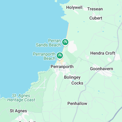
Surf spots nearby
- Penhale (1.6 mi)
- Trevaunance Cove (2.7 mi)
- Holywell Bay (3.1 mi)
- Crantock (4.2 mi)
- South Fistral (5.1 mi)
- Fistral (5.4 mi)
- Chapel Porth (5.6 mi)
- Towan (5.7 mi)
- Little Fistral (5.8 mi)
- Great Western (5.8 mi)
Not Magic Seaweed (MSW)
Although we look a bit like Magic Seaweed we are not MagicSeaweed as they no longer exist...