Riomar Surf Report
| Wave height * | 1ft / 0.4m |
|---|---|
| Swell period | 11s |
| Swell direction | |
| Wind | |
| Sea temp | 22°C / 71°F |

10 day Riomar surf forecast
Sun
4/Jan
1ft
11
9
15
- High 1:09am
- Low 7:45am
- High 1:40pm
- Low 8:16pm
Mon
5/Jan
2.5ft
1
3
9
- High 1:59am
- Low 8:36am
- High 2:25pm
- Low 9:06pm
Tue
6/Jan
2.5ft
8
5
10
- High 2:49am
- Low 9:26am
- High 3:09pm
- Low 9:57pm
Wed
7/Jan
2ft
8
2
11
- High 3:40am
- Low 10:19am
- High 3:53pm
- Low 10:48pm
Thu
8/Jan
1.5ft
5
4
9
- High 4:32am
- Low 11:13am
- High 4:39pm
- Low 11:42pm
Fri
9/Jan
1.5ft
8
14
15
- High 5:27am
- Low 12:09pm
- High 5:29pm
Sat
10/Jan
1.5ft
9
8
2
- Low 12:35am
- High 6:25am
- Low 1:06pm
- High 6:22pm
Sun
11/Jan
1ft
25
27
26
- Low 1:28am
- High 7:23am
- Low 2:00pm
- High 7:18pm
Mon
12/Jan
4ft
23
21
20
- Low 2:20am
- High 8:18am
- Low 2:51pm
- High 8:13pm
Sun 4th Jan
| 4:00 | 2ft | 2.1ft | 12s | 14mph (19mph) | |||
| 7:00 | 1.5ft | 1.9ft | 12s | 11mph (12mph) | |||
| 10:00 | 1.5ft | 1.6ft | 12s | 10mph (11mph) | |||
| 13:00 | 1ft | 1.4ft | 12s | 9mph (9mph) | |||
| 16:00 | 1ft | 1.4ft | 11s | 16mph (16mph) | |||
| 19:00 | 1.5ft | 1.7ft | 11s | 15mph (15mph) |
| Tide times |
|---|
| High 1:09am (0.94m) |
| Low 7:45am (-0.34m) |
| High 1:40pm (0.97m) |
| Low 8:16pm (-0.16m) |
| Daylight | |
|---|---|
| First light | 06:47 |
| Sunrise | 07:12 |
| Sunset | 17:40 |
| Dark | 18:05 |
Mon 5th Jan
| 4:00 | 1.5ft | 2ft | 11s | 5mph (6mph) | |||
| 7:00 | 2ft | 2.6ft | 9s | 1mph (4mph) | |||
| 10:00 | 2ft | 3ft | 8s | 4mph (3mph) | |||
| 13:00 | 2.5ft | 3.1ft | 9s | 3mph (2mph) | |||
| 16:00 | 2.5ft | 3.1ft | 9s | 7mph (7mph) | |||
| 19:00 | 2.5ft | 3.1ft | 8s | 9mph (11mph) |
| Tide times |
|---|
| High 1:59am (0.90m) |
| Low 8:36am (-0.20m) |
| High 2:25pm (0.91m) |
| Low 9:06pm (-0.13m) |
| Daylight | |
|---|---|
| First light | 06:47 |
| Sunrise | 07:12 |
| Sunset | 17:40 |
| Dark | 18:06 |
Tue 6th Jan
| 4:00 | 3ft | 3.3ft | 7s | 8mph (9mph) | |||
| 7:00 | 2.5ft | 3.2ft | 7s | 8mph (8mph) | |||
| 10:00 | 2.5ft | 3.1ft | 7s | 4mph (4mph) | |||
| 13:00 | 2.5ft | 2.9ft | 7s | 5mph (5mph) | |||
| 16:00 | 2.5ft | 2.9ft | 7s | 9mph (9mph) | |||
| 19:00 | 2.5ft | 2.9ft | 7s | 10mph (12mph) |
| Tide times |
|---|
| High 2:49am (0.85m) |
| Low 9:26am (-0.04m) |
| High 3:09pm (0.85m) |
| Low 9:57pm (-0.07m) |
| Daylight | |
|---|---|
| First light | 06:47 |
| Sunrise | 07:13 |
| Sunset | 17:41 |
| Dark | 18:07 |
Wed 7th Jan
| 4:00 | 2.5ft | 2.5ft | 16s | 8mph (8mph) | |||
| 7:00 | 2ft | 2.3ft | 16s | 8mph (9mph) | |||
| 10:00 | 2ft | 2.2ft | 15s | 6mph (7mph) | |||
| 13:00 | 2ft | 2.1ft | 15s | 2mph (2mph) | |||
| 16:00 | 2ft | 2.1ft | 15s | 9mph (9mph) | |||
| 19:00 | 2ft | 2.1ft | 14s | 11mph (13mph) |
| Tide times |
|---|
| High 3:40am (0.80m) |
| Low 10:19am (0.12m) |
| High 3:53pm (0.79m) |
| Low 10:48pm (-0.02m) |
| Daylight | |
|---|---|
| First light | 06:47 |
| Sunrise | 07:13 |
| Sunset | 17:42 |
| Dark | 18:07 |
Thu 8th Jan
| 4:00 | 1.5ft | 2.1ft | 13s | 6mph (6mph) | |||
| 7:00 | 1.5ft | 2ft | 13s | 5mph (4mph) | |||
| 10:00 | 1.5ft | 1.9ft | 13s | 5mph (4mph) | |||
| 13:00 | 1.5ft | 1.8ft | 13s | 4mph (4mph) | |||
| 16:00 | 1.5ft | 1.8ft | 13s | 5mph (6mph) | |||
| 19:00 | 1.5ft | 1.8ft | 12s | 9mph (11mph) |
| Tide times |
|---|
| High 4:32am (0.76m) |
| Low 11:13am (0.25m) |
| High 4:39pm (0.73m) |
| Low 11:42pm (0.03m) |
| Daylight | |
|---|---|
| First light | 06:47 |
| Sunrise | 07:13 |
| Sunset | 17:43 |
| Dark | 18:08 |
Fri 9th Jan
| 4:00 | 2ft | 2.3ft | 12s | 8mph (11mph) | |||
| 7:00 | 2ft | 2.2ft | 12s | 8mph (11mph) | |||
| 10:00 | 2ft | 2.3ft | 12s | 8mph (11mph) | |||
| 13:00 | 1.5ft | 2.6ft | 8s | 14mph (17mph) | |||
| 16:00 | 2ft | 3.2ft | 4s | 13mph (17mph) | |||
| 19:00 | 1.5ft | 2.9ft | 5s | 15mph (19mph) |
| Tide times |
|---|
| High 5:27am (0.72m) |
| Low 12:09pm (0.34m) |
| High 5:29pm (0.69m) |
| Daylight | |
|---|---|
| First light | 06:48 |
| Sunrise | 07:13 |
| Sunset | 17:43 |
| Dark | 18:09 |
Sat 10th Jan
| 4:00 | 1.5ft | 2ft | 11s | 11mph (15mph) | |||
| 7:00 | 1.5ft | 1.8ft | 11s | 9mph (11mph) | |||
| 10:00 | 1.5ft | 1.6ft | 11s | 8mph (11mph) | |||
| 13:00 | 1.5ft | 1.5ft | 11s | 8mph (8mph) | |||
| 16:00 | 1ft | 1.4ft | 11s | 9mph (10mph) | |||
| 19:00 | 1ft | 1.3ft | 11s | 2mph (8mph) |
| Tide times |
|---|
| Low 12:35am (0.06m) |
| High 6:25am (0.70m) |
| Low 1:06pm (0.39m) |
| High 6:22pm (0.66m) |
| Daylight | |
|---|---|
| First light | 06:48 |
| Sunrise | 07:13 |
| Sunset | 17:44 |
| Dark | 18:09 |
Sun 11th Jan
| 4:00 | 1ft | 1.4ft | 11s | 26mph (26mph) | |||
| 7:00 | 1.5ft | 1.6ft | 11s | 25mph (26mph) | |||
| 10:00 | 1ft | 2ft | 7s | 25mph (26mph) | |||
| 13:00 | 1ft | 2.8ft | 4s | 27mph (28mph) | |||
| 16:00 | 1.5ft | 3.5ft | 5s | 26mph (27mph) | |||
| 19:00 | 2.5ft | 4ft | 5s | 26mph (27mph) |
| Tide times |
|---|
| Low 1:28am (0.06m) |
| High 7:23am (0.69m) |
| Low 2:00pm (0.39m) |
| High 7:18pm (0.66m) |
| Daylight | |
|---|---|
| First light | 06:48 |
| Sunrise | 07:13 |
| Sunset | 17:45 |
| Dark | 18:10 |
Mon 12th Jan
| 4:00 | 4ft | 4.8ft | 6s | 25mph (25mph) | |||
| 7:00 | 4ft | 5.1ft | 6s | 23mph (24mph) | |||
| 10:00 | 4.5ft | 5.5ft | 7s | 23mph (25mph) | |||
| 13:00 | 4ft | 5.3ft | 7s | 21mph (22mph) | |||
| 16:00 | 4ft | 5.3ft | 7s | 21mph (22mph) | |||
| 19:00 | 4ft | 5.5ft | 8s | 20mph (21mph) |
| Tide times |
|---|
| Low 2:20am (0.03m) |
| High 8:18am (0.71m) |
| Low 2:51pm (0.36m) |
| High 8:13pm (0.67m) |
| Daylight | |
|---|---|
| First light | 06:48 |
| Sunrise | 07:13 |
| Sunset | 17:46 |
| Dark | 18:11 |
Tue 13th Jan
| 4:00 | 4.5ft | 5.1ft | 7s | 15mph (15mph) | |||
| 7:00 | 4ft | 4.9ft | 7s | 12mph (12mph) | |||
| 10:00 | 4ft | 4.8ft | 7s | 11mph (11mph) | |||
| 13:00 | 4ft | 4.6ft | 7s | 6mph (7mph) | |||
| 16:00 | 3.5ft | 4.4ft | 7s | 6mph (5mph) | |||
| 19:00 | 3.5ft | 4.1ft | 7s | 12mph (11mph) |
| Tide times |
|---|
| Daylight | |
|---|---|
| First light | 06:48 |
| Sunrise | 07:13 |
| Sunset | 17:47 |
| Dark | 18:12 |
Nearest buoys
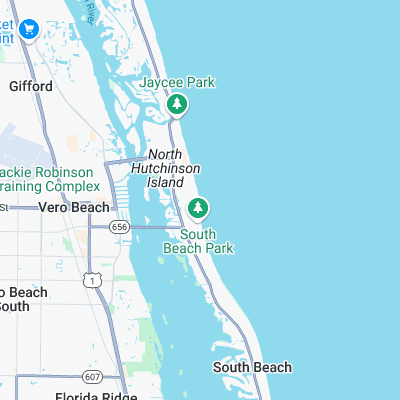
Surf spots nearby
- Vero Beach Pier (2.1 mi)
- Wabasso (8.9 mi)
- Fort Pierce North Jetty (12 mi)
- Blue Heron Beach (14.7 mi)
- Monster Hole (16.2 mi)
- Sebastian Inlet (16.5 mi)
- Spanish House (17.5 mi)
- Long Point (18 mi)
- Walton Rocks (22.1 mi)
Not Magic Seaweed (MSW)
Although we look a bit like Magic Seaweed we are not MagicSeaweed as they no longer exist...