Barra da Tijuca (Posto 8) Surf Report
| Wave height * | 3ft / 0.9m |
|---|---|
| Swell period | 10s |
| Swell direction | |
| Wind | |
| Sea temp | 24°C / 76°F |

10 day Barra da Tijuca surf forecast
Wed
7/Jan
3ft
4
6
6
- Low 12:39am
- High 5:57am
- Low 12:54pm
- High 5:41pm
Thu
8/Jan
2ft
4
3
2
- Low 1:25am
- High 6:40am
- Low 1:30pm
- High 6:41pm
Fri
9/Jan
2ft
4
7
5
- Low 2:03am
- High 7:17am
- Low 2:03pm
- High 7:31pm
Sat
10/Jan
3ft
5
3
7
- Low 3:00am
- High 7:52am
- Low 3:35pm
- High 8:22pm
Sun
11/Jan
3.5ft
6
4
7
- Low 5:05am
- High 8:35am
- Low 5:17pm
- High 9:56pm
Mon
12/Jan
3ft
6
8
6
- Low 5:56am
- High 10:05am
- Low 6:02pm
- High 11:37pm
Tue
13/Jan
2.5ft
4
7
7
- Low 6:39am
- High 11:25am
- Low 6:45pm
Wed
14/Jan
2.5ft
4
7
5
- High 12:22am
- Low 7:30am
- High 12:10pm
- Low 7:36pm
Thu
15/Jan
3ft
4
6
6
- High 1:12am
- Low 8:21am
- High 12:57pm
- Low 8:27pm
Fri
16/Jan
3ft
4
4
10
Wed 7th Jan
| 3:00 | 3ft | 4.3ft | 10s | 4mph (5mph) | |||
| 6:00 | 3ft | 4ft | 10s | 4mph (5mph) | |||
| 9:00 | 3ft | 3.7ft | 9s | 4mph (7mph) | |||
| 12:00 | 3ft | 3.6ft | 9s | 6mph (12mph) | |||
| 15:00 | 2.5ft | 3.5ft | 9s | 7mph (11mph) | |||
| 18:00 | 2.5ft | 3.5ft | 9s | 6mph (9mph) | |||
| 21:00 | 2.5ft | 3.3ft | 9s | 4mph (5mph) |
| Tide times |
|---|
| Low 12:39am (0.85m) |
| High 5:57am (3.38m) |
| Low 12:54pm (1.97m) |
| High 5:41pm (3.77m) |
| Daylight | |
|---|---|
| First light | 04:50 |
| Sunrise | 05:15 |
| Sunset | 18:44 |
| Dark | 19:09 |
Thu 8th Jan
| 3:00 | 2.5ft | 3.1ft | 9s | 4mph (6mph) | |||
| 6:00 | 2.5ft | 3.2ft | 8s | 4mph (6mph) | |||
| 9:00 | 2.5ft | 3ft | 6s | 5mph (10mph) | |||
| 12:00 | 2ft | 2.8ft | 6s | 3mph (9mph) | |||
| 15:00 | 2ft | 2.8ft | 6s | 9mph (9mph) | |||
| 18:00 | 2ft | 2.7ft | 6s | 2mph (2mph) | |||
| 21:00 | 2ft | 2.7ft | 6s | 2mph (2mph) |
| Tide times |
|---|
| Low 1:25am (1.18m) |
| High 6:40am (3.19m) |
| Low 1:30pm (1.92m) |
| High 6:41pm (3.52m) |
| Daylight | |
|---|---|
| First light | 04:51 |
| Sunrise | 05:16 |
| Sunset | 18:44 |
| Dark | 19:09 |
Fri 9th Jan
| 3:00 | 2ft | 3ft | 6s | 4mph (4mph) | |||
| 6:00 | 2ft | 2.9ft | 6s | 4mph (5mph) | |||
| 9:00 | 2ft | 2.6ft | 7s | 2mph (4mph) | |||
| 12:00 | 2ft | 2.5ft | 6s | 7mph (7mph) | |||
| 15:00 | 2.5ft | 2.9ft | 6s | 8mph (12mph) | |||
| 18:00 | 2.5ft | 3.6ft | 6s | 5mph (9mph) | |||
| 21:00 | 3.5ft | 4.6ft | 6s | 2mph (3mph) |
| Tide times |
|---|
| Low 2:03am (1.50m) |
| High 7:17am (3.02m) |
| Low 2:03pm (1.85m) |
| High 7:31pm (3.25m) |
| Daylight | |
|---|---|
| First light | 04:52 |
| Sunrise | 05:17 |
| Sunset | 18:44 |
| Dark | 19:09 |
Sat 10th Jan
| 3:00 | 3.5ft | 4.4ft | 7s | 3mph (3mph) | |||
| 6:00 | 3ft | 4.1ft | 7s | 5mph (6mph) | |||
| 9:00 | 3.5ft | 4ft | 8s | 4mph (9mph) | |||
| 12:00 | 3ft | 4ft | 10s | 3mph (8mph) | |||
| 15:00 | 4ft | 5.1ft | 10s | 8mph (10mph) | |||
| 18:00 | 4.5ft | 6.2ft | 7s | 7mph (13mph) | |||
| 21:00 | 5ft | 6.4ft | 7s | 4mph (4mph) |
| Tide times |
|---|
| Low 3:00am (1.78m) |
| High 7:52am (2.83m) |
| Low 3:35pm (1.76m) |
| High 8:22pm (2.94m) |
| Daylight | |
|---|---|
| First light | 04:53 |
| Sunrise | 05:17 |
| Sunset | 18:44 |
| Dark | 19:09 |
Sun 11th Jan
| 3:00 | 4.5ft | 5.6ft | 8s | 5mph (6mph) | |||
| 6:00 | 4ft | 5.1ft | 8s | 6mph (8mph) | |||
| 9:00 | 3.5ft | 4.7ft | 8s | 8mph (14mph) | |||
| 12:00 | 3.5ft | 4.3ft | 8s | 4mph (9mph) | |||
| 15:00 | 3.5ft | 4.5ft | 8s | 8mph (8mph) | |||
| 18:00 | 4ft | 5.2ft | 7s | 7mph (11mph) | |||
| 21:00 | 4ft | 5.6ft | 7s | 3mph (3mph) |
| Tide times |
|---|
| Low 5:05am (1.77m) |
| High 8:35am (2.63m) |
| Low 5:17pm (1.41m) |
| High 9:56pm (2.70m) |
| Daylight | |
|---|---|
| First light | 04:53 |
| Sunrise | 05:18 |
| Sunset | 18:44 |
| Dark | 19:09 |
Mon 12th Jan
| 3:00 | 4ft | 4.9ft | 8s | 5mph (8mph) | |||
| 6:00 | 3.5ft | 4.3ft | 8s | 6mph (9mph) | |||
| 9:00 | 3ft | 3.8ft | 9s | 4mph (6mph) | |||
| 12:00 | 3ft | 3.5ft | 8s | 8mph (6mph) | |||
| 15:00 | 3ft | 3.7ft | 7s | 8mph (12mph) | |||
| 18:00 | 3ft | 4.3ft | 7s | 6mph (11mph) | |||
| 21:00 | 4ft | 5.1ft | 7s | 2mph (3mph) |
| Tide times |
|---|
| Low 5:56am (1.60m) |
| High 10:05am (2.49m) |
| Low 6:02pm (1.04m) |
| High 11:37pm (2.82m) |
| Daylight | |
|---|---|
| First light | 04:54 |
| Sunrise | 05:19 |
| Sunset | 18:44 |
| Dark | 19:09 |
Tue 13th Jan
| 3:00 | 3.5ft | 4.6ft | 7s | 2mph (2mph) | |||
| 6:00 | 3ft | 4ft | 7s | 4mph (4mph) | |||
| 9:00 | 3ft | 3.7ft | 7s | 1mph (6mph) | |||
| 12:00 | 2.5ft | 3.6ft | 7s | 7mph (8mph) | |||
| 15:00 | 2.5ft | 3.5ft | 8s | 11mph (16mph) | |||
| 18:00 | 3ft | 3.9ft | 8s | 7mph (12mph) | |||
| 21:00 | 3ft | 4.2ft | 7s | 5mph (8mph) |
| Tide times |
|---|
| Low 6:39am (1.42m) |
| High 11:25am (2.64m) |
| Low 6:45pm (0.74m) |
| Daylight | |
|---|---|
| First light | 04:55 |
| Sunrise | 05:20 |
| Sunset | 18:44 |
| Dark | 19:09 |
Wed 14th Jan
| 3:00 | 3ft | 3.9ft | 7s | 5mph (7mph) | |||
| 6:00 | 3ft | 3.7ft | 7s | 4mph (5mph) | |||
| 9:00 | 3ft | 3.7ft | 7s | 1mph (4mph) | |||
| 12:00 | 2.5ft | 3.6ft | 7s | 7mph (7mph) | |||
| 15:00 | 3ft | 3.8ft | 7s | 8mph (12mph) | |||
| 18:00 | 4ft | 4.8ft | 7s | 5mph (9mph) | |||
| 21:00 | 4.5ft | 5.8ft | 7s | 1mph (2mph) |
| Tide times |
|---|
| High 12:22am (3.02m) |
| Low 7:30am (1.24m) |
| High 12:10pm (2.87m) |
| Low 7:36pm (0.50m) |
| Daylight | |
|---|---|
| First light | 04:56 |
| Sunrise | 05:20 |
| Sunset | 18:44 |
| Dark | 19:09 |
Thu 15th Jan
| 3:00 | 4ft | 4.7ft | 7s | 4mph (4mph) | |||
| 6:00 | 3ft | 4ft | 7s | 4mph (4mph) | |||
| 9:00 | 3ft | 3.7ft | 7s | 2mph (5mph) | |||
| 12:00 | 3ft | 3.7ft | 7s | 6mph (7mph) | |||
| 15:00 | 3.5ft | 5ft | 7s | 8mph (13mph) | |||
| 18:00 | 5ft | 6.7ft | 7s | 6mph (9mph) | |||
| 21:00 | 5.5ft | 7.4ft | 7s | 5mph (7mph) |
| Tide times |
|---|
| High 1:12am (3.23m) |
| Low 8:21am (1.07m) |
| High 12:57pm (3.13m) |
| Low 8:27pm (0.27m) |
| Daylight | |
|---|---|
| First light | 04:56 |
| Sunrise | 05:21 |
| Sunset | 18:44 |
| Dark | 19:09 |
Fri 16th Jan
| 3:00 | 4ft | 5.3ft | 7s | 3mph (4mph) | |||
| 6:00 | 3.5ft | 4.6ft | 7s | 4mph (6mph) | |||
| 9:00 | 3ft | 4.2ft | 7s | 4mph (8mph) | |||
| 12:00 | 3ft | 3.8ft | 7s | 4mph (10mph) | |||
| 15:00 | 3.5ft | 4.6ft | 7s | 9mph (9mph) | |||
| 18:00 | 4.5ft | 6ft | 7s | 10mph (17mph) | |||
| 21:00 | 5ft | 6.6ft | 7s | 3mph (3mph) |
| Tide times |
|---|
| Daylight | |
|---|---|
| First light | 04:57 |
| Sunrise | 05:22 |
| Sunset | 18:44 |
| Dark | 19:09 |
Nearest buoys
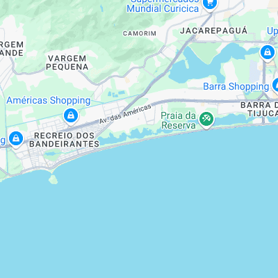
Surf spots nearby
- Praia da Macumba (3.1 mi)
- Prainha (5.2 mi)
- Lage Postinho (7.7 mi)
- Tropical (posto 1) (8 mi)
- Barra de Guaratiba (9.6 mi)
- Leblon (13.3 mi)
- Ipanema (14.3 mi)
- Leme (15.1 mi)
- Arpoador (15.1 mi)
- Praia do Diabo (15.3 mi)
Not Magic Seaweed (MSW)
Although we look a bit like Magic Seaweed we are not MagicSeaweed as they no longer exist...