Himilayas Surf Report
| Wave height * | 5ft / 1.6m |
|---|---|
| Swell period | 11s |
| Swell direction | |
| Wind | |
| Sea temp | 26°C / 78°F |

10 day Himilayas surf forecast
Fri
2/Jan
7ft
9
9
7
- High 3:14am
- Low 9:35am
- High 3:05pm
- Low 7:21pm
Sat
3/Jan
5.5ft
3
5
4
- High 3:56am
- Low 10:15am
- High 3:59pm
- Low 8:09pm
Sun
4/Jan
4.5ft
4
14
8
- High 4:38am
- Low 10:53am
- High 4:56pm
- Low 8:57pm
Mon
5/Jan
4ft
6
18
18
- High 5:17am
- Low 11:30am
- High 5:58pm
- Low 9:49pm
Tue
6/Jan
3ft
16
13
15
- High 5:53am
- Low 12:06pm
- High 7:08pm
- Low 10:48pm
Wed
7/Jan
7.5ft
15
11
5
- High 6:28am
- Low 12:40pm
- High 8:24pm
Thu
8/Jan
5ft
4
5
5
- Low 12:09am
- High 7:01am
- Low 1:13pm
- High 9:39pm
Fri
9/Jan
5.5ft
13
17
15
- Low 2:11am
- High 7:34am
- Low 1:46pm
- High 10:42pm
Sat
10/Jan
6.5ft
14
17
15
- Low 4:43am
- High 8:15am
- Low 2:23pm
- High 11:32pm
Fri 2nd Jan
| 5:00 | 5.5ft | 7.8ft | 10s | 9mph (18mph) | |||
| 8:00 | 6ft | 7.9ft | 10s | 9mph (18mph) | |||
| 11:00 | 7.5ft | 8ft | 11s | 9mph (16mph) | |||
| 14:00 | 7ft | 8ft | 13s | 9mph (13mph) | |||
| 17:00 | 6ft | 8ft | 13s | 10mph (17mph) | |||
| 20:00 | 6.5ft | 8.2ft | 13s | 7mph (16mph) |
| Tide times |
|---|
| High 3:14am (2.16m) |
| Low 9:35am (-0.01m) |
| High 3:05pm (0.45m) |
| Low 7:21pm (-0.29m) |
| Daylight | |
|---|---|
| First light | 06:46 |
| Sunrise | 07:11 |
| Sunset | 18:02 |
| Dark | 18:26 |
Sat 3rd Jan
| 5:00 | 5.5ft | 7.7ft | 12s | 3mph (3mph) | |||
| 8:00 | 5.5ft | 7.4ft | 12s | 3mph (4mph) | |||
| 11:00 | 5.5ft | 7.2ft | 12s | 4mph (4mph) | |||
| 14:00 | 5.5ft | 7ft | 12s | 5mph (7mph) | |||
| 17:00 | 5ft | 6.8ft | 12s | 3mph (4mph) | |||
| 20:00 | 5ft | 6.7ft | 12s | 4mph (4mph) |
| Tide times |
|---|
| High 3:56am (2.09m) |
| Low 10:15am (-0.02m) |
| High 3:59pm (0.50m) |
| Low 8:09pm (-0.19m) |
| Daylight | |
|---|---|
| First light | 06:47 |
| Sunrise | 07:11 |
| Sunset | 18:02 |
| Dark | 18:26 |
Sun 4th Jan
| 5:00 | 4.5ft | 6.3ft | 12s | 3mph (3mph) | |||
| 8:00 | 4.5ft | 6.3ft | 12s | 4mph (11mph) | |||
| 11:00 | 4.5ft | 6.2ft | 12s | 10mph (14mph) | |||
| 14:00 | 4.5ft | 6.1ft | 12s | 14mph (22mph) | |||
| 17:00 | 4.5ft | 6.1ft | 11s | 12mph (24mph) | |||
| 20:00 | 4.5ft | 6.4ft | 11s | 8mph (20mph) |
| Tide times |
|---|
| High 4:38am (1.96m) |
| Low 10:53am (-0.02m) |
| High 4:56pm (0.56m) |
| Low 8:57pm (-0.03m) |
| Daylight | |
|---|---|
| First light | 06:47 |
| Sunrise | 07:11 |
| Sunset | 18:03 |
| Dark | 18:27 |
Mon 5th Jan
| 5:00 | 4.5ft | 7ft | 11s | 4mph (5mph) | |||
| 8:00 | 4.5ft | 7.3ft | 11s | 6mph (16mph) | |||
| 11:00 | 4ft | 8.5ft | 11s | 13mph (22mph) | |||
| 14:00 | 4ft | 9.4ft | 10s | 18mph (26mph) | |||
| 17:00 | 2.5ft | 9.3ft | 10s | 18mph (29mph) | |||
| 20:00 | 3ft | 9ft | 10s | 18mph (30mph) |
| Tide times |
|---|
| High 5:17am (1.79m) |
| Low 11:30am (-0.01m) |
| High 5:58pm (0.65m) |
| Low 9:49pm (0.18m) |
| Daylight | |
|---|---|
| First light | 06:47 |
| Sunrise | 07:11 |
| Sunset | 18:04 |
| Dark | 18:28 |
Tue 6th Jan
| 5:00 | 3ft | 10.4ft | 9s | 19mph (28mph) | |||
| 8:00 | 3ft | 10.5ft | 9s | 16mph (27mph) | |||
| 11:00 | 3ft | 10.3ft | 9s | 15mph (24mph) | |||
| 14:00 | 3ft | 10.1ft | 9s | 13mph (22mph) | |||
| 17:00 | 3ft | 9.9ft | 9s | 14mph (23mph) | |||
| 20:00 | 3ft | 9.5ft | 9s | 15mph (26mph) |
| Tide times |
|---|
| High 5:53am (1.58m) |
| Low 12:06pm (-0.00m) |
| High 7:08pm (0.76m) |
| Low 10:48pm (0.40m) |
| Daylight | |
|---|---|
| First light | 06:47 |
| Sunrise | 07:11 |
| Sunset | 18:04 |
| Dark | 18:28 |
Wed 7th Jan
| 5:00 | 8.5ft | 9.2ft | 10s | 14mph (25mph) | |||
| 8:00 | 8ft | 8.8ft | 10s | 15mph (25mph) | |||
| 11:00 | 8ft | 8.6ft | 9s | 14mph (23mph) | |||
| 14:00 | 7.5ft | 8.3ft | 9s | 11mph (19mph) | |||
| 17:00 | 7ft | 7.9ft | 13s | 7mph (16mph) | |||
| 20:00 | 6.5ft | 7.4ft | 14s | 5mph (16mph) |
| Tide times |
|---|
| High 6:28am (1.34m) |
| Low 12:40pm (0.01m) |
| High 8:24pm (0.90m) |
| Daylight | |
|---|---|
| First light | 06:48 |
| Sunrise | 07:12 |
| Sunset | 18:05 |
| Dark | 18:29 |
Thu 8th Jan
| 5:00 | 5.5ft | 6.5ft | 14s | 4mph (10mph) | |||
| 8:00 | 5.5ft | 6.3ft | 14s | 4mph (9mph) | |||
| 11:00 | 5.5ft | 6.1ft | 14s | 6mph (8mph) | |||
| 14:00 | 5ft | 5.7ft | 14s | 5mph (5mph) | |||
| 17:00 | 5ft | 5.5ft | 13s | 6mph (6mph) | |||
| 20:00 | 5ft | 5.4ft | 13s | 5mph (9mph) |
| Tide times |
|---|
| Low 12:09am (0.60m) |
| High 7:01am (1.11m) |
| Low 1:13pm (0.02m) |
| High 9:39pm (1.07m) |
| Daylight | |
|---|---|
| First light | 06:48 |
| Sunrise | 07:12 |
| Sunset | 18:06 |
| Dark | 18:30 |
Fri 9th Jan
| 5:00 | 5ft | 5.4ft | 12s | 9mph (20mph) | |||
| 8:00 | 5ft | 5.5ft | 12s | 13mph (22mph) | |||
| 11:00 | 5ft | 5.6ft | 12s | 16mph (25mph) | |||
| 14:00 | 5.5ft | 5.7ft | 12s | 17mph (25mph) | |||
| 17:00 | 5ft | 5.6ft | 12s | 16mph (24mph) | |||
| 20:00 | 5ft | 5.6ft | 12s | 15mph (28mph) |
| Tide times |
|---|
| Low 2:11am (0.70m) |
| High 7:34am (0.88m) |
| Low 1:46pm (0.03m) |
| High 10:42pm (1.24m) |
| Daylight | |
|---|---|
| First light | 06:48 |
| Sunrise | 07:12 |
| Sunset | 18:06 |
| Dark | 18:30 |
Sat 10th Jan
| 5:00 | 5.5ft | 6.6ft | 13s | 11mph (22mph) | |||
| 8:00 | 6ft | 7ft | 13s | 14mph (24mph) | |||
| 11:00 | 6.5ft | 7.4ft | 12s | 17mph (24mph) | |||
| 14:00 | 6.5ft | 8.3ft | 18s | 17mph (25mph) | |||
| 17:00 | 7.5ft | 9ft | 17s | 14mph (23mph) | |||
| 20:00 | 7.5ft | 9.3ft | 16s | 15mph (26mph) |
| Tide times |
|---|
| Low 4:43am (0.65m) |
| High 8:15am (0.68m) |
| Low 2:23pm (0.03m) |
| High 11:32pm (1.39m) |
| Daylight | |
|---|---|
| First light | 06:48 |
| Sunrise | 07:12 |
| Sunset | 18:07 |
| Dark | 18:31 |
Sun 11th Jan
| 5:00 | 7.5ft | 8.5ft | 15s | 10mph (21mph) | |||
| 8:00 | 7ft | 8.2ft | 14s | 11mph (22mph) | |||
| 11:00 | 7ft | 7.9ft | 14s | 13mph (21mph) | |||
| 14:00 | 6.5ft | 7.7ft | 14s | 12mph (19mph) |
| Tide times |
|---|
| Low 6:28am (0.50m) |
| High 9:30am (0.52m) |
| Daylight | |
|---|---|
| First light | 06:48 |
| Sunrise | 07:12 |
| Sunset | 18:08 |
| Dark | 18:32 |
Nearest buoys
A series of reefs ranging from inside section to cloud break. Produces a long, fat left on huge days. Rights on the inside on smaller days
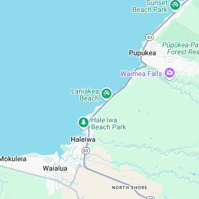
Surf spots nearby
- Laniakea (0.3 mi)
- Holtons (0.4 mi)
- Jockos Point (0.6 mi)
- Chun's Reef (0.7 mi)
- Piddley's (0.9 mi)
- Marijuana's (1 mi)
- Leftover's (1.2 mi)
- Alligator Rock (1.4 mi)
- Puaena Point (1.4 mi)
- Uppers (1.8 mi)
Not Magic Seaweed (MSW)
Although we look a bit like Magic Seaweed we are not MagicSeaweed as they no longer exist...