Alligator Rock Surf Report
| Wave height * | 4ft / 1.2m |
|---|---|
| Swell period | 14s |
| Swell direction | |
| Wind | |
| Sea temp | 25°C / 78°F |

10 day Alligator Rock surf forecast
Sun
14/Dec
6.5ft
6
3
3
- High 12:45am
- Low 6:45am
- High 11:32am
- Low 4:33pm
Mon
15/Dec
5.5ft
8
3
6
- High 1:16am
- Low 7:33am
- High 12:19pm
- Low 5:02pm
Tue
16/Dec
4.5ft
5
4
11
- High 1:48am
- Low 8:13am
- High 1:03pm
- Low 5:33pm
Wed
17/Dec
5.5ft
8
12
8
- High 2:19am
- Low 8:48am
- High 1:43pm
- Low 6:06pm
Thu
18/Dec
5ft
7
11
6
- High 2:53am
- Low 9:22am
- High 2:22pm
- Low 6:41pm
Fri
19/Dec
5ft
4
6
3
- High 3:28am
- Low 9:58am
- High 3:01pm
- Low 7:16pm
Sat
20/Dec
5ft
3
7
9
- High 4:03am
- Low 10:35am
- High 3:44pm
- Low 7:52pm
Sun
21/Dec
4ft
14
13
14
- High 4:39am
- Low 11:14am
- High 4:33pm
- Low 8:29pm
Mon
22/Dec
4ft
22
24
24
- High 5:16am
- Low 11:52am
- High 5:33pm
- Low 9:11pm
Sun 14th Dec
| 5:00 | 4ft | 5.5ft | 15s | 11mph (15mph) | |||
| 8:00 | 5ft | 5.9ft | 14s | 6mph (7mph) | |||
| 11:00 | 5.5ft | 6.5ft | 14s | 4mph (3mph) | |||
| 14:00 | 6.5ft | 7.3ft | 14s | 3mph (3mph) | |||
| 17:00 | 7ft | 7.8ft | 13s | 4mph (3mph) | |||
| 20:00 | 7ft | 7.9ft | 13s | 3mph (4mph) |
| Tide times |
|---|
| High 12:45am (1.56m) |
| Low 6:45am (0.49m) |
| High 11:32am (0.66m) |
| Low 4:33pm (-0.03m) |
| Daylight | |
|---|---|
| First light | 06:38 |
| Sunrise | 07:02 |
| Sunset | 17:52 |
| Dark | 18:16 |
Mon 15th Dec
| 5:00 | 6.5ft | 8ft | 13s | 5mph (6mph) | |||
| 8:00 | 6ft | 8.1ft | 12s | 8mph (11mph) | |||
| 11:00 | 6ft | 8.1ft | 13s | 8mph (13mph) | |||
| 14:00 | 5.5ft | 8ft | 13s | 3mph (6mph) | |||
| 17:00 | 5.5ft | 7.9ft | 13s | 6mph (10mph) | |||
| 20:00 | 5.5ft | 7.7ft | 13s | 6mph (11mph) |
| Tide times |
|---|
| High 1:16am (1.69m) |
| Low 7:33am (0.39m) |
| High 12:19pm (0.57m) |
| Low 5:02pm (-0.05m) |
| Daylight | |
|---|---|
| First light | 06:38 |
| Sunrise | 07:03 |
| Sunset | 17:52 |
| Dark | 18:16 |
Tue 16th Dec
| 5:00 | 4.5ft | 6.7ft | 13s | 8mph (10mph) | |||
| 8:00 | 4.5ft | 6.4ft | 13s | 5mph (9mph) | |||
| 11:00 | 4.5ft | 6.2ft | 13s | 6mph (11mph) | |||
| 14:00 | 4.5ft | 6.1ft | 12s | 4mph (8mph) | |||
| 17:00 | 4.5ft | 6.2ft | 12s | 11mph (16mph) | |||
| 20:00 | 4.5ft | 6.5ft | 12s | 11mph (18mph) |
| Tide times |
|---|
| High 1:48am (1.78m) |
| Low 8:13am (0.31m) |
| High 1:03pm (0.50m) |
| Low 5:33pm (-0.08m) |
| Daylight | |
|---|---|
| First light | 06:39 |
| Sunrise | 07:03 |
| Sunset | 17:52 |
| Dark | 18:17 |
Wed 17th Dec
| 5:00 | 5.5ft | 6.9ft | 13s | 8mph (13mph) | |||
| 8:00 | 5.5ft | 7.1ft | 13s | 8mph (16mph) | |||
| 11:00 | 5.5ft | 7.3ft | 13s | 10mph (15mph) | |||
| 14:00 | 5.5ft | 7.5ft | 13s | 12mph (17mph) | |||
| 17:00 | 6ft | 7.5ft | 13s | 14mph (18mph) | |||
| 20:00 | 6ft | 7.5ft | 13s | 8mph (15mph) |
| Tide times |
|---|
| High 2:19am (1.84m) |
| Low 8:48am (0.25m) |
| High 1:43pm (0.47m) |
| Low 6:06pm (-0.10m) |
| Daylight | |
|---|---|
| First light | 06:39 |
| Sunrise | 07:04 |
| Sunset | 17:53 |
| Dark | 18:17 |
Thu 18th Dec
| 5:00 | 5.5ft | 7.1ft | 12s | 8mph (12mph) | |||
| 8:00 | 5.5ft | 6.9ft | 13s | 7mph (9mph) | |||
| 11:00 | 5.5ft | 6.8ft | 13s | 7mph (12mph) | |||
| 14:00 | 5ft | 6.7ft | 13s | 11mph (13mph) | |||
| 17:00 | 5ft | 6.7ft | 13s | 12mph (13mph) | |||
| 20:00 | 5ft | 6.7ft | 13s | 6mph (6mph) |
| Tide times |
|---|
| High 2:53am (1.87m) |
| Low 9:22am (0.21m) |
| High 2:22pm (0.45m) |
| Low 6:41pm (-0.12m) |
| Daylight | |
|---|---|
| First light | 06:40 |
| Sunrise | 07:04 |
| Sunset | 17:53 |
| Dark | 18:17 |
Fri 19th Dec
| 5:00 | 5ft | 6.5ft | 12s | 5mph (5mph) | |||
| 8:00 | 5ft | 6.4ft | 12s | 4mph (4mph) | |||
| 11:00 | 5ft | 6.3ft | 11s | 1mph (3mph) | |||
| 14:00 | 5ft | 6.5ft | 11s | 6mph (5mph) | |||
| 17:00 | 5ft | 6.7ft | 11s | 5mph (5mph) | |||
| 20:00 | 5.5ft | 6.9ft | 11s | 3mph (3mph) |
| Tide times |
|---|
| High 3:28am (1.87m) |
| Low 9:58am (0.18m) |
| High 3:01pm (0.43m) |
| Low 7:16pm (-0.11m) |
| Daylight | |
|---|---|
| First light | 06:41 |
| Sunrise | 07:05 |
| Sunset | 17:54 |
| Dark | 18:18 |
Sat 20th Dec
| 5:00 | 5.5ft | 7ft | 12s | 0mph (1mph) | |||
| 8:00 | 5ft | 6.8ft | 12s | 3mph (4mph) | |||
| 11:00 | 5ft | 6.6ft | 14s | 5mph (5mph) | |||
| 14:00 | 5ft | 6.5ft | 14s | 7mph (6mph) | |||
| 17:00 | 5ft | 6.3ft | 14s | 6mph (6mph) | |||
| 20:00 | 4.5ft | 6.2ft | 13s | 9mph (9mph) |
| Tide times |
|---|
| High 4:03am (1.86m) |
| Low 10:35am (0.16m) |
| High 3:44pm (0.43m) |
| Low 7:52pm (-0.08m) |
| Daylight | |
|---|---|
| First light | 06:41 |
| Sunrise | 07:05 |
| Sunset | 17:54 |
| Dark | 18:18 |
Sun 21st Dec
| 5:00 | 4ft | 5.8ft | 13s | 11mph (12mph) | |||
| 8:00 | 4ft | 5.7ft | 12s | 14mph (15mph) | |||
| 11:00 | 4ft | 5.5ft | 12s | 16mph (17mph) | |||
| 14:00 | 4ft | 5.3ft | 12s | 13mph (15mph) | |||
| 17:00 | 3.5ft | 5.2ft | 12s | 13mph (14mph) | |||
| 20:00 | 3.5ft | 5.1ft | 12s | 14mph (17mph) |
| Tide times |
|---|
| High 4:39am (1.84m) |
| Low 11:14am (0.15m) |
| High 4:33pm (0.43m) |
| Low 8:29pm (-0.00m) |
| Daylight | |
|---|---|
| First light | 06:42 |
| Sunrise | 07:06 |
| Sunset | 17:55 |
| Dark | 18:19 |
Mon 22nd Dec
| 5:00 | 4ft | 5ft | 12s | 21mph (22mph) | |||
| 8:00 | 4ft | 5ft | 12s | 22mph (23mph) | |||
| 11:00 | 4ft | 5ft | 12s | 23mph (25mph) | |||
| 14:00 | 4ft | 5ft | 13s | 24mph (25mph) | |||
| 17:00 | 4ft | 5ft | 12s | 26mph (28mph) | |||
| 20:00 | 4ft | 5ft | 12s | 24mph (25mph) |
| Tide times |
|---|
| High 5:16am (1.78m) |
| Low 11:52am (0.12m) |
| High 5:33pm (0.46m) |
| Low 9:11pm (0.12m) |
| Daylight | |
|---|---|
| First light | 06:42 |
| Sunrise | 07:06 |
| Sunset | 17:55 |
| Dark | 18:19 |
Tue 23rd Dec
| 5:00 | 4ft | 5.3ft | 12s | 25mph (26mph) | |||
| 8:00 | 4ft | 5.4ft | 13s | 23mph (24mph) | |||
| 11:00 | 4ft | 5.3ft | 13s | 24mph (25mph) | |||
| 14:00 | 3.5ft | 5.1ft | 13s | 23mph (25mph) |
| Tide times |
|---|
| High 5:53am (1.70m) |
| Daylight | |
|---|---|
| First light | 06:42 |
| Sunrise | 07:07 |
| Sunset | 17:56 |
| Dark | 18:20 |
Nearest buoys
Shifting peaking with a slightly fat right-hander and shorter left. Sometimes referred to as Little Sunset as it can get heavy and takes a fair swell to get going
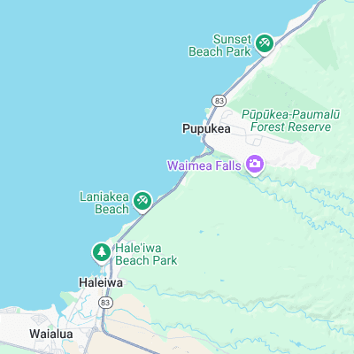
Surf spots nearby
- Leftover's (0.2 mi)
- Uppers (0.4 mi)
- Marijuana's (0.4 mi)
- Piddley's (0.6 mi)
- Chun's Reef (0.7 mi)
- Jockos Point (0.8 mi)
- Holtons (1 mi)
- Pinballs (1.1 mi)
- Waimea Bay (1.1 mi)
- Laniakea (1.1 mi)
Not Magic Seaweed (MSW)
Although we look a bit like Magic Seaweed we are not MagicSeaweed as they no longer exist...