Laniakea Surf Report
| Wave height * | 6.5ft / 2m |
|---|---|
| Swell period | 14s |
| Swell direction | |
| Wind | |
| Sea temp | 26°C / 78°F |

10 day Laniakea surf forecast
Wed
31/Dec
6.5ft
6
9
5
- High 1:44am
- Low 8:12am
- High 1:17pm
- Low 5:43pm
Thu
1/Jan
4.5ft
5
9
8
- High 2:29am
- Low 8:55am
- High 2:12pm
- Low 6:32pm
Fri
2/Jan
8ft
9
10
9
- High 3:14am
- Low 9:35am
- High 3:05pm
- Low 7:21pm
Sat
3/Jan
6ft
12
13
12
- High 3:56am
- Low 10:15am
- High 3:59pm
- Low 8:09pm
Sun
4/Jan
4.5ft
12
13
5
- High 4:38am
- Low 10:53am
- High 4:56pm
- Low 8:57pm
Mon
5/Jan
4.5ft
14
18
15
- High 5:17am
- Low 11:30am
- High 5:58pm
- Low 9:49pm
Tue
6/Jan
3.5ft
14
14
14
- High 5:53am
- Low 12:06pm
- High 7:08pm
- Low 10:48pm
Wed
7/Jan
5ft
5
9
6
- High 6:28am
- Low 12:40pm
- High 8:24pm
Thu
8/Jan
4.5ft
2
4
3
- Low 12:09am
- High 7:01am
- Low 1:13pm
- High 9:39pm
Wed 31st Dec
| 5:00 | 6.5ft | 8.5ft | 14s | 8mph (16mph) | |||
| 8:00 | 6.5ft | 8.2ft | 14s | 6mph (15mph) | |||
| 11:00 | 6.5ft | 8.1ft | 14s | 9mph (15mph) | |||
| 14:00 | 6.5ft | 7.7ft | 13s | 9mph (14mph) | |||
| 17:00 | 6ft | 7.5ft | 13s | 9mph (14mph) | |||
| 20:00 | 5.5ft | 7.4ft | 14s | 5mph (12mph) |
| Tide times |
|---|
| High 1:44am (2.09m) |
| Low 8:12am (0.10m) |
| High 1:17pm (0.41m) |
| Low 5:43pm (-0.34m) |
| Daylight | |
|---|---|
| First light | 06:46 |
| Sunrise | 07:10 |
| Sunset | 18:00 |
| Dark | 18:25 |
Thu 1st Jan
| 5:00 | 5ft | 6.6ft | 13s | 5mph (12mph) | |||
| 8:00 | 5ft | 6.3ft | 12s | 5mph (12mph) | |||
| 11:00 | 4.5ft | 6.2ft | 12s | 9mph (14mph) | |||
| 14:00 | 4.5ft | 6.2ft | 12s | 9mph (13mph) | |||
| 17:00 | 5ft | 6.5ft | 12s | 8mph (15mph) | |||
| 20:00 | 5ft | 6.8ft | 12s | 8mph (19mph) |
| Tide times |
|---|
| High 2:29am (2.16m) |
| Low 8:55am (0.03m) |
| High 2:12pm (0.42m) |
| Low 6:32pm (-0.34m) |
| Daylight | |
|---|---|
| First light | 06:46 |
| Sunrise | 07:10 |
| Sunset | 18:01 |
| Dark | 18:25 |
Fri 2nd Jan
| 5:00 | 5ft | 7.3ft | 12s | 8mph (17mph) | |||
| 8:00 | 6ft | 7.8ft | 11s | 9mph (18mph) | |||
| 11:00 | 7.5ft | 8.4ft | 9s | 12mph (19mph) | |||
| 14:00 | 8ft | 8.9ft | 9s | 10mph (17mph) | |||
| 17:00 | 8ft | 9ft | 10s | 12mph (19mph) | |||
| 20:00 | 7ft | 8.8ft | 12s | 9mph (18mph) |
| Tide times |
|---|
| High 3:14am (2.16m) |
| Low 9:35am (-0.01m) |
| High 3:05pm (0.45m) |
| Low 7:21pm (-0.29m) |
| Daylight | |
|---|---|
| First light | 06:46 |
| Sunrise | 07:10 |
| Sunset | 18:02 |
| Dark | 18:26 |
Sat 3rd Jan
| 5:00 | 6ft | 8.7ft | 12s | 10mph (20mph) | |||
| 8:00 | 6ft | 8.7ft | 12s | 12mph (19mph) | |||
| 11:00 | 6ft | 8.6ft | 12s | 13mph (17mph) | |||
| 14:00 | 6ft | 8.3ft | 12s | 13mph (15mph) | |||
| 17:00 | 5.5ft | 7.8ft | 12s | 10mph (16mph) | |||
| 20:00 | 5.5ft | 7.6ft | 12s | 12mph (20mph) |
| Tide times |
|---|
| High 3:56am (2.09m) |
| Low 10:15am (-0.02m) |
| High 3:59pm (0.50m) |
| Low 8:09pm (-0.19m) |
| Daylight | |
|---|---|
| First light | 06:47 |
| Sunrise | 07:11 |
| Sunset | 18:02 |
| Dark | 18:26 |
Sun 4th Jan
| 5:00 | 5ft | 7.2ft | 12s | 12mph (21mph) | |||
| 8:00 | 5ft | 7.1ft | 12s | 12mph (21mph) | |||
| 11:00 | 5ft | 7.1ft | 12s | 14mph (19mph) | |||
| 14:00 | 4.5ft | 7.2ft | 12s | 13mph (21mph) | |||
| 17:00 | 5ft | 7.3ft | 12s | 7mph (14mph) | |||
| 20:00 | 5ft | 7.2ft | 11s | 5mph (11mph) |
| Tide times |
|---|
| High 4:38am (1.96m) |
| Low 10:53am (-0.02m) |
| High 4:56pm (0.56m) |
| Low 8:57pm (-0.03m) |
| Daylight | |
|---|---|
| First light | 06:47 |
| Sunrise | 07:11 |
| Sunset | 18:03 |
| Dark | 18:27 |
Mon 5th Jan
| 5:00 | 4.5ft | 7.2ft | 11s | 10mph (21mph) | |||
| 8:00 | 4.5ft | 7.3ft | 11s | 14mph (23mph) | |||
| 11:00 | 4.5ft | 7.4ft | 13s | 17mph (25mph) | |||
| 14:00 | 4.5ft | 7.3ft | 11s | 18mph (26mph) | |||
| 17:00 | 2ft | 7.9ft | 9s | 15mph (24mph) | |||
| 20:00 | 2.5ft | 8.2ft | 9s | 15mph (25mph) |
| Tide times |
|---|
| High 5:17am (1.79m) |
| Low 11:30am (-0.01m) |
| High 5:58pm (0.65m) |
| Low 9:49pm (0.18m) |
| Daylight | |
|---|---|
| First light | 06:47 |
| Sunrise | 07:11 |
| Sunset | 18:04 |
| Dark | 18:28 |
Tue 6th Jan
| 5:00 | 2ft | 7.7ft | 8s | 14mph (25mph) | |||
| 8:00 | 2ft | 7.3ft | 9s | 14mph (25mph) | |||
| 11:00 | 4ft | 7ft | 12s | 15mph (24mph) | |||
| 14:00 | 3.5ft | 6.8ft | 12s | 14mph (20mph) | |||
| 17:00 | 3.5ft | 6.6ft | 12s | 13mph (21mph) | |||
| 20:00 | 3.5ft | 6.6ft | 11s | 14mph (25mph) |
| Tide times |
|---|
| High 5:53am (1.58m) |
| Low 12:06pm (-0.00m) |
| High 7:08pm (0.76m) |
| Low 10:48pm (0.40m) |
| Daylight | |
|---|---|
| First light | 06:47 |
| Sunrise | 07:11 |
| Sunset | 18:04 |
| Dark | 18:28 |
Wed 7th Jan
| 5:00 | 5.5ft | 6.1ft | 15s | 7mph (15mph) | |||
| 8:00 | 5.5ft | 5.8ft | 13s | 5mph (12mph) | |||
| 11:00 | 5ft | 5.6ft | 14s | 7mph (12mph) | |||
| 14:00 | 5ft | 5.6ft | 15s | 9mph (12mph) | |||
| 17:00 | 4.5ft | 5.4ft | 14s | 8mph (14mph) | |||
| 20:00 | 4ft | 5.3ft | 13s | 6mph (14mph) |
| Tide times |
|---|
| High 6:28am (1.34m) |
| Low 12:40pm (0.01m) |
| High 8:24pm (0.90m) |
| Daylight | |
|---|---|
| First light | 06:48 |
| Sunrise | 07:12 |
| Sunset | 18:05 |
| Dark | 18:29 |
Thu 8th Jan
| 5:00 | 4.5ft | 5.3ft | 13s | 2mph (3mph) | |||
| 8:00 | 4ft | 5.2ft | 13s | 2mph (3mph) | |||
| 11:00 | 4ft | 5.1ft | 12s | 3mph (5mph) | |||
| 14:00 | 4.5ft | 5.3ft | 12s | 4mph (5mph) | |||
| 17:00 | 4ft | 5.7ft | 12s | 3mph (4mph) | |||
| 20:00 | 4.5ft | 6ft | 12s | 3mph (3mph) |
| Tide times |
|---|
| Low 12:09am (0.60m) |
| High 7:01am (1.11m) |
| Low 1:13pm (0.02m) |
| High 9:39pm (1.07m) |
| Daylight | |
|---|---|
| First light | 06:48 |
| Sunrise | 07:12 |
| Sunset | 18:06 |
| Dark | 18:30 |
Fri 9th Jan
| 5:00 | 4.5ft | 6.2ft | 10s | 6mph (14mph) | |||
| 8:00 | 4ft | 5.8ft | 11s | 3mph (3mph) | |||
| 11:00 | 4ft | 5.4ft | 11s | 9mph (11mph) | |||
| 14:00 | 4ft | 5.2ft | 11s | 11mph (14mph) |
| Tide times |
|---|
| Low 2:11am (0.70m) |
| High 7:34am (0.88m) |
| Daylight | |
|---|---|
| First light | 06:48 |
| Sunrise | 07:12 |
| Sunset | 18:06 |
| Dark | 18:30 |
Nearest buoys
One of the best, but not so well known spots on the North Shore. Consists of a hollow right wall and a shorter, snappy left bowl. Works through a good range of sizes
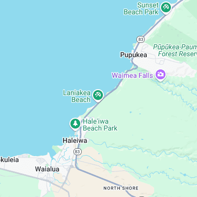
Surf spots nearby
- Holtons (0.1 mi)
- Jockos Point (0.3 mi)
- Himilayas (0.3 mi)
- Chun's Reef (0.4 mi)
- Piddley's (0.5 mi)
- Marijuana's (0.7 mi)
- Leftover's (0.9 mi)
- Alligator Rock (1.1 mi)
- Uppers (1.5 mi)
- Puaena Point (1.7 mi)
Not Magic Seaweed (MSW)
Although we look a bit like Magic Seaweed we are not MagicSeaweed as they no longer exist...