Waimea Bay Surf Report
| Wave height * | 5ft / 1.5m |
|---|---|
| Swell period | 15s |
| Swell direction | |
| Wind | |
| Sea temp | 25°C / 76°F |

10 day Waimea Bay surf forecast
Wed
28/Jan
4ft
3
4
9
- High 12:46am
- Low 7:24am
- High 12:27pm
- Low 4:46pm
Thu
29/Jan
6ft
4
6
7
- High 1:34am
- Low 7:57am
- High 1:24pm
- Low 5:42pm
Fri
30/Jan
7.5ft
6
11
13
- High 2:17am
- Low 8:28am
- High 2:14pm
- Low 6:33pm
Sat
31/Jan
7.5ft
13
14
12
- High 2:57am
- Low 8:59am
- High 3:00pm
- Low 7:22pm
Sun
1/Feb
4.5ft
5
13
11
- High 3:34am
- Low 9:28am
- High 3:46pm
- Low 8:08pm
Mon
2/Feb
4ft
9
22
20
- High 4:07am
- Low 9:57am
- High 4:34pm
- Low 8:55pm
Tue
3/Feb
9.5ft
10
12
10
- High 4:39am
- Low 10:24am
- High 5:23pm
- Low 9:45pm
Wed
4/Feb
6ft
6
9
10
- High 5:08am
- Low 10:50am
- High 6:15pm
- Low 10:42pm
Thu
5/Feb
8ft
7
7
10
- High 5:35am
- Low 11:16am
- High 7:14pm
- Low 11:57pm
Wed 28th Jan
| 5:00 | 5ft | 7.2ft | 15s | 4mph (3mph) | |||
| 8:00 | 5ft | 6.8ft | 14s | 3mph (3mph) | |||
| 11:00 | 4.5ft | 6.5ft | 14s | 3mph (3mph) | |||
| 14:00 | 4ft | 6.1ft | 14s | 4mph (5mph) | |||
| 17:00 | 4.5ft | 5.7ft | 13s | 9mph (10mph) | |||
| 20:00 | 4ft | 5.4ft | 13s | 9mph (11mph) |
| Tide times |
|---|
| High 12:46am (1.87m) |
| Low 7:24am (0.08m) |
| High 12:27pm (0.35m) |
| Low 4:46pm (-0.26m) |
| Daylight | |
|---|---|
| First light | 06:47 |
| Sunrise | 07:10 |
| Sunset | 18:19 |
| Dark | 18:42 |
Thu 29th Jan
| 5:00 | 4ft | 5.2ft | 14s | 5mph (5mph) | |||
| 8:00 | 5ft | 5.6ft | 17s | 4mph (4mph) | |||
| 11:00 | 5.5ft | 6.3ft | 16s | 1mph (3mph) | |||
| 14:00 | 6ft | 6.9ft | 16s | 6mph (8mph) | |||
| 17:00 | 6.5ft | 7.5ft | 15s | 7mph (9mph) | |||
| 20:00 | 6.5ft | 7.9ft | 15s | 7mph (9mph) |
| Tide times |
|---|
| High 1:34am (1.96m) |
| Low 7:57am (0.00m) |
| High 1:24pm (0.41m) |
| Low 5:42pm (-0.30m) |
| Daylight | |
|---|---|
| First light | 06:47 |
| Sunrise | 07:10 |
| Sunset | 18:20 |
| Dark | 18:43 |
Fri 30th Jan
| 5:00 | 7ft | 8.5ft | 14s | 6mph (7mph) | |||
| 8:00 | 7ft | 8.6ft | 14s | 6mph (7mph) | |||
| 11:00 | 7ft | 8.9ft | 14s | 11mph (9mph) | |||
| 14:00 | 7.5ft | 9.3ft | 16s | 11mph (12mph) | |||
| 17:00 | 8.5ft | 10.6ft | 17s | 13mph (14mph) | |||
| 20:00 | 9.5ft | 12ft | 17s | 13mph (14mph) |
| Tide times |
|---|
| High 2:17am (1.99m) |
| Low 8:28am (-0.04m) |
| High 2:14pm (0.51m) |
| Low 6:33pm (-0.30m) |
| Daylight | |
|---|---|
| First light | 06:47 |
| Sunrise | 07:10 |
| Sunset | 18:20 |
| Dark | 18:44 |
Sat 31st Jan
| 5:00 | 9.5ft | 11.7ft | 16s | 12mph (13mph) | |||
| 8:00 | 9ft | 11ft | 16s | 13mph (14mph) | |||
| 11:00 | 8.5ft | 10.3ft | 15s | 13mph (13mph) | |||
| 14:00 | 7.5ft | 9.6ft | 15s | 14mph (14mph) | |||
| 17:00 | 7ft | 9ft | 14s | 12mph (13mph) | |||
| 20:00 | 7ft | 8.5ft | 14s | 12mph (13mph) |
| Tide times |
|---|
| High 2:57am (1.95m) |
| Low 8:59am (-0.07m) |
| High 3:00pm (0.61m) |
| Low 7:22pm (-0.24m) |
| Daylight | |
|---|---|
| First light | 06:46 |
| Sunrise | 07:10 |
| Sunset | 18:21 |
| Dark | 18:44 |
Sun 1st Feb
| 5:00 | 5.5ft | 7ft | 13s | 7mph (8mph) | |||
| 8:00 | 5.5ft | 6.6ft | 13s | 5mph (4mph) | |||
| 11:00 | 5ft | 6.2ft | 13s | 5mph (6mph) | |||
| 14:00 | 4.5ft | 5.9ft | 12s | 13mph (15mph) | |||
| 17:00 | 4.5ft | 5.5ft | 12s | 16mph (19mph) | |||
| 20:00 | 4ft | 5.2ft | 12s | 11mph (13mph) |
| Tide times |
|---|
| High 3:34am (1.86m) |
| Low 9:28am (-0.08m) |
| High 3:46pm (0.72m) |
| Low 8:08pm (-0.14m) |
| Daylight | |
|---|---|
| First light | 06:46 |
| Sunrise | 07:09 |
| Sunset | 18:22 |
| Dark | 18:45 |
Mon 2nd Feb
| 5:00 | 3ft | 4.6ft | 11s | 9mph (13mph) | |||
| 8:00 | 3ft | 4.6ft | 11s | 9mph (13mph) | |||
| 11:00 | 3.5ft | 5ft | 11s | 16mph (21mph) | |||
| 14:00 | 4ft | 5.5ft | 11s | 22mph (26mph) | |||
| 17:00 | 4ft | 6.1ft | 11s | 22mph (28mph) | |||
| 20:00 | 4.5ft | 6.4ft | 11s | 20mph (28mph) |
| Tide times |
|---|
| High 4:07am (1.72m) |
| Low 9:57am (-0.08m) |
| High 4:34pm (0.82m) |
| Low 8:55pm (0.02m) |
| Daylight | |
|---|---|
| First light | 06:46 |
| Sunrise | 07:09 |
| Sunset | 18:22 |
| Dark | 18:45 |
Tue 3rd Feb
| 5:00 | 8.5ft | 11.1ft | 14s | 13mph (13mph) | |||
| 8:00 | 9.5ft | 12.5ft | 16s | 10mph (10mph) | |||
| 11:00 | 9.5ft | 12.8ft | 15s | 10mph (10mph) | |||
| 14:00 | 9.5ft | 12.5ft | 15s | 12mph (12mph) | |||
| 17:00 | 9ft | 12.3ft | 14s | 10mph (10mph) | |||
| 20:00 | 9ft | 11.9ft | 14s | 10mph (10mph) |
| Tide times |
|---|
| High 4:39am (1.54m) |
| Low 10:24am (-0.07m) |
| High 5:23pm (0.91m) |
| Low 9:45pm (0.20m) |
| Daylight | |
|---|---|
| First light | 06:45 |
| Sunrise | 07:08 |
| Sunset | 18:23 |
| Dark | 18:46 |
Wed 4th Feb
| 5:00 | 7.5ft | 9.7ft | 13s | 5mph (5mph) | |||
| 8:00 | 6.5ft | 9ft | 13s | 6mph (6mph) | |||
| 11:00 | 6.5ft | 8.4ft | 13s | 7mph (6mph) | |||
| 14:00 | 6ft | 8.2ft | 12s | 9mph (8mph) | |||
| 17:00 | 6.5ft | 8.8ft | 12s | 8mph (8mph) | |||
| 20:00 | 7.5ft | 10.1ft | 15s | 10mph (10mph) |
| Tide times |
|---|
| High 5:08am (1.32m) |
| Low 10:50am (-0.05m) |
| High 6:15pm (1.00m) |
| Low 10:42pm (0.38m) |
| Daylight | |
|---|---|
| First light | 06:45 |
| Sunrise | 07:08 |
| Sunset | 18:23 |
| Dark | 18:46 |
Thu 5th Feb
| 5:00 | 9ft | 11ft | 14s | 7mph (7mph) | |||
| 8:00 | 8ft | 10.5ft | 14s | 7mph (7mph) | |||
| 11:00 | 8ft | 10ft | 13s | 5mph (7mph) | |||
| 14:00 | 8ft | 9.8ft | 13s | 7mph (10mph) | |||
| 17:00 | 7ft | 9.5ft | 14s | 14mph (16mph) | |||
| 20:00 | 6.5ft | 8.9ft | 14s | 10mph (12mph) |
| Tide times |
|---|
| High 5:35am (1.09m) |
| Low 11:16am (-0.01m) |
| High 7:14pm (1.07m) |
| Low 11:57pm (0.53m) |
| Daylight | |
|---|---|
| First light | 06:45 |
| Sunrise | 07:08 |
| Sunset | 18:24 |
| Dark | 18:47 |
Fri 6th Feb
| 5:00 | 5.5ft | 7ft | 12s | 9mph (12mph) | |||
| 8:00 | 5ft | 6.5ft | 12s | 6mph (7mph) | |||
| 11:00 | 4.5ft | 6.1ft | 12s | 3mph (5mph) | |||
| 14:00 | 4.5ft | 5.8ft | 12s | 11mph (8mph) |
| Tide times |
|---|
| Daylight | |
|---|---|
| First light | 06:44 |
| Sunrise | 07:07 |
| Sunset | 18:25 |
| Dark | 18:48 |
Nearest buoys
The one time pinnacle of big wave riding. Although slightly overshadowed by tow in spots Waimea is still capable of putting on a show at 25ft+
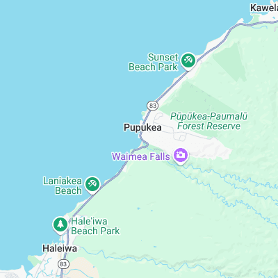
Surf spots nearby
- Pinballs (0.1 mi)
- Rubber Duckies (0.3 mi)
- Uppers (0.7 mi)
- Log Cabins (0.7 mi)
- Alligator Rock (1.1 mi)
- Off The Wall (1.1 mi)
- Leftover's (1.3 mi)
- Rockpile (1.4 mi)
- Outside Log Cabins (1.4 mi)
- Marijuana's (1.5 mi)
Not Magic Seaweed (MSW)
Although we look a bit like Magic Seaweed we are not MagicSeaweed as they no longer exist...