Rockpile Surf Report
| Wave height * | 6.5ft / 1.9m |
|---|---|
| Swell period | 14s |
| Swell direction | |
| Wind | |
| Sea temp | 25°C / 78°F |

10 day Rockpile surf forecast
Wed
31/Dec
6.5ft
20
17
18
- High 1:44am
- Low 8:12am
- High 1:17pm
- Low 5:43pm
Thu
1/Jan
4.5ft
17
21
23
- High 2:29am
- Low 8:55am
- High 2:12pm
- Low 6:32pm
Fri
2/Jan
8ft
22
22
21
- High 3:14am
- Low 9:35am
- High 3:05pm
- Low 7:21pm
Sat
3/Jan
6ft
23
20
24
- High 3:56am
- Low 10:15am
- High 3:59pm
- Low 8:09pm
Sun
4/Jan
4.5ft
24
23
13
- High 4:38am
- Low 10:53am
- High 4:56pm
- Low 8:57pm
Mon
5/Jan
4.5ft
26
27
27
- High 5:17am
- Low 11:30am
- High 5:58pm
- Low 9:49pm
Tue
6/Jan
3.5ft
26
24
26
- High 5:53am
- Low 12:06pm
- High 7:08pm
- Low 10:48pm
Wed
7/Jan
5ft
17
18
17
- High 6:28am
- Low 12:40pm
- High 8:24pm
Thu
8/Jan
4.5ft
10
4
8
- Low 12:09am
- High 7:01am
- Low 1:13pm
- High 9:39pm
Wed 31st Dec
| 5:00 | 6.5ft | 8.5ft | 14s | 20mph (22mph) | |||
| 8:00 | 6.5ft | 8.2ft | 14s | 20mph (21mph) | |||
| 11:00 | 6.5ft | 8.1ft | 14s | 19mph (20mph) | |||
| 14:00 | 6.5ft | 7.7ft | 13s | 17mph (19mph) | |||
| 17:00 | 6ft | 7.5ft | 13s | 17mph (19mph) | |||
| 20:00 | 5.5ft | 7.4ft | 14s | 18mph (20mph) |
| Tide times |
|---|
| High 1:44am (2.09m) |
| Low 8:12am (0.10m) |
| High 1:17pm (0.41m) |
| Low 5:43pm (-0.34m) |
| Daylight | |
|---|---|
| First light | 06:46 |
| Sunrise | 07:10 |
| Sunset | 18:00 |
| Dark | 18:24 |
Thu 1st Jan
| 5:00 | 5ft | 6.6ft | 13s | 17mph (19mph) | |||
| 8:00 | 5ft | 6.3ft | 12s | 17mph (19mph) | |||
| 11:00 | 4.5ft | 6.2ft | 12s | 18mph (19mph) | |||
| 14:00 | 4.5ft | 6.2ft | 12s | 21mph (23mph) | |||
| 17:00 | 5ft | 6.5ft | 12s | 25mph (26mph) | |||
| 20:00 | 5ft | 6.8ft | 12s | 23mph (25mph) |
| Tide times |
|---|
| High 2:29am (2.16m) |
| Low 8:55am (0.03m) |
| High 2:12pm (0.42m) |
| Low 6:32pm (-0.34m) |
| Daylight | |
|---|---|
| First light | 06:46 |
| Sunrise | 07:10 |
| Sunset | 18:01 |
| Dark | 18:25 |
Fri 2nd Jan
| 5:00 | 5ft | 7.3ft | 12s | 23mph (23mph) | |||
| 8:00 | 6ft | 7.8ft | 11s | 22mph (23mph) | |||
| 11:00 | 7.5ft | 8.4ft | 9s | 23mph (23mph) | |||
| 14:00 | 8ft | 8.9ft | 9s | 22mph (23mph) | |||
| 17:00 | 8ft | 9ft | 10s | 23mph (24mph) | |||
| 20:00 | 7ft | 8.8ft | 12s | 21mph (22mph) |
| Tide times |
|---|
| High 3:14am (2.16m) |
| Low 9:35am (-0.01m) |
| High 3:05pm (0.45m) |
| Low 7:21pm (-0.29m) |
| Daylight | |
|---|---|
| First light | 06:46 |
| Sunrise | 07:10 |
| Sunset | 18:01 |
| Dark | 18:26 |
Sat 3rd Jan
| 5:00 | 6ft | 8.7ft | 12s | 23mph (24mph) | |||
| 8:00 | 6ft | 8.7ft | 12s | 23mph (24mph) | |||
| 11:00 | 6ft | 8.6ft | 12s | 22mph (23mph) | |||
| 14:00 | 6ft | 8.3ft | 12s | 20mph (21mph) | |||
| 17:00 | 5.5ft | 7.8ft | 12s | 21mph (22mph) | |||
| 20:00 | 5.5ft | 7.6ft | 12s | 24mph (25mph) |
| Tide times |
|---|
| High 3:56am (2.09m) |
| Low 10:15am (-0.02m) |
| High 3:59pm (0.50m) |
| Low 8:09pm (-0.19m) |
| Daylight | |
|---|---|
| First light | 06:47 |
| Sunrise | 07:11 |
| Sunset | 18:02 |
| Dark | 18:26 |
Sun 4th Jan
| 5:00 | 5ft | 7.2ft | 12s | 23mph (25mph) | |||
| 8:00 | 5ft | 7.1ft | 12s | 24mph (25mph) | |||
| 11:00 | 5ft | 7.1ft | 12s | 23mph (25mph) | |||
| 14:00 | 4.5ft | 7.2ft | 12s | 23mph (24mph) | |||
| 17:00 | 5ft | 7.3ft | 12s | 21mph (22mph) | |||
| 20:00 | 5ft | 7.2ft | 11s | 13mph (16mph) |
| Tide times |
|---|
| High 4:38am (1.96m) |
| Low 10:53am (-0.02m) |
| High 4:56pm (0.56m) |
| Low 8:57pm (-0.03m) |
| Daylight | |
|---|---|
| First light | 06:47 |
| Sunrise | 07:11 |
| Sunset | 18:03 |
| Dark | 18:27 |
Mon 5th Jan
| 5:00 | 4.5ft | 7.2ft | 11s | 21mph (24mph) | |||
| 8:00 | 4.5ft | 7.3ft | 11s | 26mph (28mph) | |||
| 11:00 | 4.5ft | 7.4ft | 13s | 27mph (31mph) | |||
| 14:00 | 4.5ft | 7.3ft | 11s | 27mph (29mph) | |||
| 17:00 | 2ft | 7.9ft | 9s | 26mph (28mph) | |||
| 20:00 | 2.5ft | 8.2ft | 9s | 27mph (30mph) |
| Tide times |
|---|
| High 5:17am (1.79m) |
| Low 11:30am (-0.01m) |
| High 5:58pm (0.65m) |
| Low 9:49pm (0.18m) |
| Daylight | |
|---|---|
| First light | 06:47 |
| Sunrise | 07:11 |
| Sunset | 18:03 |
| Dark | 18:27 |
Tue 6th Jan
| 5:00 | 2ft | 7.7ft | 8s | 25mph (29mph) | |||
| 8:00 | 2ft | 7.3ft | 9s | 26mph (29mph) | |||
| 11:00 | 4ft | 7ft | 12s | 26mph (28mph) | |||
| 14:00 | 3.5ft | 6.8ft | 12s | 24mph (25mph) | |||
| 17:00 | 3.5ft | 6.6ft | 12s | 24mph (26mph) | |||
| 20:00 | 3.5ft | 6.6ft | 11s | 26mph (28mph) |
| Tide times |
|---|
| High 5:53am (1.58m) |
| Low 12:06pm (-0.00m) |
| High 7:08pm (0.76m) |
| Low 10:48pm (0.40m) |
| Daylight | |
|---|---|
| First light | 06:47 |
| Sunrise | 07:11 |
| Sunset | 18:04 |
| Dark | 18:28 |
Wed 7th Jan
| 5:00 | 5.5ft | 6.1ft | 15s | 19mph (21mph) | |||
| 8:00 | 5.5ft | 5.8ft | 13s | 17mph (18mph) | |||
| 11:00 | 5ft | 5.6ft | 14s | 16mph (17mph) | |||
| 14:00 | 5ft | 5.6ft | 15s | 18mph (19mph) | |||
| 17:00 | 4.5ft | 5.4ft | 14s | 19mph (20mph) | |||
| 20:00 | 4ft | 5.3ft | 13s | 17mph (18mph) |
| Tide times |
|---|
| High 6:28am (1.34m) |
| Low 12:40pm (0.01m) |
| High 8:24pm (0.90m) |
| Daylight | |
|---|---|
| First light | 06:48 |
| Sunrise | 07:12 |
| Sunset | 18:05 |
| Dark | 18:29 |
Thu 8th Jan
| 5:00 | 4.5ft | 5.3ft | 13s | 9mph (10mph) | |||
| 8:00 | 4ft | 5.2ft | 13s | 10mph (10mph) | |||
| 11:00 | 4ft | 5.1ft | 12s | 9mph (8mph) | |||
| 14:00 | 4.5ft | 5.3ft | 12s | 4mph (5mph) | |||
| 17:00 | 4ft | 5.7ft | 12s | 8mph (9mph) | |||
| 20:00 | 4.5ft | 6ft | 12s | 8mph (9mph) |
| Tide times |
|---|
| Low 12:09am (0.60m) |
| High 7:01am (1.11m) |
| Low 1:13pm (0.02m) |
| High 9:39pm (1.07m) |
| Daylight | |
|---|---|
| First light | 06:48 |
| Sunrise | 07:12 |
| Sunset | 18:05 |
| Dark | 18:29 |
Fri 9th Jan
| 5:00 | 4.5ft | 6.2ft | 10s | 16mph (19mph) | |||
| 8:00 | 4ft | 5.8ft | 11s | 5mph (5mph) | |||
| 11:00 | 4ft | 5.4ft | 11s | 15mph (17mph) | |||
| 14:00 | 4ft | 5.2ft | 11s | 22mph (21mph) |
| Tide times |
|---|
| Low 2:11am (0.70m) |
| High 7:34am (0.88m) |
| Daylight | |
|---|---|
| First light | 06:48 |
| Sunrise | 07:12 |
| Sunset | 18:06 |
| Dark | 18:30 |
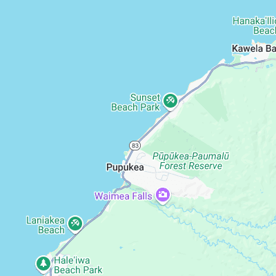
Nearest buoys
Set in directly front of the pile of rocks known as the Banzai Rocks this spot is powerful peak with the left being the longer choice.
Surf spots nearby
- Backdoor (0.3 mi)
- Outside Log Cabins (0.3 mi)
- Off The Wall (0.3 mi)
- Pipeline (0.6 mi)
- Log Cabins (0.7 mi)
- Rocky Point (0.8 mi)
- Rubber Duckies (1.1 mi)
- Pinballs (1.4 mi)
- Waimea Bay (1.4 mi)
- Sunset Beach (1.5 mi)
Not Magic Seaweed (MSW)
Although we look a bit like Magic Seaweed we are not MagicSeaweed as they no longer exist...