Off The Wall (OTW) Surf Report
| Wave height * | 4ft / 1.2m |
|---|---|
| Swell period | 12s |
| Swell direction | |
| Wind | |
| Sea temp | 25°C / 77°F |

10 day Off The Wall surf forecast
Sun
4/Jan
4ft
5
9
18
- High 4:38am
- Low 10:53am
- High 4:56pm
- Low 8:57pm
Mon
5/Jan
1.5ft
26
27
34
- High 5:17am
- Low 11:30am
- High 5:58pm
- Low 9:49pm
Tue
6/Jan
1ft
34
39
25
- High 5:53am
- Low 12:06pm
- High 7:08pm
- Low 10:48pm
Wed
7/Jan
6ft
4
8
7
- High 6:28am
- Low 12:40pm
- High 8:24pm
Thu
8/Jan
4.5ft
5
2
3
- Low 12:09am
- High 7:01am
- Low 1:13pm
- High 9:39pm
Fri
9/Jan
3ft
4
7
4
- Low 2:11am
- High 7:34am
- Low 1:46pm
- High 10:42pm
Sat
10/Jan
3.5ft
2
4
2
- Low 4:43am
- High 8:15am
- Low 2:23pm
- High 11:32pm
Sun
11/Jan
4.5ft
4
10
9
- Low 6:28am
- High 9:30am
- Low 3:03pm
Mon
12/Jan
8.5ft
20
20
26
- High 12:15am
- Low 7:11am
- High 11:00am
- Low 3:47pm
Sun 4th Jan
| 5:00 | 4ft | 6.6ft | 12s | 1mph (1mph) | |||
| 8:00 | 4ft | 6.5ft | 12s | 5mph (5mph) | |||
| 11:00 | 4ft | 6.4ft | 12s | 10mph (10mph) | |||
| 14:00 | 4ft | 6.5ft | 12s | 9mph (10mph) | |||
| 17:00 | 4ft | 6.4ft | 12s | 13mph (14mph) | |||
| 20:00 | 4ft | 6.6ft | 11s | 18mph (21mph) |
| Tide times |
|---|
| High 4:38am (1.96m) |
| Low 10:53am (-0.02m) |
| High 4:56pm (0.56m) |
| Low 8:57pm (-0.03m) |
| Daylight | |
|---|---|
| First light | 06:47 |
| Sunrise | 07:11 |
| Sunset | 18:03 |
| Dark | 18:27 |
Mon 5th Jan
| 5:00 | 3.5ft | 7.4ft | 11s | 22mph (25mph) | |||
| 8:00 | 1ft | 8.3ft | 9s | 26mph (31mph) | |||
| 11:00 | 1.5ft | 8.9ft | 9s | 28mph (34mph) | |||
| 14:00 | 1.5ft | 9.6ft | 9s | 27mph (31mph) | |||
| 17:00 | 1ft | 10.2ft | 9s | 32mph (37mph) | |||
| 20:00 | 2.5ft | 10.2ft | 9s | 34mph (40mph) |
| Tide times |
|---|
| High 5:17am (1.79m) |
| Low 11:30am (-0.01m) |
| High 5:58pm (0.65m) |
| Low 9:49pm (0.18m) |
| Daylight | |
|---|---|
| First light | 06:47 |
| Sunrise | 07:11 |
| Sunset | 18:03 |
| Dark | 18:27 |
Tue 6th Jan
| 5:00 | 2.5ft | 10.1ft | 9s | 32mph (39mph) | |||
| 8:00 | 2ft | 10.5ft | 9s | 34mph (41mph) | |||
| 11:00 | 1.5ft | 9.9ft | 9s | 36mph (42mph) | |||
| 14:00 | 1ft | 10.2ft | 9s | 39mph (44mph) | |||
| 17:00 | 1ft | 10ft | 9s | 30mph (35mph) | |||
| 20:00 | 1ft | 9.6ft | 9s | 25mph (28mph) |
| Tide times |
|---|
| High 5:53am (1.58m) |
| Low 12:06pm (-0.00m) |
| High 7:08pm (0.76m) |
| Low 10:48pm (0.40m) |
| Daylight | |
|---|---|
| First light | 06:47 |
| Sunrise | 07:11 |
| Sunset | 18:04 |
| Dark | 18:28 |
Wed 7th Jan
| 5:00 | 7ft | 8.1ft | 11s | 6mph (6mph) | |||
| 8:00 | 6.5ft | 7.8ft | 11s | 4mph (4mph) | |||
| 11:00 | 6.5ft | 7.4ft | 10s | 5mph (6mph) | |||
| 14:00 | 6ft | 7.2ft | 11s | 8mph (7mph) | |||
| 17:00 | 6ft | 7ft | 14s | 7mph (6mph) | |||
| 20:00 | 5.5ft | 6.7ft | 12s | 7mph (8mph) |
| Tide times |
|---|
| High 6:28am (1.34m) |
| Low 12:40pm (0.01m) |
| High 8:24pm (0.90m) |
| Daylight | |
|---|---|
| First light | 06:48 |
| Sunrise | 07:12 |
| Sunset | 18:05 |
| Dark | 18:29 |
Thu 8th Jan
| 5:00 | 5ft | 5.9ft | 13s | 3mph (3mph) | |||
| 8:00 | 5ft | 5.7ft | 13s | 5mph (5mph) | |||
| 11:00 | 5ft | 5.6ft | 13s | 2mph (3mph) | |||
| 14:00 | 4.5ft | 5.4ft | 12s | 2mph (2mph) | |||
| 17:00 | 4ft | 5.3ft | 12s | 3mph (3mph) | |||
| 20:00 | 4ft | 5.2ft | 12s | 3mph (3mph) |
| Tide times |
|---|
| Low 12:09am (0.60m) |
| High 7:01am (1.11m) |
| Low 1:13pm (0.02m) |
| High 9:39pm (1.07m) |
| Daylight | |
|---|---|
| First light | 06:48 |
| Sunrise | 07:12 |
| Sunset | 18:05 |
| Dark | 18:29 |
Fri 9th Jan
| 5:00 | 3.5ft | 4.7ft | 12s | 4mph (4mph) | |||
| 8:00 | 3.5ft | 4.5ft | 12s | 4mph (4mph) | |||
| 11:00 | 3.5ft | 4.4ft | 12s | 4mph (2mph) | |||
| 14:00 | 3ft | 4.3ft | 12s | 7mph (5mph) | |||
| 17:00 | 3ft | 4.2ft | 11s | 5mph (4mph) | |||
| 20:00 | 3ft | 4.1ft | 11s | 4mph (4mph) |
| Tide times |
|---|
| Low 2:11am (0.70m) |
| High 7:34am (0.88m) |
| Low 1:46pm (0.03m) |
| High 10:42pm (1.24m) |
| Daylight | |
|---|---|
| First light | 06:48 |
| Sunrise | 07:12 |
| Sunset | 18:06 |
| Dark | 18:30 |
Sat 10th Jan
| 5:00 | 3.5ft | 4.2ft | 14s | 2mph (2mph) | |||
| 8:00 | 3.5ft | 4.3ft | 17s | 2mph (2mph) | |||
| 11:00 | 3.5ft | 4.5ft | 16s | 4mph (2mph) | |||
| 14:00 | 3.5ft | 4.6ft | 16s | 4mph (3mph) | |||
| 17:00 | 4ft | 5.1ft | 16s | 3mph (2mph) | |||
| 20:00 | 4.5ft | 5.5ft | 15s | 2mph (2mph) |
| Tide times |
|---|
| Low 4:43am (0.65m) |
| High 8:15am (0.68m) |
| Low 2:23pm (0.03m) |
| High 11:32pm (1.39m) |
| Daylight | |
|---|---|
| First light | 06:48 |
| Sunrise | 07:12 |
| Sunset | 18:07 |
| Dark | 18:31 |
Sun 11th Jan
| 5:00 | 5.5ft | 6.6ft | 13s | 2mph (2mph) | |||
| 8:00 | 5ft | 6.7ft | 13s | 4mph (5mph) | |||
| 11:00 | 4.5ft | 6.8ft | 14s | 4mph (7mph) | |||
| 14:00 | 4.5ft | 6.7ft | 16s | 10mph (13mph) | |||
| 17:00 | 4.5ft | 6.5ft | 16s | 12mph (14mph) | |||
| 20:00 | 4.5ft | 6.5ft | 15s | 9mph (12mph) |
| Tide times |
|---|
| Low 6:28am (0.50m) |
| High 9:30am (0.52m) |
| Low 3:03pm (0.02m) |
| Daylight | |
|---|---|
| First light | 06:48 |
| Sunrise | 07:12 |
| Sunset | 18:07 |
| Dark | 18:31 |
Mon 12th Jan
| 5:00 | 6ft | 8.1ft | 13s | 16mph (20mph) | |||
| 8:00 | 6ft | 8.7ft | 14s | 20mph (25mph) | |||
| 11:00 | 7ft | 9.8ft | 14s | 15mph (20mph) | |||
| 14:00 | 8.5ft | 12.2ft | 14s | 20mph (23mph) | |||
| 17:00 | 10.5ft | 14.1ft | 14s | 22mph (30mph) | |||
| 20:00 | 10.5ft | 14.2ft | 15s | 26mph (32mph) |
| Tide times |
|---|
| High 12:15am (1.52m) |
| Low 7:11am (0.37m) |
| High 11:00am (0.43m) |
| Low 3:47pm (-0.01m) |
| Daylight | |
|---|---|
| First light | 06:48 |
| Sunrise | 07:12 |
| Sunset | 18:08 |
| Dark | 18:32 |
Tue 13th Jan
| 5:00 | 10.5ft | 12.8ft | 14s | 23mph (30mph) | |||
| 8:00 | 9.5ft | 12.1ft | 14s | 24mph (29mph) | |||
| 11:00 | 9ft | 11.5ft | 14s | 27mph (29mph) | |||
| 14:00 | 8.5ft | 10.9ft | 14s | 25mph (27mph) |
| Tide times |
|---|
| High 12:53am (1.62m) |
| Low 7:39am (0.28m) |
| High 12:06pm (0.40m) |
| Daylight | |
|---|---|
| First light | 06:48 |
| Sunrise | 07:12 |
| Sunset | 18:09 |
| Dark | 18:33 |
Nearest buoys
Also known as Kodak Reef because it often looks better in the mags than it actually was! Often closey right which can produce some epic, gaping barrels on the right day. There is a lesser quality left too.
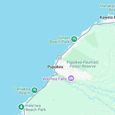
Surf spots nearby
- Outside Log Cabins (0.3 mi)
- Rockpile (0.3 mi)
- Log Cabins (0.4 mi)
- Backdoor (0.7 mi)
- Rubber Duckies (0.8 mi)
- Pipeline (0.9 mi)
- Pinballs (1.1 mi)
- Waimea Bay (1.1 mi)
- Rocky Point (1.2 mi)
- Uppers (1.8 mi)
Not Magic Seaweed (MSW)
Although we look a bit like Magic Seaweed we are not MagicSeaweed as they no longer exist...