Pinballs Surf Report
| Wave height * | 4.5ft / 1.3m |
|---|---|
| Swell period | 11s |
| Swell direction | |
| Wind | |
| Sea temp | 25°C / 78°F |

10 day Pinballs surf forecast
Fri
2/Jan
6ft
22
19
19
- High 3:14am
- Low 9:35am
- High 3:05pm
- Low 7:21pm
Sat
3/Jan
4.5ft
13
4
8
- High 3:56am
- Low 10:15am
- High 3:59pm
- Low 8:09pm
Sun
4/Jan
3.5ft
10
15
14
- High 4:38am
- Low 10:53am
- High 4:56pm
- Low 8:57pm
Mon
5/Jan
3ft
24
27
28
- High 5:17am
- Low 11:30am
- High 5:58pm
- Low 9:49pm
Tue
6/Jan
1.5ft
29
27
28
- High 5:53am
- Low 12:06pm
- High 7:08pm
- Low 10:48pm
Wed
7/Jan
7ft
26
22
19
- High 6:28am
- Low 12:40pm
- High 8:24pm
Thu
8/Jan
4.5ft
18
14
15
- Low 12:09am
- High 7:01am
- Low 1:13pm
- High 9:39pm
Fri
9/Jan
4.5ft
24
24
26
- Low 2:11am
- High 7:34am
- Low 1:46pm
- High 10:42pm
Sat
10/Jan
6ft
22
23
24
- Low 4:43am
- High 8:15am
- Low 2:23pm
- High 11:32pm
Fri 2nd Jan
| 5:00 | 6.5ft | 7.8ft | 10s | 22mph (24mph) | |||
| 8:00 | 7ft | 7.9ft | 10s | 22mph (24mph) | |||
| 11:00 | 7ft | 8ft | 11s | 21mph (23mph) | |||
| 14:00 | 6ft | 8ft | 13s | 19mph (20mph) | |||
| 17:00 | 5ft | 8ft | 13s | 20mph (21mph) | |||
| 20:00 | 5.5ft | 8.2ft | 13s | 19mph (20mph) |
| Tide times |
|---|
| High 3:14am (2.16m) |
| Low 9:35am (-0.01m) |
| High 3:05pm (0.45m) |
| Low 7:21pm (-0.29m) |
| Daylight | |
|---|---|
| First light | 06:46 |
| Sunrise | 07:10 |
| Sunset | 18:02 |
| Dark | 18:26 |
Sat 3rd Jan
| 5:00 | 4.5ft | 7.7ft | 12s | 13mph (14mph) | |||
| 8:00 | 4.5ft | 7.4ft | 12s | 13mph (13mph) | |||
| 11:00 | 4.5ft | 7.2ft | 12s | 12mph (12mph) | |||
| 14:00 | 4.5ft | 7ft | 12s | 4mph (6mph) | |||
| 17:00 | 4.5ft | 6.8ft | 12s | 7mph (8mph) | |||
| 20:00 | 4.5ft | 6.7ft | 12s | 8mph (9mph) |
| Tide times |
|---|
| High 3:56am (2.09m) |
| Low 10:15am (-0.02m) |
| High 3:59pm (0.50m) |
| Low 8:09pm (-0.19m) |
| Daylight | |
|---|---|
| First light | 06:47 |
| Sunrise | 07:11 |
| Sunset | 18:02 |
| Dark | 18:26 |
Sun 4th Jan
| 5:00 | 3.5ft | 6.3ft | 12s | 9mph (12mph) | |||
| 8:00 | 3.5ft | 6.3ft | 12s | 10mph (13mph) | |||
| 11:00 | 3.5ft | 6.2ft | 12s | 12mph (15mph) | |||
| 14:00 | 3.5ft | 6.1ft | 12s | 15mph (19mph) | |||
| 17:00 | 3.5ft | 6.1ft | 11s | 19mph (25mph) | |||
| 20:00 | 4ft | 6.4ft | 11s | 14mph (22mph) |
| Tide times |
|---|
| High 4:38am (1.96m) |
| Low 10:53am (-0.02m) |
| High 4:56pm (0.56m) |
| Low 8:57pm (-0.03m) |
| Daylight | |
|---|---|
| First light | 06:47 |
| Sunrise | 07:11 |
| Sunset | 18:03 |
| Dark | 18:27 |
Mon 5th Jan
| 5:00 | 3.5ft | 7ft | 11s | 10mph (13mph) | |||
| 8:00 | 3.5ft | 7.3ft | 11s | 24mph (26mph) | |||
| 11:00 | 3ft | 8.5ft | 11s | 26mph (30mph) | |||
| 14:00 | 3ft | 9.4ft | 10s | 27mph (32mph) | |||
| 17:00 | 1.5ft | 9.3ft | 10s | 29mph (34mph) | |||
| 20:00 | 2ft | 9ft | 10s | 28mph (35mph) |
| Tide times |
|---|
| High 5:17am (1.79m) |
| Low 11:30am (-0.01m) |
| High 5:58pm (0.65m) |
| Low 9:49pm (0.18m) |
| Daylight | |
|---|---|
| First light | 06:47 |
| Sunrise | 07:11 |
| Sunset | 18:04 |
| Dark | 18:28 |
Tue 6th Jan
| 5:00 | 2ft | 10.4ft | 9s | 32mph (38mph) | |||
| 8:00 | 2ft | 10.5ft | 9s | 29mph (35mph) | |||
| 11:00 | 2ft | 10.3ft | 9s | 28mph (33mph) | |||
| 14:00 | 1.5ft | 10.1ft | 9s | 27mph (32mph) | |||
| 17:00 | 1.5ft | 9.9ft | 9s | 26mph (30mph) | |||
| 20:00 | 1.5ft | 9.5ft | 9s | 28mph (32mph) |
| Tide times |
|---|
| High 5:53am (1.58m) |
| Low 12:06pm (-0.00m) |
| High 7:08pm (0.76m) |
| Low 10:48pm (0.40m) |
| Daylight | |
|---|---|
| First light | 06:47 |
| Sunrise | 07:11 |
| Sunset | 18:04 |
| Dark | 18:28 |
Wed 7th Jan
| 5:00 | 8ft | 9.2ft | 10s | 26mph (30mph) | |||
| 8:00 | 7.5ft | 8.8ft | 10s | 26mph (30mph) | |||
| 11:00 | 7.5ft | 8.6ft | 9s | 25mph (28mph) | |||
| 14:00 | 7ft | 8.3ft | 9s | 22mph (24mph) | |||
| 17:00 | 6ft | 7.9ft | 13s | 20mph (21mph) | |||
| 20:00 | 5.5ft | 7.4ft | 14s | 19mph (21mph) |
| Tide times |
|---|
| High 6:28am (1.34m) |
| Low 12:40pm (0.01m) |
| High 8:24pm (0.90m) |
| Daylight | |
|---|---|
| First light | 06:48 |
| Sunrise | 07:12 |
| Sunset | 18:05 |
| Dark | 18:29 |
Thu 8th Jan
| 5:00 | 5ft | 6.5ft | 14s | 18mph (20mph) | |||
| 8:00 | 4.5ft | 6.3ft | 14s | 18mph (19mph) | |||
| 11:00 | 4.5ft | 6.1ft | 14s | 16mph (17mph) | |||
| 14:00 | 4.5ft | 5.7ft | 14s | 14mph (15mph) | |||
| 17:00 | 4.5ft | 5.5ft | 13s | 13mph (15mph) | |||
| 20:00 | 4.5ft | 5.4ft | 13s | 15mph (17mph) |
| Tide times |
|---|
| Low 12:09am (0.60m) |
| High 7:01am (1.11m) |
| Low 1:13pm (0.02m) |
| High 9:39pm (1.07m) |
| Daylight | |
|---|---|
| First light | 06:48 |
| Sunrise | 07:12 |
| Sunset | 18:06 |
| Dark | 18:29 |
Fri 9th Jan
| 5:00 | 4.5ft | 5.4ft | 12s | 20mph (22mph) | |||
| 8:00 | 4.5ft | 5.5ft | 12s | 24mph (27mph) | |||
| 11:00 | 4.5ft | 5.6ft | 12s | 24mph (28mph) | |||
| 14:00 | 4.5ft | 5.7ft | 12s | 24mph (27mph) | |||
| 17:00 | 4.5ft | 5.6ft | 12s | 24mph (28mph) | |||
| 20:00 | 4.5ft | 5.6ft | 12s | 26mph (33mph) |
| Tide times |
|---|
| Low 2:11am (0.70m) |
| High 7:34am (0.88m) |
| Low 1:46pm (0.03m) |
| High 10:42pm (1.24m) |
| Daylight | |
|---|---|
| First light | 06:48 |
| Sunrise | 07:12 |
| Sunset | 18:06 |
| Dark | 18:30 |
Sat 10th Jan
| 5:00 | 4.5ft | 6.6ft | 13s | 22mph (26mph) | |||
| 8:00 | 5.5ft | 7ft | 13s | 22mph (26mph) | |||
| 11:00 | 5.5ft | 7.4ft | 12s | 23mph (27mph) | |||
| 14:00 | 6ft | 8.3ft | 18s | 23mph (26mph) | |||
| 17:00 | 6.5ft | 9ft | 17s | 22mph (25mph) | |||
| 20:00 | 6.5ft | 9.3ft | 16s | 24mph (28mph) |
| Tide times |
|---|
| Low 4:43am (0.65m) |
| High 8:15am (0.68m) |
| Low 2:23pm (0.03m) |
| High 11:32pm (1.39m) |
| Daylight | |
|---|---|
| First light | 06:48 |
| Sunrise | 07:12 |
| Sunset | 18:07 |
| Dark | 18:31 |
Sun 11th Jan
| 5:00 | 6.5ft | 8.5ft | 15s | 21mph (25mph) | |||
| 8:00 | 6ft | 8.2ft | 14s | 22mph (26mph) | |||
| 11:00 | 6ft | 7.9ft | 14s | 23mph (27mph) | |||
| 14:00 | 5.5ft | 7.7ft | 14s | 21mph (23mph) |
| Tide times |
|---|
| Low 6:28am (0.50m) |
| High 9:30am (0.52m) |
| Daylight | |
|---|---|
| First light | 06:48 |
| Sunrise | 07:12 |
| Sunset | 18:08 |
| Dark | 18:31 |
Nearest buoys
Right hand point break on the inside of Waimea Bay. Often works when the rest of the north shore is blown out. Steep take off and sometimes bumpy and backwashy
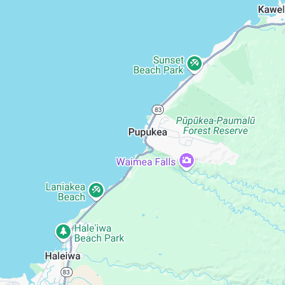
Surf spots nearby
- Waimea Bay (0.1 mi)
- Rubber Duckies (0.3 mi)
- Log Cabins (0.7 mi)
- Uppers (0.7 mi)
- Alligator Rock (1.1 mi)
- Off The Wall (1.1 mi)
- Leftover's (1.3 mi)
- Outside Log Cabins (1.4 mi)
- Rockpile (1.4 mi)
- Marijuana's (1.5 mi)
Not Magic Seaweed (MSW)
Although we look a bit like Magic Seaweed we are not MagicSeaweed as they no longer exist...