Backdoor Surf Report
| Wave height * | 6.5ft / 2m |
|---|---|
| Swell period | 15s |
| Swell direction | |
| Wind | |
| Sea temp | 25°C / 78°F |

10 day Backdoor surf forecast
Tue
30/Dec
6.5ft
15
19
16
- High 12:58am
- Low 7:24am
- High 12:11pm
- Low 4:53pm
Wed
31/Dec
6ft
18
15
15
- High 1:44am
- Low 8:12am
- High 1:17pm
- Low 5:43pm
Thu
1/Jan
5ft
18
16
19
- High 2:29am
- Low 8:55am
- High 2:12pm
- Low 6:32pm
Fri
2/Jan
7.5ft
26
23
24
- High 3:14am
- Low 9:35am
- High 3:05pm
- Low 7:21pm
Sat
3/Jan
6.5ft
22
22
22
- High 3:56am
- Low 10:15am
- High 3:59pm
- Low 8:09pm
Sun
4/Jan
2.5ft
21
23
23
- High 4:38am
- Low 10:53am
- High 4:56pm
- Low 8:57pm
Mon
5/Jan
3ft
24
25
23
- High 5:17am
- Low 11:30am
- High 5:58pm
- Low 9:49pm
Tue
6/Jan
2.5ft
23
18
19
- High 5:53am
- Low 12:06pm
- High 7:08pm
- Low 10:48pm
Wed
7/Jan
5ft
16
14
13
- High 6:28am
- Low 12:40pm
- High 8:24pm
Tue 30th Dec
| 5:00 | 6.5ft | 8ft | 14s | 16mph (19mph) | |||
| 8:00 | 6.5ft | 7.9ft | 14s | 15mph (17mph) | |||
| 11:00 | 6.5ft | 8ft | 14s | 19mph (23mph) | |||
| 14:00 | 6.5ft | 8.1ft | 14s | 19mph (20mph) | |||
| 17:00 | 7ft | 8.3ft | 14s | 17mph (19mph) | |||
| 20:00 | 7ft | 8.4ft | 16s | 16mph (19mph) |
| Tide times |
|---|
| High 12:58am (1.96m) |
| Low 7:24am (0.23m) |
| High 12:11pm (0.46m) |
| Low 4:53pm (-0.30m) |
| Daylight | |
|---|---|
| First light | 06:45 |
| Sunrise | 07:10 |
| Sunset | 18:00 |
| Dark | 18:24 |
Wed 31st Dec
| 5:00 | 6.5ft | 8.4ft | 14s | 18mph (20mph) | |||
| 8:00 | 6ft | 8.2ft | 14s | 18mph (20mph) | |||
| 11:00 | 6.5ft | 7.8ft | 14s | 17mph (19mph) | |||
| 14:00 | 6ft | 7.5ft | 13s | 15mph (16mph) | |||
| 17:00 | 5.5ft | 7.3ft | 13s | 14mph (15mph) | |||
| 20:00 | 5.5ft | 7.2ft | 14s | 15mph (17mph) |
| Tide times |
|---|
| High 1:44am (2.09m) |
| Low 8:12am (0.10m) |
| High 1:17pm (0.41m) |
| Low 5:43pm (-0.34m) |
| Daylight | |
|---|---|
| First light | 06:46 |
| Sunrise | 07:10 |
| Sunset | 18:00 |
| Dark | 18:24 |
Thu 1st Jan
| 5:00 | 5ft | 6.8ft | 13s | 16mph (19mph) | |||
| 8:00 | 5ft | 6.6ft | 12s | 18mph (20mph) | |||
| 11:00 | 5ft | 6.5ft | 12s | 18mph (20mph) | |||
| 14:00 | 5ft | 6.4ft | 12s | 16mph (17mph) | |||
| 17:00 | 5ft | 6.4ft | 12s | 17mph (19mph) | |||
| 20:00 | 5ft | 6.3ft | 12s | 19mph (21mph) |
| Tide times |
|---|
| High 2:29am (2.16m) |
| Low 8:55am (0.03m) |
| High 2:12pm (0.42m) |
| Low 6:32pm (-0.34m) |
| Daylight | |
|---|---|
| First light | 06:46 |
| Sunrise | 07:10 |
| Sunset | 18:01 |
| Dark | 18:25 |
Fri 2nd Jan
| 5:00 | 5.5ft | 7ft | 13s | 22mph (25mph) | |||
| 8:00 | 5ft | 7.2ft | 12s | 26mph (30mph) | |||
| 11:00 | 6.5ft | 7.5ft | 11s | 25mph (28mph) | |||
| 14:00 | 7.5ft | 8.1ft | 10s | 23mph (26mph) | |||
| 17:00 | 8ft | 8.7ft | 10s | 24mph (27mph) | |||
| 20:00 | 8ft | 9.1ft | 9s | 24mph (26mph) |
| Tide times |
|---|
| High 3:14am (2.16m) |
| Low 9:35am (-0.01m) |
| High 3:05pm (0.45m) |
| Low 7:21pm (-0.29m) |
| Daylight | |
|---|---|
| First light | 06:46 |
| Sunrise | 07:10 |
| Sunset | 18:01 |
| Dark | 18:26 |
Sat 3rd Jan
| 5:00 | 7ft | 9ft | 9s | 23mph (24mph) | |||
| 8:00 | 7ft | 8.9ft | 9s | 22mph (23mph) | |||
| 11:00 | 6.5ft | 8.8ft | 9s | 24mph (25mph) | |||
| 14:00 | 6.5ft | 8.6ft | 9s | 22mph (23mph) | |||
| 17:00 | 6.5ft | 8.5ft | 9s | 21mph (22mph) | |||
| 20:00 | 6.5ft | 8.4ft | 9s | 22mph (23mph) |
| Tide times |
|---|
| High 3:56am (2.09m) |
| Low 10:15am (-0.02m) |
| High 3:59pm (0.50m) |
| Low 8:09pm (-0.19m) |
| Daylight | |
|---|---|
| First light | 06:47 |
| Sunrise | 07:11 |
| Sunset | 18:02 |
| Dark | 18:26 |
Sun 4th Jan
| 5:00 | 6ft | 8.3ft | 9s | 23mph (25mph) | |||
| 8:00 | 6ft | 8.2ft | 9s | 21mph (22mph) | |||
| 11:00 | 6ft | 8.3ft | 9s | 23mph (26mph) | |||
| 14:00 | 2.5ft | 8.1ft | 9s | 23mph (24mph) | |||
| 17:00 | 2.5ft | 7.8ft | 9s | 23mph (26mph) | |||
| 20:00 | 2ft | 7.7ft | 9s | 23mph (25mph) |
| Tide times |
|---|
| High 4:38am (1.96m) |
| Low 10:53am (-0.02m) |
| High 4:56pm (0.56m) |
| Low 8:57pm (-0.03m) |
| Daylight | |
|---|---|
| First light | 06:47 |
| Sunrise | 07:11 |
| Sunset | 18:03 |
| Dark | 18:27 |
Mon 5th Jan
| 5:00 | 2ft | 7.6ft | 8s | 24mph (28mph) | |||
| 8:00 | 2ft | 7.5ft | 8s | 24mph (28mph) | |||
| 11:00 | 2ft | 7.6ft | 8s | 26mph (29mph) | |||
| 14:00 | 3ft | 8.1ft | 8s | 25mph (27mph) | |||
| 17:00 | 2.5ft | 8ft | 8s | 24mph (27mph) | |||
| 20:00 | 2ft | 7.2ft | 8s | 23mph (25mph) |
| Tide times |
|---|
| High 5:17am (1.79m) |
| Low 11:30am (-0.01m) |
| High 5:58pm (0.65m) |
| Low 9:49pm (0.18m) |
| Daylight | |
|---|---|
| First light | 06:47 |
| Sunrise | 07:11 |
| Sunset | 18:03 |
| Dark | 18:27 |
Tue 6th Jan
| 5:00 | 2ft | 6.3ft | 8s | 21mph (24mph) | |||
| 8:00 | 1.5ft | 6ft | 8s | 23mph (24mph) | |||
| 11:00 | 2ft | 6ft | 8s | 21mph (23mph) | |||
| 14:00 | 2.5ft | 6ft | 8s | 18mph (19mph) | |||
| 17:00 | 2ft | 6.4ft | 8s | 18mph (19mph) | |||
| 20:00 | 2.5ft | 6.7ft | 8s | 19mph (20mph) |
| Tide times |
|---|
| High 5:53am (1.58m) |
| Low 12:06pm (-0.00m) |
| High 7:08pm (0.76m) |
| Low 10:48pm (0.40m) |
| Daylight | |
|---|---|
| First light | 06:47 |
| Sunrise | 07:11 |
| Sunset | 18:04 |
| Dark | 18:28 |
Wed 7th Jan
| 5:00 | 5.5ft | 6ft | 16s | 14mph (16mph) | |||
| 8:00 | 5.5ft | 5.9ft | 15s | 16mph (17mph) | |||
| 11:00 | 5.5ft | 5.8ft | 16s | 15mph (16mph) | |||
| 14:00 | 5ft | 5.6ft | 16s | 14mph (16mph) | |||
| 17:00 | 5ft | 5.6ft | 15s | 13mph (15mph) | |||
| 20:00 | 5ft | 5.7ft | 15s | 13mph (14mph) |
| Tide times |
|---|
| High 6:28am (1.34m) |
| Low 12:40pm (0.01m) |
| High 8:24pm (0.90m) |
| Daylight | |
|---|---|
| First light | 06:48 |
| Sunrise | 07:12 |
| Sunset | 18:05 |
| Dark | 18:29 |
Thu 8th Jan
| 5:00 | 5ft | 5.5ft | 14s | 15mph (17mph) | |||
| 8:00 | 5ft | 5.6ft | 13s | 18mph (20mph) | |||
| 11:00 | 5ft | 5.6ft | 13s | 16mph (18mph) | |||
| 14:00 | 5.5ft | 5.9ft | 19s | 18mph (20mph) |
| Tide times |
|---|
| Low 12:09am (0.60m) |
| High 7:01am (1.11m) |
| Daylight | |
|---|---|
| First light | 06:48 |
| Sunrise | 07:12 |
| Sunset | 18:05 |
| Dark | 18:29 |
Nearest buoys
The right off the peak at Pipeline. Backdoor is doesn't hold as big a swell as Pipe but it is just as heavy and the reef is a whole lot gnarlier
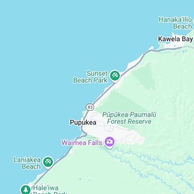
Surf spots nearby
- Pipeline (0.3 mi)
- Rockpile (0.3 mi)
- Outside Log Cabins (0.5 mi)
- Rocky Point (0.5 mi)
- Off The Wall (0.7 mi)
- Log Cabins (1 mi)
- Sunset Beach (1.2 mi)
- Rubber Duckies (1.4 mi)
- Pinballs (1.7 mi)
- Waimea Bay (1.7 mi)
Not Magic Seaweed (MSW)
Although we look a bit like Magic Seaweed we are not MagicSeaweed as they no longer exist...