Sunset Beach Surf Report
| Wave height * | 4.5ft / 1.4m |
|---|---|
| Swell period | 13s |
| Swell direction | |
| Wind | |
| Sea temp | 26°C / 78°F |

10 day Sunset Beach surf forecast
Sat
29/Nov
7.5ft
5
6
10
- Low 4:58am
- High 10:01am
- Low 4:34pm
- High 11:47pm
Sun
30/Nov
10.5ft
10
12
6
- Low 6:16am
- High 10:53am
- Low 5:06pm
Mon
1/Dec
6.5ft
8
10
11
- High 12:30am
- Low 7:23am
- High 11:45am
- Low 5:41pm
Tue
2/Dec
4.5ft
4
9
5
- High 1:14am
- Low 8:25am
- High 12:37pm
- Low 6:19pm
Wed
3/Dec
5ft
2
6
11
- High 1:59am
- Low 9:24am
- High 1:29pm
- Low 6:59pm
Thu
4/Dec
6ft
9
15
16
- High 2:45am
- Low 10:21am
- High 2:23pm
- Low 7:42pm
Fri
5/Dec
6ft
25
20
23
- High 3:33am
- Low 11:16am
- High 3:23pm
- Low 8:27pm
Sat
6/Dec
5.5ft
20
17
21
- High 4:21am
- Low 12:10pm
- High 4:31pm
- Low 9:16pm
Sun
7/Dec
5.5ft
18
16
19
- High 5:09am
- Low 1:00pm
- High 5:53pm
- Low 10:10pm
Sat 29th Nov
| 5:00 | 4ft | 5.1ft | 12s | 3mph (2mph) | |||
| 8:00 | 3.5ft | 5ft | 12s | 5mph (6mph) | |||
| 11:00 | 5ft | 5.7ft | 21s | 3mph (2mph) | |||
| 14:00 | 7.5ft | 8.5ft | 20s | 6mph (4mph) | |||
| 17:00 | 9.5ft | 10.9ft | 19s | 8mph (7mph) | |||
| 20:00 | 10.5ft | 12.2ft | 18s | 10mph (10mph) |
| Tide times |
|---|
| Low 4:58am (0.81m) |
| High 10:01am (1.41m) |
| Low 4:34pm (-0.00m) |
| High 11:47pm (2.08m) |
| Daylight | |
|---|---|
| First light | 06:29 |
| Sunrise | 06:52 |
| Sunset | 17:48 |
| Dark | 18:12 |
Sun 30th Nov
| 5:00 | 11ft | 12.9ft | 17s | 11mph (12mph) | |||
| 8:00 | 11ft | 12.9ft | 17s | 10mph (11mph) | |||
| 11:00 | 10.5ft | 12.5ft | 17s | 10mph (10mph) | |||
| 14:00 | 10.5ft | 12.1ft | 16s | 12mph (12mph) | |||
| 17:00 | 10ft | 11.9ft | 16s | 10mph (10mph) | |||
| 20:00 | 9ft | 11.4ft | 16s | 6mph (6mph) |
| Tide times |
|---|
| Low 6:16am (0.68m) |
| High 10:53am (1.21m) |
| Low 5:06pm (-0.10m) |
| Daylight | |
|---|---|
| First light | 06:29 |
| Sunrise | 06:53 |
| Sunset | 17:48 |
| Dark | 18:12 |
Mon 1st Dec
| 5:00 | 8ft | 9.9ft | 15s | 9mph (10mph) | |||
| 8:00 | 7.5ft | 9.4ft | 15s | 8mph (9mph) | |||
| 11:00 | 7ft | 8.8ft | 15s | 8mph (9mph) | |||
| 14:00 | 6.5ft | 8.3ft | 14s | 10mph (10mph) | |||
| 17:00 | 6ft | 7.8ft | 14s | 11mph (11mph) | |||
| 20:00 | 5.5ft | 7.2ft | 14s | 11mph (12mph) |
| Tide times |
|---|
| High 12:30am (2.39m) |
| Low 7:23am (0.54m) |
| High 11:45am (1.02m) |
| Low 5:41pm (-0.17m) |
| Daylight | |
|---|---|
| First light | 06:30 |
| Sunrise | 06:54 |
| Sunset | 17:48 |
| Dark | 18:12 |
Tue 2nd Dec
| 5:00 | 5ft | 6.5ft | 14s | 5mph (5mph) | |||
| 8:00 | 5ft | 6.6ft | 13s | 4mph (4mph) | |||
| 11:00 | 5ft | 6.5ft | 13s | 6mph (6mph) | |||
| 14:00 | 4.5ft | 6.3ft | 13s | 9mph (7mph) | |||
| 17:00 | 4.5ft | 5.9ft | 13s | 6mph (5mph) | |||
| 20:00 | 4ft | 5.6ft | 12s | 5mph (5mph) |
| Tide times |
|---|
| High 1:14am (2.64m) |
| Low 8:25am (0.42m) |
| High 12:37pm (0.87m) |
| Low 6:19pm (-0.21m) |
| Daylight | |
|---|---|
| First light | 06:30 |
| Sunrise | 06:54 |
| Sunset | 17:48 |
| Dark | 18:12 |
Wed 3rd Dec
| 5:00 | 4ft | 5.5ft | 12s | 3mph (2mph) | |||
| 8:00 | 4ft | 5.6ft | 12s | 2mph (1mph) | |||
| 11:00 | 4.5ft | 5.8ft | 12s | 4mph (3mph) | |||
| 14:00 | 5ft | 6.1ft | 12s | 6mph (6mph) | |||
| 17:00 | 5ft | 6.2ft | 12s | 7mph (7mph) | |||
| 20:00 | 5ft | 6.4ft | 12s | 11mph (12mph) |
| Tide times |
|---|
| High 1:59am (2.80m) |
| Low 9:24am (0.34m) |
| High 1:29pm (0.75m) |
| Low 6:59pm (-0.21m) |
| Daylight | |
|---|---|
| First light | 06:31 |
| Sunrise | 06:55 |
| Sunset | 17:48 |
| Dark | 18:12 |
Thu 4th Dec
| 5:00 | 6ft | 7.2ft | 12s | 11mph (13mph) | |||
| 8:00 | 6ft | 7.5ft | 13s | 9mph (11mph) | |||
| 11:00 | 6ft | 7.5ft | 13s | 16mph (17mph) | |||
| 14:00 | 6ft | 7.5ft | 13s | 15mph (16mph) | |||
| 17:00 | 6ft | 7.4ft | 13s | 14mph (15mph) | |||
| 20:00 | 6ft | 7.3ft | 13s | 16mph (19mph) |
| Tide times |
|---|
| High 2:45am (2.86m) |
| Low 10:21am (0.29m) |
| High 2:23pm (0.67m) |
| Low 7:42pm (-0.15m) |
| Daylight | |
|---|---|
| First light | 06:32 |
| Sunrise | 06:56 |
| Sunset | 17:49 |
| Dark | 18:13 |
Fri 5th Dec
| 5:00 | 5.5ft | 7.3ft | 13s | 25mph (29mph) | |||
| 8:00 | 6ft | 7.7ft | 13s | 25mph (31mph) | |||
| 11:00 | 6ft | 8ft | 13s | 24mph (28mph) | |||
| 14:00 | 6ft | 8ft | 13s | 20mph (22mph) | |||
| 17:00 | 6ft | 8ft | 13s | 23mph (26mph) | |||
| 20:00 | 6ft | 8.2ft | 13s | 23mph (26mph) |
| Tide times |
|---|
| High 3:33am (2.83m) |
| Low 11:16am (0.26m) |
| High 3:23pm (0.63m) |
| Low 8:27pm (-0.02m) |
| Daylight | |
|---|---|
| First light | 06:32 |
| Sunrise | 06:56 |
| Sunset | 17:49 |
| Dark | 18:13 |
Sat 6th Dec
| 5:00 | 6ft | 8.1ft | 13s | 22mph (26mph) | |||
| 8:00 | 6.5ft | 8.4ft | 13s | 20mph (24mph) | |||
| 11:00 | 5.5ft | 8.1ft | 13s | 20mph (21mph) | |||
| 14:00 | 5.5ft | 7.6ft | 13s | 17mph (17mph) | |||
| 17:00 | 5ft | 7.3ft | 13s | 16mph (18mph) | |||
| 20:00 | 5ft | 7.1ft | 13s | 21mph (24mph) |
| Tide times |
|---|
| High 4:21am (2.71m) |
| Low 12:10pm (0.25m) |
| High 4:31pm (0.63m) |
| Low 9:16pm (0.16m) |
| Daylight | |
|---|---|
| First light | 06:33 |
| Sunrise | 06:57 |
| Sunset | 17:49 |
| Dark | 18:13 |
Sun 7th Dec
| 5:00 | 5ft | 7.1ft | 11s | 17mph (20mph) | |||
| 8:00 | 5ft | 6.9ft | 9s | 18mph (22mph) | |||
| 11:00 | 5ft | 7.1ft | 9s | 16mph (19mph) | |||
| 14:00 | 5.5ft | 7.6ft | 9s | 16mph (18mph) | |||
| 17:00 | 6.5ft | 7.6ft | 9s | 17mph (20mph) | |||
| 20:00 | 6ft | 7.2ft | 9s | 19mph (23mph) |
| Tide times |
|---|
| High 5:09am (2.52m) |
| Low 1:00pm (0.24m) |
| High 5:53pm (0.69m) |
| Low 10:10pm (0.38m) |
| Daylight | |
|---|---|
| First light | 06:34 |
| Sunrise | 06:58 |
| Sunset | 17:49 |
| Dark | 18:13 |
Mon 8th Dec
| 5:00 | 5.5ft | 6.2ft | 12s | 18mph (21mph) | |||
| 8:00 | 5ft | 6.3ft | 15s | 20mph (24mph) | |||
| 11:00 | 5ft | 6.4ft | 15s | 21mph (25mph) | |||
| 14:00 | 5ft | 6.3ft | 15s | 21mph (24mph) |
| Tide times |
|---|
| Daylight | |
|---|---|
| First light | 06:34 |
| Sunrise | 06:58 |
| Sunset | 17:49 |
| Dark | 18:13 |
Nearest buoys
Legendary very powerful right-hander offering big drops on the main peak leading into a top-bottom inside barrel section. Occasional lefts
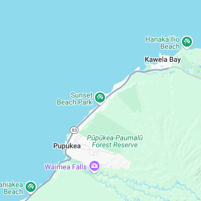
Surf spots nearby
- Rocky Point (0.6 mi)
- Velzyland (0.8 mi)
- Pipeline (0.9 mi)
- Backdoor (1.2 mi)
- Rockpile (1.5 mi)
- Outside Log Cabins (1.7 mi)
- Off The Wall (1.8 mi)
- Log Cabins (2.2 mi)
- Rubber Duckies (2.5 mi)
- Waimea Bay (2.8 mi)
Not Magic Seaweed (MSW)
Although we look a bit like Magic Seaweed we are not MagicSeaweed as they no longer exist...