Porthcurno Surf Report
| Wave height * | 1.5ft / 0.5m |
|---|---|
| Swell period | 15s |
| Swell direction | |
| Wind | |
| Sea temp | 11°C / 52°F |

10 day Porthcurno surf forecast
Thu
1/Jan
1.5ft
13
14
21
- High 2:16am
- Low 8:58am
- High 2:47pm
- Low 9:25pm
Fri
2/Jan
0ft
20
25
23
- High 3:15am
- Low 9:59am
- High 3:43pm
- Low 10:23pm
Sat
3/Jan
0ft
26
24
21
- High 4:08am
- Low 10:56am
- High 4:34pm
- Low 11:16pm
Sun
4/Jan
0ft
19
12
17
- High 4:57am
- Low 11:48am
- High 5:22pm
Mon
5/Jan
1ft
13
16
19
- Low 12:06am
- High 5:43am
- Low 12:37pm
- High 6:08pm
Tue
6/Jan
1ft
12
16
8
- Low 12:53am
- High 6:28am
- Low 1:23pm
- High 6:52pm
Wed
7/Jan
2ft
8
20
24
- Low 1:37am
- High 7:11am
- Low 2:07pm
- High 7:35pm
Thu
8/Jan
4ft
17
37
23
- Low 2:18am
- High 7:53am
- Low 2:48pm
- High 8:17pm
Fri
9/Jan
7.5ft
26
18
7
- Low 2:58am
- High 8:35am
- Low 3:28pm
- High 8:59pm
Sat
10/Jan
3.5ft
20
15
13
- Low 3:39am
- High 9:19am
- Low 4:11pm
Thu 1st Jan
| 3:00 | 1ft | 2.7ft | 12s | 3mph (5mph) | |||
| 6:00 | 1.5ft | 2.7ft | 12s | 13mph (15mph) | |||
| 9:00 | 1.5ft | 3ft | 11s | 17mph (18mph) | |||
| 12:00 | 1.5ft | 3.4ft | 15s | 14mph (15mph) | |||
| 15:00 | 1.5ft | 3.4ft | 15s | 16mph (18mph) | |||
| 18:00 | 0ft | 4.1ft | 10s | 21mph (22mph) | |||
| 21:00 | 0ft | 4.5ft | 11s | 17mph (17mph) |
| Tide times |
|---|
| High 2:16am (4.94m) |
| Low 8:58am (1.42m) |
| High 2:47pm (5.04m) |
| Low 9:25pm (1.31m) |
| Daylight | |
|---|---|
| First light | 07:43 |
| Sunrise | 08:21 |
| Sunset | 16:31 |
| Dark | 17:09 |
Fri 2nd Jan
| 3:00 | 2ft | 4ft | 13s | 17mph (19mph) | |||
| 6:00 | 0ft | 4.1ft | 12s | 20mph (23mph) | |||
| 9:00 | 0ft | 4.5ft | 11s | 22mph (24mph) | |||
| 12:00 | 0ft | 5.2ft | 7s | 25mph (25mph) | |||
| 15:00 | 0ft | 5.9ft | 7s | 26mph (27mph) | |||
| 18:00 | 0ft | 5.7ft | 7s | 23mph (24mph) | |||
| 21:00 | 0ft | 5.4ft | 7s | 20mph (20mph) |
| Tide times |
|---|
| High 3:15am (5.22m) |
| Low 9:59am (1.16m) |
| High 3:43pm (5.24m) |
| Low 10:23pm (1.11m) |
| Daylight | |
|---|---|
| First light | 07:43 |
| Sunrise | 08:21 |
| Sunset | 16:32 |
| Dark | 17:10 |
Sat 3rd Jan
| 3:00 | 0ft | 5.7ft | 7s | 23mph (22mph) | |||
| 6:00 | 0ft | 6.6ft | 9s | 26mph (27mph) | |||
| 9:00 | 0ft | 7ft | 8s | 26mph (28mph) | |||
| 12:00 | 0ft | 7ft | 9s | 24mph (23mph) | |||
| 15:00 | 0ft | 6.7ft | 8s | 23mph (24mph) | |||
| 18:00 | 0ft | 6.4ft | 8s | 21mph (22mph) | |||
| 21:00 | 0ft | 6.1ft | 8s | 20mph (21mph) |
| Tide times |
|---|
| High 4:08am (5.48m) |
| Low 10:56am (0.94m) |
| High 4:34pm (5.39m) |
| Low 11:16pm (0.96m) |
| Daylight | |
|---|---|
| First light | 07:42 |
| Sunrise | 08:20 |
| Sunset | 16:33 |
| Dark | 17:11 |
Sun 4th Jan
| 3:00 | 0ft | 5.3ft | 7s | 21mph (18mph) | |||
| 6:00 | 0ft | 5.1ft | 7s | 19mph (17mph) | |||
| 9:00 | 0ft | 4.8ft | 7s | 16mph (15mph) | |||
| 12:00 | 0ft | 4.4ft | 7s | 12mph (13mph) | |||
| 15:00 | 0ft | 4.1ft | 7s | 16mph (15mph) | |||
| 18:00 | 0ft | 4.1ft | 7s | 17mph (16mph) | |||
| 21:00 | 0ft | 3.9ft | 11s | 14mph (14mph) |
| Tide times |
|---|
| High 4:57am (5.65m) |
| Low 11:48am (0.79m) |
| High 5:22pm (5.45m) |
| Daylight | |
|---|---|
| First light | 07:42 |
| Sunrise | 08:20 |
| Sunset | 16:34 |
| Dark | 17:12 |
Mon 5th Jan
| 3:00 | 1.5ft | 3.4ft | 12s | 12mph (11mph) | |||
| 6:00 | 1.5ft | 3.1ft | 12s | 13mph (13mph) | |||
| 9:00 | 1ft | 2.8ft | 12s | 13mph (13mph) | |||
| 12:00 | 1ft | 2.6ft | 11s | 16mph (16mph) | |||
| 15:00 | 1.5ft | 2.7ft | 11s | 18mph (19mph) | |||
| 18:00 | 0ft | 3.6ft | 6s | 19mph (24mph) | |||
| 21:00 | 0ft | 4.2ft | 6s | 18mph (17mph) |
| Tide times |
|---|
| Low 12:06am (0.88m) |
| High 5:43am (5.72m) |
| Low 12:37pm (0.73m) |
| High 6:08pm (5.43m) |
| Daylight | |
|---|---|
| First light | 07:42 |
| Sunrise | 08:20 |
| Sunset | 16:35 |
| Dark | 17:13 |
Tue 6th Jan
| 3:00 | 0ft | 3.4ft | 7s | 10mph (8mph) | |||
| 6:00 | 0.5ft | 3.2ft | 7s | 12mph (11mph) | |||
| 9:00 | 1ft | 3ft | 10s | 15mph (14mph) | |||
| 12:00 | 1ft | 2.9ft | 9s | 16mph (16mph) | |||
| 15:00 | 1ft | 3ft | 7s | 11mph (11mph) | |||
| 18:00 | 1.5ft | 3.5ft | 5s | 8mph (6mph) | |||
| 21:00 | 3ft | 3.7ft | 5s | 10mph (9mph) |
| Tide times |
|---|
| Low 12:53am (0.88m) |
| High 6:28am (5.69m) |
| Low 1:23pm (0.79m) |
| High 6:52pm (5.33m) |
| Daylight | |
|---|---|
| First light | 07:42 |
| Sunrise | 08:20 |
| Sunset | 16:36 |
| Dark | 17:14 |
Wed 7th Jan
| 3:00 | 2ft | 4.3ft | 6s | 5mph (5mph) | |||
| 6:00 | 1.5ft | 4.6ft | 13s | 8mph (8mph) | |||
| 9:00 | 2ft | 4.8ft | 13s | 14mph (13mph) | |||
| 12:00 | 2ft | 5ft | 12s | 20mph (22mph) | |||
| 15:00 | 2ft | 5.5ft | 12s | 26mph (30mph) | |||
| 18:00 | 2.5ft | 6.1ft | 12s | 24mph (32mph) | |||
| 21:00 | 5ft | 7.3ft | 6s | 16mph (22mph) |
| Tide times |
|---|
| Low 1:37am (0.98m) |
| High 7:11am (5.56m) |
| Low 2:07pm (0.94m) |
| High 7:35pm (5.16m) |
| Daylight | |
|---|---|
| First light | 07:42 |
| Sunrise | 08:19 |
| Sunset | 16:38 |
| Dark | 17:15 |
Thu 8th Jan
| 3:00 | 4ft | 7ft | 7s | 16mph (25mph) | |||
| 6:00 | 4.5ft | 6.8ft | 6s | 17mph (29mph) | |||
| 9:00 | 3.5ft | 7.4ft | 7s | 32mph (47mph) | |||
| 12:00 | 4ft | 8.2ft | 7s | 37mph (52mph) | |||
| 15:00 | 4ft | 9.9ft | 8s | 25mph (38mph) | |||
| 18:00 | 5ft | 12ft | 9s | 23mph (32mph) | |||
| 21:00 | 6.5ft | 14.8ft | 9s | 27mph (36mph) |
| Tide times |
|---|
| Low 2:18am (1.16m) |
| High 7:53am (5.35m) |
| Low 2:48pm (1.17m) |
| High 8:17pm (4.95m) |
| Daylight | |
|---|---|
| First light | 07:41 |
| Sunrise | 08:19 |
| Sunset | 16:39 |
| Dark | 17:16 |
Fri 9th Jan
| 3:00 | 6ft | 16.5ft | 11s | 26mph (34mph) | |||
| 6:00 | 7ft | 17ft | 11s | 26mph (34mph) | |||
| 9:00 | 7.5ft | 17.6ft | 12s | 24mph (30mph) | |||
| 12:00 | 7.5ft | 17.3ft | 12s | 18mph (24mph) | |||
| 15:00 | 7.5ft | 18.1ft | 12s | 16mph (19mph) | |||
| 18:00 | 6.5ft | 18.2ft | 12s | 7mph (8mph) | |||
| 21:00 | 7.5ft | 17.6ft | 12s | 7mph (8mph) |
| Tide times |
|---|
| Low 2:58am (1.39m) |
| High 8:35am (5.09m) |
| Low 3:28pm (1.44m) |
| High 8:59pm (4.72m) |
| Daylight | |
|---|---|
| First light | 07:41 |
| Sunrise | 08:18 |
| Sunset | 16:40 |
| Dark | 17:17 |
Sat 10th Jan
| 3:00 | 7ft | 16.4ft | 12s | 12mph (13mph) | |||
| 6:00 | 6.5ft | 15.6ft | 12s | 20mph (21mph) | |||
| 9:00 | 6ft | 14.5ft | 12s | 19mph (20mph) | |||
| 12:00 | 3.5ft | 13.6ft | 11s | 15mph (16mph) | |||
| 15:00 | 3.5ft | 12.7ft | 11s | 15mph (16mph) | |||
| 18:00 | 5ft | 11.6ft | 11s | 13mph (15mph) | |||
| 21:00 | 4.5ft | 10.6ft | 11s | 13mph (16mph) |
| Tide times |
|---|
| Low 3:39am (1.64m) |
| High 9:19am (4.81m) |
| Low 4:11pm (1.71m) |
| Daylight | |
|---|---|
| First light | 07:41 |
| Sunrise | 08:18 |
| Sunset | 16:41 |
| Dark | 17:19 |
Nearest buoys
Certainly the most photogenic surf spot on the coast. Turquoise water, dramatic cliffs and top to bottom barrels. Only works at low tide and is prone to closing out. Lefts are best
Surf spots nearby
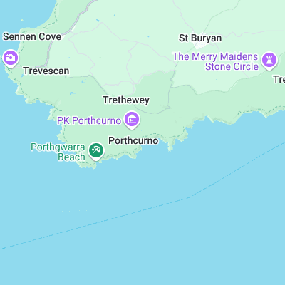
- Nanjizel (2.1 mi)
- Sennen (3.4 mi)
- Gwenver (3.7 mi)
- Newlyn Harbour Wall (6.2 mi)
- Danger Bay (7.7 mi)
- Marazion (9.4 mi)
- Perranuthnoe (10.3 mi)
- Praa Sands (12.2 mi)
- Carbis Bay (13.6 mi)
- Hawks Point (13.8 mi)
Not Magic Seaweed (MSW)
Although we look a bit like Magic Seaweed we are not MagicSeaweed as they no longer exist...