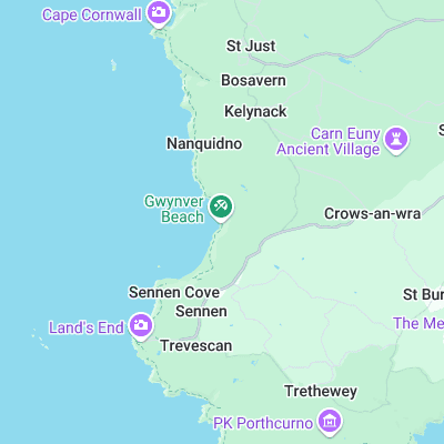
Gwenver (Gwynver) Surf Report
| Wave height * | 3ft / 0.8m |
|---|---|
| Swell period | 7s |
| Swell direction | |
| Wind | |
| Sea temp | 11°C / 52°F |

10 day Gwenver surf forecast
Fri
2/Jan
3ft
24
26
22
- High 3:15am
- Low 9:59am
- High 3:43pm
- Low 10:23pm
Sat
3/Jan
3.5ft
28
22
25
- High 4:08am
- Low 10:56am
- High 4:34pm
- Low 11:16pm
Sun
4/Jan
2.5ft
22
18
17
- High 4:57am
- Low 11:48am
- High 5:22pm
Mon
5/Jan
2ft
11
20
21
- Low 12:06am
- High 5:43am
- Low 12:37pm
- High 6:08pm
Tue
6/Jan
2.5ft
6
2
16
- Low 12:53am
- High 6:28am
- Low 1:23pm
- High 6:52pm
Wed
7/Jan
3ft
30
17
16
- Low 1:37am
- High 7:11am
- Low 2:07pm
- High 7:35pm
Thu
8/Jan
4.5ft
33
31
15
- Low 2:18am
- High 7:53am
- Low 2:48pm
- High 8:17pm
Fri
9/Jan
4.5ft
42
29
24
- Low 2:58am
- High 8:35am
- Low 3:28pm
- High 8:59pm
Sat
10/Jan
3.5ft
18
22
27
- Low 3:39am
- High 9:19am
- Low 4:11pm
- High 9:46pm
Sun
11/Jan
6ft
20
14
26
- Low 4:24am
- High 10:08am
- Low 5:00pm
Fri 2nd Jan
| 3:00 | 2ft | 4.5ft | 7s | 19mph (21mph) | |||
| 6:00 | 2.5ft | 5ft | 7s | 24mph (26mph) | |||
| 9:00 | 3ft | 5.8ft | 7s | 26mph (26mph) | |||
| 12:00 | 3ft | 6.6ft | 8s | 26mph (26mph) | |||
| 15:00 | 3.5ft | 7.1ft | 7s | 25mph (26mph) | |||
| 18:00 | 3ft | 6.6ft | 7s | 22mph (23mph) | |||
| 21:00 | 3ft | 6.1ft | 8s | 20mph (20mph) |
| Tide times |
|---|
| High 3:15am (5.22m) |
| Low 9:59am (1.16m) |
| High 3:43pm (5.24m) |
| Low 10:23pm (1.11m) |
| Daylight | |
|---|---|
| First light | 07:43 |
| Sunrise | 08:21 |
| Sunset | 16:32 |
| Dark | 17:10 |
Sat 3rd Jan
| 3:00 | 3ft | 6.7ft | 7s | 25mph (25mph) | |||
| 6:00 | 3.5ft | 7.4ft | 8s | 28mph (29mph) | |||
| 9:00 | 3.5ft | 7.7ft | 8s | 26mph (27mph) | |||
| 12:00 | 3.5ft | 7.4ft | 8s | 22mph (23mph) | |||
| 15:00 | 3.5ft | 7.1ft | 8s | 24mph (25mph) | |||
| 18:00 | 3.5ft | 7.2ft | 8s | 25mph (26mph) | |||
| 21:00 | 3.5ft | 7.1ft | 8s | 21mph (21mph) |
| Tide times |
|---|
| High 4:08am (5.48m) |
| Low 10:56am (0.94m) |
| High 4:34pm (5.39m) |
| Low 11:16pm (0.96m) |
| Daylight | |
|---|---|
| First light | 07:43 |
| Sunrise | 08:21 |
| Sunset | 16:33 |
| Dark | 17:11 |
Sun 4th Jan
| 3:00 | 3ft | 6.1ft | 7s | 23mph (22mph) | |||
| 6:00 | 3ft | 6ft | 7s | 22mph (21mph) | |||
| 9:00 | 2.5ft | 5.5ft | 7s | 19mph (20mph) | |||
| 12:00 | 2.5ft | 5ft | 7s | 18mph (19mph) | |||
| 15:00 | 2ft | 4.6ft | 7s | 19mph (19mph) | |||
| 18:00 | 2ft | 4.3ft | 7s | 17mph (18mph) | |||
| 21:00 | 2ft | 3.9ft | 9s | 17mph (18mph) |
| Tide times |
|---|
| High 4:57am (5.65m) |
| Low 11:48am (0.79m) |
| High 5:22pm (5.45m) |
| Daylight | |
|---|---|
| First light | 07:43 |
| Sunrise | 08:21 |
| Sunset | 16:34 |
| Dark | 17:12 |
Mon 5th Jan
| 3:00 | 3ft | 3.6ft | 12s | 15mph (15mph) | |||
| 6:00 | 2ft | 3.8ft | 10s | 11mph (12mph) | |||
| 9:00 | 2ft | 4.3ft | 6s | 11mph (14mph) | |||
| 12:00 | 2ft | 4.4ft | 7s | 20mph (20mph) | |||
| 15:00 | 2ft | 4ft | 6s | 22mph (22mph) | |||
| 18:00 | 1.5ft | 3.5ft | 6s | 21mph (20mph) | |||
| 21:00 | 1.5ft | 3.1ft | 7s | 18mph (19mph) |
| Tide times |
|---|
| Low 12:06am (0.88m) |
| High 5:43am (5.72m) |
| Low 12:37pm (0.73m) |
| High 6:08pm (5.43m) |
| Daylight | |
|---|---|
| First light | 07:42 |
| Sunrise | 08:20 |
| Sunset | 16:35 |
| Dark | 17:13 |
Tue 6th Jan
| 3:00 | 1.5ft | 2.8ft | 10s | 10mph (10mph) | |||
| 6:00 | 1.5ft | 3ft | 9s | 6mph (6mph) | |||
| 9:00 | 2.5ft | 2.8ft | 11s | 5mph (4mph) | |||
| 12:00 | 2.5ft | 2.5ft | 11s | 2mph (2mph) | |||
| 15:00 | 2ft | 3ft | 9s | 7mph (10mph) | |||
| 18:00 | 3ft | 3.8ft | 5s | 16mph (16mph) | |||
| 21:00 | 3.5ft | 4.9ft | 5s | 15mph (15mph) |
| Tide times |
|---|
| Low 12:53am (0.88m) |
| High 6:28am (5.69m) |
| Low 1:23pm (0.79m) |
| High 6:52pm (5.33m) |
| Daylight | |
|---|---|
| First light | 07:42 |
| Sunrise | 08:20 |
| Sunset | 16:36 |
| Dark | 17:14 |
Wed 7th Jan
| 3:00 | 3ft | 6.5ft | 6s | 26mph (26mph) | |||
| 6:00 | 3ft | 6.3ft | 7s | 30mph (30mph) | |||
| 9:00 | 3ft | 6.1ft | 8s | 26mph (27mph) | |||
| 12:00 | 3ft | 6.1ft | 7s | 17mph (19mph) | |||
| 15:00 | 3ft | 6.2ft | 11s | 13mph (15mph) | |||
| 18:00 | 5ft | 6.2ft | 12s | 16mph (17mph) | |||
| 21:00 | 5.5ft | 6.2ft | 12s | 17mph (19mph) |
| Tide times |
|---|
| Low 1:37am (0.98m) |
| High 7:11am (5.56m) |
| Low 2:07pm (0.94m) |
| High 7:35pm (5.16m) |
| Daylight | |
|---|---|
| First light | 07:42 |
| Sunrise | 08:20 |
| Sunset | 16:37 |
| Dark | 17:15 |
Thu 8th Jan
| 3:00 | 5ft | 5.4ft | 11s | 30mph (32mph) | |||
| 6:00 | 5ft | 5.6ft | 11s | 33mph (38mph) | |||
| 9:00 | 4ft | 5.7ft | 10s | 36mph (44mph) | |||
| 12:00 | 4.5ft | 5.2ft | 11s | 31mph (35mph) | |||
| 15:00 | 4ft | 4.6ft | 11s | 22mph (32mph) | |||
| 18:00 | 3.5ft | 4.1ft | 10s | 15mph (20mph) | |||
| 21:00 | 3.5ft | 3.7ft | 10s | 9mph (14mph) |
| Tide times |
|---|
| Low 2:18am (1.16m) |
| High 7:53am (5.35m) |
| Low 2:48pm (1.17m) |
| High 8:17pm (4.95m) |
| Daylight | |
|---|---|
| First light | 07:42 |
| Sunrise | 08:19 |
| Sunset | 16:39 |
| Dark | 17:16 |
Fri 9th Jan
| 3:00 | 4ft | 4.5ft | 13s | 32mph (44mph) | |||
| 6:00 | 5ft | 5.4ft | 10s | 42mph (55mph) | |||
| 9:00 | 5ft | 6.3ft | 6s | 49mph (65mph) | |||
| 12:00 | 4.5ft | 6ft | 8s | 29mph (34mph) | |||
| 15:00 | 5ft | 5.6ft | 12s | 30mph (34mph) | |||
| 18:00 | 5ft | 5.4ft | 12s | 24mph (28mph) | |||
| 21:00 | 5ft | 5.3ft | 12s | 23mph (25mph) |
| Tide times |
|---|
| Low 2:58am (1.39m) |
| High 8:35am (5.09m) |
| Low 3:28pm (1.44m) |
| High 8:59pm (4.72m) |
| Daylight | |
|---|---|
| First light | 07:41 |
| Sunrise | 08:19 |
| Sunset | 16:40 |
| Dark | 17:17 |
Sat 10th Jan
| 3:00 | 4.5ft | 4.8ft | 11s | 15mph (17mph) | |||
| 6:00 | 4ft | 4.5ft | 11s | 18mph (19mph) | |||
| 9:00 | 4ft | 4.3ft | 11s | 20mph (21mph) | |||
| 12:00 | 3.5ft | 4.1ft | 11s | 22mph (23mph) | |||
| 15:00 | 3.5ft | 4.2ft | 11s | 27mph (30mph) | |||
| 18:00 | 4.5ft | 5.1ft | 14s | 27mph (30mph) | |||
| 21:00 | 6ft | 6.9ft | 13s | 26mph (28mph) |
| Tide times |
|---|
| Low 3:39am (1.64m) |
| High 9:19am (4.81m) |
| Low 4:11pm (1.71m) |
| High 9:46pm (4.50m) |
| Daylight | |
|---|---|
| First light | 07:41 |
| Sunrise | 08:18 |
| Sunset | 16:41 |
| Dark | 17:19 |
Sun 11th Jan
| 3:00 | 6.5ft | 7.5ft | 12s | 25mph (28mph) | |||
| 6:00 | 6.5ft | 7.1ft | 12s | 20mph (22mph) | |||
| 9:00 | 6ft | 6.8ft | 11s | 10mph (13mph) | |||
| 12:00 | 6ft | 6.9ft | 11s | 14mph (16mph) | |||
| 15:00 | 6ft | 7ft | 11s | 20mph (21mph) | |||
| 18:00 | 6.5ft | 7.4ft | 11s | 26mph (36mph) | |||
| 21:00 | 7ft | 8ft | 11s | 29mph (36mph) |
| Tide times |
|---|
| Low 4:24am (1.89m) |
| High 10:08am (4.54m) |
| Low 5:00pm (1.94m) |
| Daylight | |
|---|---|
| First light | 07:40 |
| Sunrise | 08:18 |
| Sunset | 16:43 |
| Dark | 17:20 |
Nearest buoys
Probably the most exposed beach in Cornwall. Located right at the west of the country and out of the shadow of Land's End Gwenver picks up any swell going. As a result it is often maxxed out and the banks are very fickle. Heavy waves and plenty of locals
There is a point at Gwenver (Ayre Point) that is referred to as 'The Point', however it isn't a real point break. In fact there is more likely to be a left peeling into the point than a right off it.
Surf spots nearby
- Sennen (0.7 mi)
- Nanjizel (2.5 mi)
- Porthcurno (3.7 mi)
- Newlyn Harbour Wall (6.3 mi)
- Danger Bay (7.4 mi)
- Marazion (9.6 mi)
- Perranuthnoe (11 mi)
- Carbis Bay (12.5 mi)
- Porthmeor (12.6 mi)
- The Breakwater (12.8 mi)
Not Magic Seaweed (MSW)
Although we look a bit like Magic Seaweed we are not MagicSeaweed as they no longer exist...